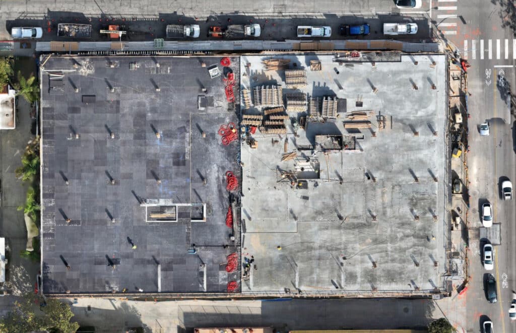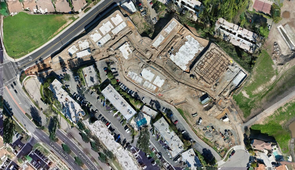
Category: Construction Site Monitoring

  • The Construction Drone Intelligence Series — Part 9

    The Construction Drone Intelligence Series — Part 9

    Construction Drone Adoption Is Growing

    The Next Opportunity Is Turning Drone Data Into Construction Intelligence

    My Perspective

    I’ve spent a lot of time talking with General Contractors, Owners, engineers and public agencies about drones, and I’ve noticed a consistent pattern.

    Most people already understand the value of aerial photography and progress monitoring. What they’re often less familiar with is everything that can happen after the drone lands.

    That’s why the new drone-usage research from Associated Builders and Contractors caught my attention.

    Only about one-third of contractors surveyed are flying drones today. And among those who are, progress monitoring and marketing are far more common than some of the advanced mapping and data applications we’ve been discussing with our clients.

    To me, that’s not a negative.

    It’s an enormous opportunity.

    The next stage of construction drone adoption isn’t simply getting more drones onto jobsites. It’s making the data they collect easier to access, integrate and use to make better construction decisions.

    That’s where things get interesting.


    Construction Drones Have Entered the Mainstream — But We’re Still Early
    Associated Builders and Contractors logo

    Associated Builders and Contractors released its first Drone Usage report in August 2026, based on a May survey of its contractor members.

    The headline number is significant:

    36.1% of responding contractors reported flying drones.

    Nearly 75% of the contractors surveyed work in commercial construction, making the findings particularly relevant to the projects and clients we work with every day. 

    DroneLife’s Jim Magill subsequently highlighted another remarkable finding: among respondents using drones, 97.1% identified DJI as their primary drone manufacturer, illustrating just how concentrated the industry’s current hardware environment has become. 

    But the statistic I find most interesting isn’t 97.1%.

    It’s 36.1%.

    Because that means almost two-thirds of the contractors surveyed aren’t flying drones yet.

    For a technology capable of collecting so much useful project information, there’s still substantial room to grow.


    What Are Construction Companies Actually Doing With Drones?

    ABC’s findings give us a fascinating picture of current adoption.

    Among contractors using drones:

    ApplicationContractors Reporting Use
    Site progress monitoring80.8%
    Marketing and media77.5%
    Inspections and mapping50.0%

    There’s an important story hiding inside those numbers.

    Construction has clearly embraced the visual value of drones.

    Progress photos? Absolutely.

    Marketing videos? Absolutely.

    But only half of drone users reported using drones for inspections and mapping.

    That’s where I believe the next major growth opportunity exists.


    The Next Evolution: From Pictures to Data

    A drone photograph tells you what a project looks like.

    A properly captured and processed drone dataset can potentially tell you much more.
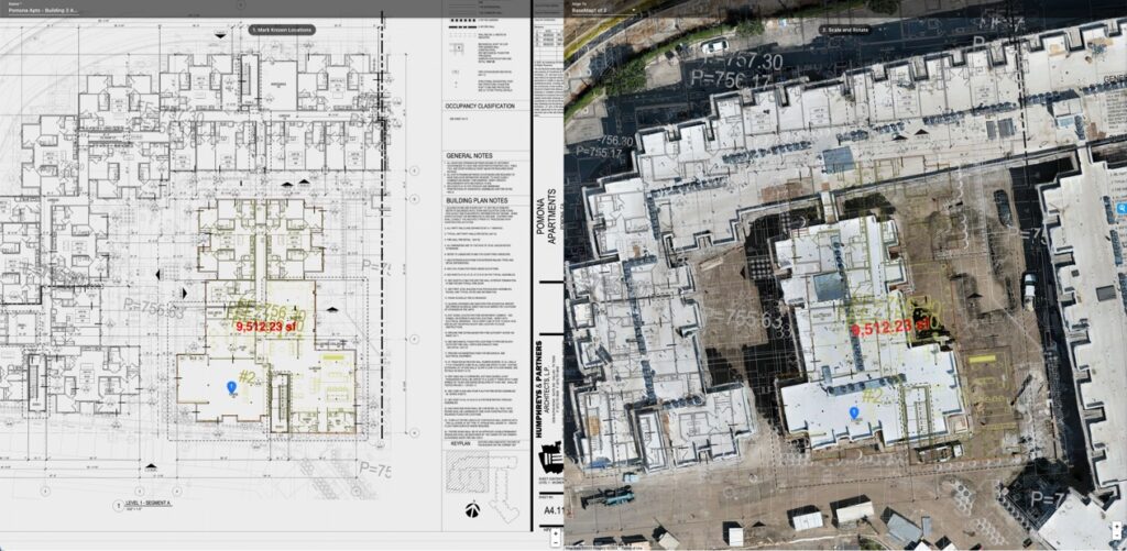
    Depending on the project, drone data can support:

    • Orthomosaic mapping
    • Progress comparisons
    • Stockpile and volume analysis
    • 3D models
    • Point clouds
    • Digital surface and terrain models
    • Site logistics
    • Inspection documentation
    • GIS workflows
    • CAD and engineering workflows
    • Executive reporting

    That’s the transition we’re focused on at Aerial Decisions:

    From drone imagery to construction intelligence.

    The aircraft captures reality.

    Photogrammetry and other technologies transform that capture into data.

    Construction and engineering platforms make the information accessible.

    And ultimately, people use that information to make decisions.


    So What’s Holding Adoption Back?

    ABC’s findings are particularly revealing here.

    Among respondents, the leading challenges to adopting drone technology included regulatory and compliance issues at 53.5%, training and staffing at 43.4%, and limited use cases at 37.4%

    DroneLife’s coverage also reports 16.2% cited difficulty integrating drones into existing workflows

    I think those numbers deserve attention.

    The challenge isn’t simply convincing contractors that drones work.

    It’s making drones easy to operationalize.


    Why Outsourcing Can Make Sense for General Contractors

    This is also why I believe many contractors should evaluate whether building an internal drone department is actually necessary.

    The ABC survey does not conclude that outsourcing is preferable; that’s my interpretation of the barriers it identified.

    Think about what an internal commercial drone program can require:

    FAA-qualified pilots, ongoing training, regulatory compliance, aircraft management, insurance, mission planning, specialized mapping expertise, data processing, software subscriptions, quality control and someone who understands how to deliver the resulting information into construction workflows.

    And then there’s utilization.

    If your team only needs specialized mapping at certain projects or milestones, maintaining all of those capabilities internally may not always make economic sense.

    A qualified drone service provider can allow a contractor to access specialized pilots, aircraft, sensors, mapping capabilities and processing expertise when the project requires them.

    The GC can focus on construction.

    The drone provider can focus on collecting and transforming the data.


    The Bigger Opportunity Is Integration

    This is where I believe our industry needs to focus next.

    Construction teams don’t need another isolated drone platform.

    They need drone information that can flow into the environments they’re already using.

    That could mean:

    Procore for project management.

    Civil 3D for civil engineering.

    ArcGIS for geospatial information.

    Bluebeam for project documentation and markups.

    Or other CAD, BIM, GIS and construction-management environments.

    The objective shouldn’t be to force everyone on a project to become a drone-data expert.

    It should be to make the information easy for each stakeholder to consume in the tools they already understand.


    Mapping May Be the Biggest Untapped Opportunity

    The fact that only 50% of drone-using respondents reported inspections and mapping particularly stands out to me. 

    We’ve already seen what happens when a construction team moves beyond individual aerial photographs and sees an entire project represented as a measurable orthomosaic.

    The conversation changes.

    Now we can talk about:

    What changed?

    How much material moved?

    Where was this condition located?

    How does today’s site compare with last month?

    Can engineering use this dataset?

    That’s no longer drone photography.

    That’s project information.


    And AI Will Raise the Value Again

    There’s another layer developing quickly.

    Once construction teams create consistent, structured datasets over time, AI has something meaningful to analyze.

    Imagine combining recurring reality capture with previous site conditions, inspection observations, schedules and other project information.

    Instead of simply asking:

    “Show me this month’s drone photos.”

    We can begin asking:

    “What changed?”
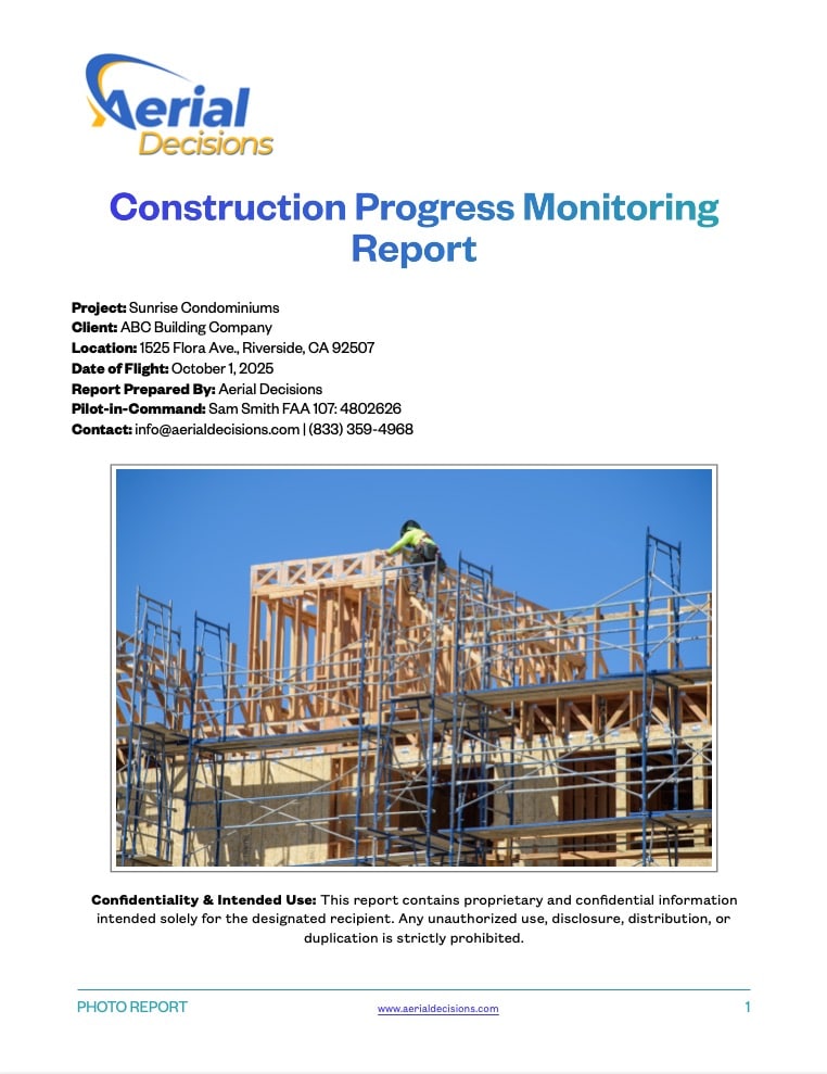
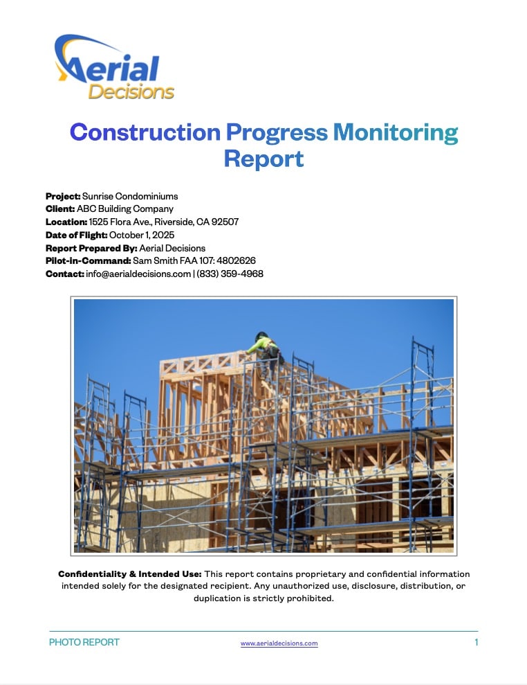
    Construction Monitoring Progress Report
    Construction Monitoring Reports are an Excellent Way to Share Site Progress with Key Stakeholders

    “What should I be paying attention to?”

    “Where are conditions inconsistent with the previous capture?”

    “What information should the project team review?”

    That is where I believe construction drone intelligence is headed.


    Mini Case Snapshot

    Project Type: Southern California municipal infrastructure project

    Starting Point: Drone imagery was initially valuable primarily for visual progress documentation.

    Next Step: Recurring mapping introduced orthomosaic data and a complete measurable view of project conditions.

    Opportunity: Make those datasets useful across existing GIS, engineering and project-management workflows rather than requiring stakeholders to work inside a dedicated drone environment.

    Takeaway: The greater value wasn’t simply capturing more images. It was making the captured information more useful to more people.


    What About the DJI Question?

    The ABC survey’s 97.1% DJI figure deserves its own conversation, particularly given the changing U.S. regulatory environment. 

    For contractors, however, I think there’s a broader strategic lesson.

    Don’t build your construction-data strategy around one aircraft manufacturer.

    Hardware will change.

    Regulations will change.

    Software will change.

    The valuable asset is the project’s historical information and the intelligence derived from it.

    That’s another reason we’re committed to a platform-agnostic approach at Aerial Decisions.

    Your data. Your intelligence. Your choice of platform.


    Data Accuracy & Professional Use

    Drone mapping can provide accurate, repeatable site information for progress monitoring, documentation, volume analysis, visualization and other construction applications.

    It is important, however, to distinguish those applications from licensed professional surveying.

    Drone mapping services are not intended to replace licensed land surveying, legal boundary determination or engineering-grade deliverables where professional licensure or certification is required.

    We believe the strongest workflows allow drone professionals, surveyors, engineers and construction teams to work together—using the right data and expertise for the right application.


    Frequently Asked Questions

    How many construction companies currently use drones?

    In ABC’s May 2026 survey, 36.1% of responding contractor members said they fly drones. Nearly 75% of the surveyed contractors work in commercial construction. 

    What are drones most commonly used for in construction?

    Among drone-using respondents, 80.8% reported site progress monitoring, 77.5% marketing and media, and 50% inspections and mapping. 

    What prevents construction companies from adopting drones?

    ABC identified regulatory/compliance issues, training/staffing and limited use cases as the three leading adoption challenges. 

    Should a General Contractor operate drones internally or outsource?

    It depends on utilization, internal expertise and business requirements. Contractors with large, continuous programs may benefit from internal capabilities, while others may find that outsourcing provides access to specialized pilots, aircraft, mapping technology and processing expertise without building the entire capability internally.

    What’s the next step in construction drone adoption?

    We believe the next opportunity is moving beyond imagery toward structured drone data that integrates with existing construction, engineering and GIS workflows and ultimately supports better project decisions.


    Executive Takeaway: We’re Only Getting Started

    I don’t look at a 36% adoption rate and see a technology struggling for acceptance.

    I see a technology that has already proven its value—and an industry with enormous room to expand how that technology is used.

    The first chapter was putting cameras in the sky.

    The next chapter is turning what those cameras capture into usable construction intelligence.

    That means better mapping.

    Better integrations.

    Open, portable data.

    Simpler workflows.

    And increasingly, AI that helps construction professionals understand what’s changing across their projects.

    The winners won’t necessarily be the construction companies flying the most drones.

    They’ll be the companies making the best decisions with the data those drones collect.


    Source Note

    This article references the Associated Builders and Contractors 2026 Drone Usage Report and reporting by Jim Magill of DroneLife.

    Read ABC’s Drone Usage findings

    Read Jim Magill’s DroneLife analysis

    Continue Reading – The Construction Drone Intelligence Series

    Disclaimer

    Drone mapping and data services provided by Aerial Decisions are intended for visual documentation, progress tracking, and general measurement purposes only. These services do not replace licensed land surveying, boundary determination, or engineering-grade deliverables.

    From The Editor:

    Do you need to hire a professional drone service provider for your project? To speak to an aerial data specialist, fill out a form, email us or for even faster response times, give us a call at (833) FLY-4YOU or (833) 359-4968. Check out our transparent pricing and watch this space as we expand on the above topics and more over the coming weeks and months.

    If you like this post, feel free to click the share button at the bottom of the page. We appreciate you helping us by spreading the content we share on our blog.

    Drones and Construction podcast on Spotify
    Stream Drones and Construction podcast on your favorite listening platform.

    Showcase Your Company on the Drones and Construction Podcast! If you’d like to be a featured guest on our podcast, send us an email: info@aerialdecisions.com and one of our crew will get right back to you to share the details.

    About Aerial Decisions

    YOUR DATA. YOUR INTELLIGENCE. YOUR CHOICE OF PLATFORM.

    Aerial Decisions is a Construction Intelligence company transforming jobsite reality into actionable data that helps contractors, owners, engineers, and municipalities make better-informed decisions.

    We combine professional aerial and reality capture with advanced data processing, visualization, analytics, and AI-optimized technology to create a clear, measurable view of what is happening across a project.

    Our platform-agnostic approach means your data isn’t locked into a single software ecosystem. We capture, process, visualize, analyze, and integrate construction intelligence into the tools and workflows your teams already use.

    Supported by a network of FAA-certified, insured professionals and purpose-built technology, Aerial Decisions provides the visibility and intelligence project teams need—from pre-construction through completion.

    Capture → Process → Visualize → Analyze → Integrate

  • The Construction Drone Intelligence Series

    The Construction Drone Intelligence Series

    Part 7 – Construction Drone Deliverables Explained: What General Contractors Actually Receive

    My Perspective

    One of the biggest misconceptions I hear is that construction companies think they’re hiring us to fly a drone.

    They’re not.

    They’re hiring us to deliver information they can use to make better decisions.

    The drone is simply the tool that allows us to collect that information safely, efficiently, and consistently.

    When I meet with General Contractors for the first time, the conversation usually starts with questions about the aircraft, cameras, or FAA certifications. By the end of the meeting, we’re talking about project visibility, executive reporting, documentation, and reducing costly surprises.

    That’s because the real value isn’t in the flight—it’s in the deliverables.

    At Aerial Decisions, our goal isn’t to provide impressive drone footage. Our goal is to provide construction intelligence that helps project teams communicate better, document progress, and manage projects with greater confidence.


    You’re Not Buying a Drone Flight—You’re Buying Better Information

    Most commercial construction professionals understand that drones can capture incredible aerial imagery.

    What many don’t realize is that the drone flight is only a small part of the process.

    The real value comes from what happens after the flight.

    Professional drone companies transform aerial data into deliverables that support project management, stakeholder communication, quality control, engineering workflows, and executive decision-making.

    Think of the drone as the data collection tool.

    The deliverables are what create value.


    What Are Construction Drone Deliverables?

    Construction drone deliverables are the digital products created from aerial imagery and collected site data.

    Rather than receiving a folder full of random drone photos, professional clients receive organized information designed to answer specific business questions.

    Examples include:

    • Orthomosaic Maps
    • High-resolution progress photography
    • Construction progress videos
    • 3D Models
    • Point Clouds
    • Digital Surface Models (DSM)
    • Digital Terrain Models (DTM)
    • Stockpile volume calculations
    • Thermal imagery
    • Executive reporting packages

    Each deliverable serves a different purpose depending on the project’s goals.


    The Most Valuable Drone Deliverables

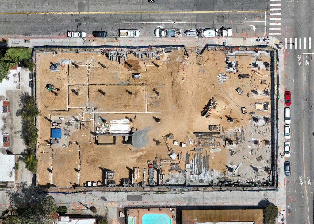
    Orthomosaic map

    Orthomosaic Maps

    One of the most requested deliverables we produce.

    An orthomosaic combines hundreds of overlapping drone images into one measurable, geographically accurate map of the project.

    Best used for:

    • Progress tracking
    • Site logistics
    • Documentation
    • Earthwork monitoring
    • Executive reporting

    Related Article: Orthomosaic Mapping in Construction: The Most Valuable Deliverable You’ve Probably Never Heard Of


    Progress Photography

    Professional progress monitoring includes much more than random aerial images.

    Typical deliverables include:

    • North, South, East & West cardinal photos
    • Oblique overview images
    • Detailed progress photos
    • Critical milestone documentation
    • Time-stamped archives

    These become part of the permanent project record.


    Construction Progress Videos

    Monthly drone video allows Owners and executives to review an entire project in just a few minutes.

    Videos typically include:

    • Site flyovers
    • Major milestones
    • Areas of concern
    • Schedule updates
    • Executive summaries

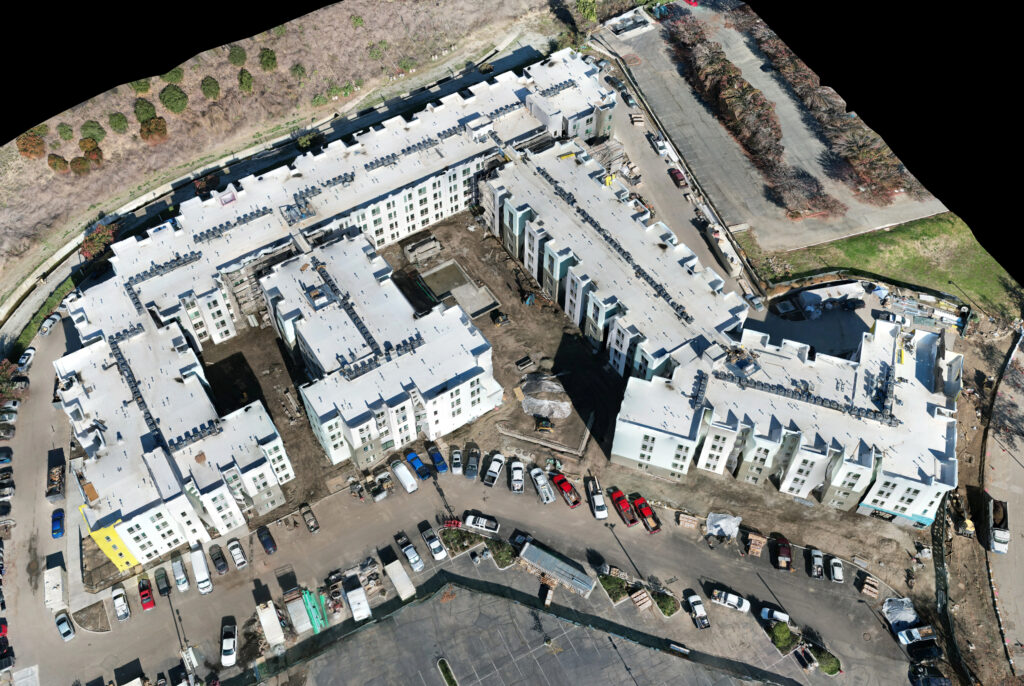
    3D Model
    3D models show dynamic range to illustrate as built specifications

    3D Models & Digital Twins

    Some projects benefit from fully interactive 3D models.

    These allow teams to:

    • View projects from any angle
    • Improve planning
    • Document existing conditions
    • Present projects to owners and stakeholders

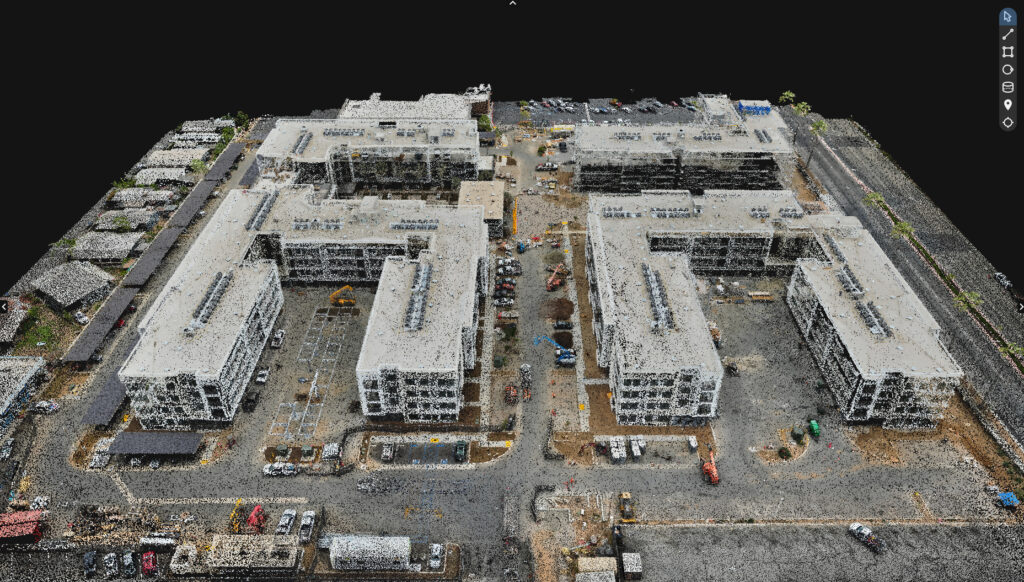
    Point Clouds

    Point Cloud of a commercial construction site

    Point clouds provide millions of spatially accurate data points representing the project.

    They’re commonly used by:

    • Engineers
    • Architects
    • BIM teams
    • Survey professionals

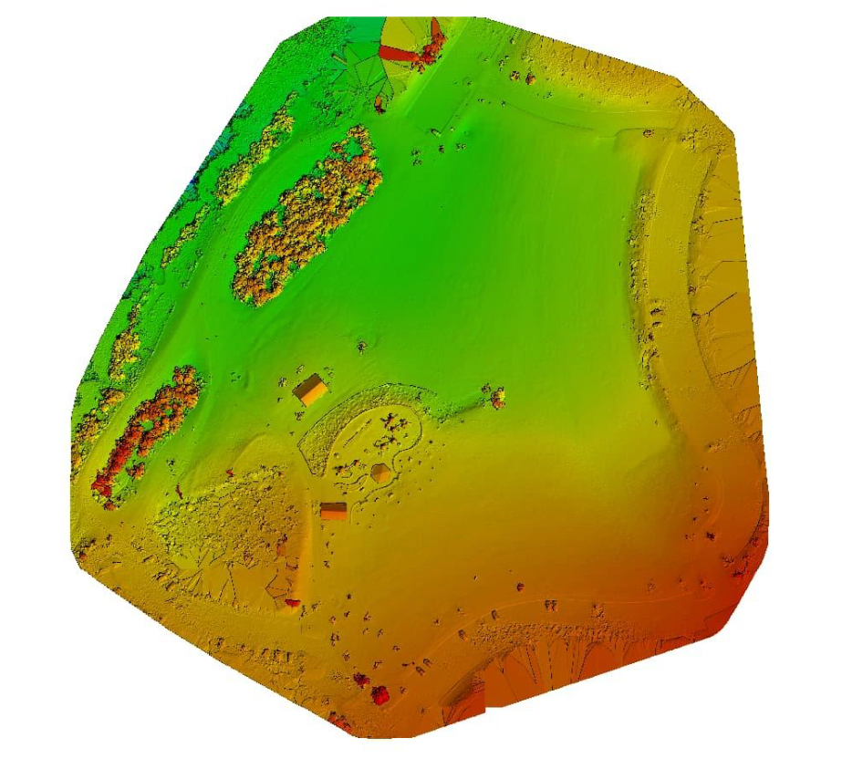
    Digital Surface Models (DSM)

    Digital Surface Model

    A DSM represents everything visible on the site:

    • Buildings
    • Equipment
    • Vegetation
    • Materials
    • Terrain

    Useful for site planning and earthwork analysis.


    Digital Terrain Models (DTM)

    Unlike a DSM, a DTM represents the bare earth beneath structures and vegetation.

    DTMs are commonly used during:

    • Site development
    • Grading
    • Drainage planning
    • Earthwork evaluation

    Volume Calculations

    Drone mapping can calculate stockpile volumes quickly and consistently.

    Typical applications include:

    • Aggregate piles
    • Soil movement
    • Excavation progress
    • Material inventory

    Thermal Imaging

    Thermal drones capture temperature differences that aren’t visible to the naked eye.

    Applications include:

    • Roof inspections
    • Solar inspections
    • Electrical systems
    • Moisture detection
    • Building envelope assessments

    Executive Reporting

    This is often the deliverable clients value the most.

    Rather than reviewing hundreds of images, executives receive a concise report highlighting:

    • Project progress
    • Key milestones
    • Areas requiring attention
    • Site changes
    • Supporting imagery

    It transforms drone data into actionable business intelligence.


    Choosing the Right Deliverables

    Not every project needs every deliverable.

    For example:

    Commercial Building

    • Progress Photography
    • Orthomosaic
    • Monthly Video
    • Executive Report

    Roadway Project

    • Orthomosaic
    • DSM
    • Progress Photography
    • Volume Calculations

    Municipal Infrastructure

    • Orthomosaic
    • Point Cloud
    • DTM
    • Executive Reporting

    The right package depends on the project’s objectives—not the drone.


    Mini Case Study

    Project: Mixed Use Apartment Complex

    Challenge: Multiple stakeholders needed a consistent way to review monthly progress across a large-scale mixed use apartment complex construction project.

    Solution: Monthly drone missions produced orthomosaic maps, standardized aerial photography, progress videos, and executive summaries.

    Outcome: Project meetings became more productive because every stakeholder reviewed the same accurate, up-to-date visual information. Reporting became faster, documentation more consistent, and communication significantly improved.


    Data Accuracy & Professional Use

    Professional drone deliverables provide highly accurate, repeatable documentation for construction progress monitoring, planning, and project communication.

    However, they are not intended to replace licensed land surveying, legal boundary determination, or engineering design services.

    Licensed surveyors remain responsible for boundary establishment, legal surveys, and engineering-grade control. Drone deliverables complement these services by providing frequent, high-quality site documentation between traditional survey milestones.


    Frequently Asked Questions

    What are construction drone deliverables?

    They are the digital products created from drone imagery, including maps, photos, videos, 3D models, point clouds, and reporting packages.

    What is the most valuable deliverable?

    For many General Contractors, orthomosaic mapping combined with executive reporting provides the greatest day-to-day value.

    Can drone deliverables integrate with construction software?
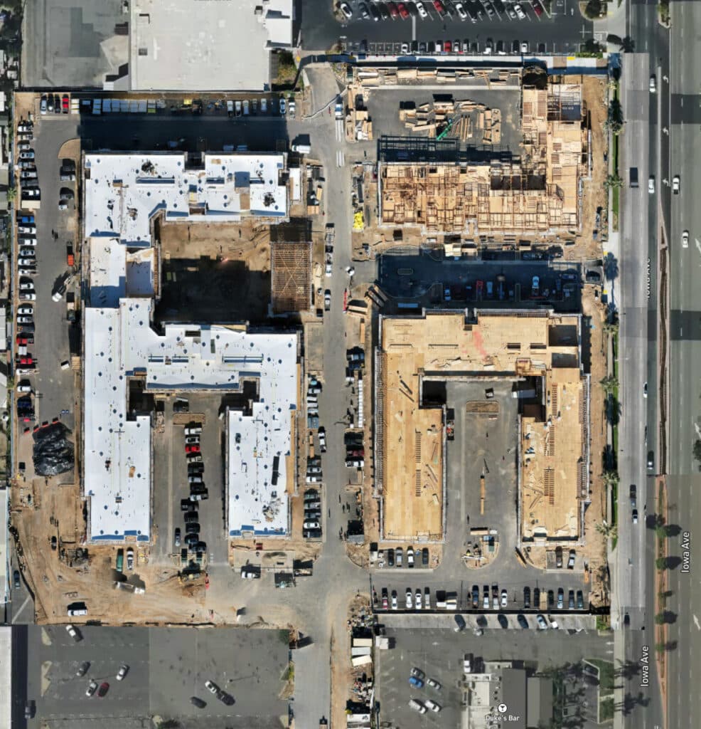
    Yes. Many deliverables can be incorporated into platforms such as Procore, Autodesk Construction Cloud, ArcGIS, Civil 3D, and Bluebeam, depending on project workflows.

    How often should drone deliverables be updated?

    Most commercial projects benefit from monthly updates, while fast-moving projects may require weekly or milestone-based flights.

    Are all drone companies able to provide these deliverables?

    No. While many companies capture aerial imagery, producing accurate mapping products, engineering datasets, and executive reporting requires specialized equipment, software, and expertise.


    Executive Takeaway

    The drone is the least important part of what we deliver.

    What matters is the information that helps construction teams make better decisions.

    Whether it’s an orthomosaic map, a progress report, a 3D model, or an executive dashboard, the right deliverables create clarity, improve communication, and provide a reliable visual record of every stage of construction.

    At Aerial Decisions, that’s what we mean by Construction Intelligence.


    Continue Reading – The Construction Drone Intelligence Series

    Disclaimer

    Drone mapping and data services provided by Aerial Decisions are intended for visual documentation, progress tracking, and general measurement purposes only. These services do not replace licensed land surveying, boundary determination, or engineering-grade deliverables.

    From The Editor:

    Do you need to hire a professional drone service provider for your project? To speak to an aerial data specialist, fill out a form, email us or for even faster response times, give us a call at (833) FLY-4YOU or (833) 359-4968. Check out our transparent pricing and watch this space as we expand on the above topics and more over the coming weeks and months.

    If you like this post, feel free to click the share button at the bottom of the page. We appreciate you helping us by spreading the content we share on our blog.

    Drones and Construction podcast on Spotify
    Stream Drones and Construction podcast on your favorite listening platform.

    Showcase Your Company on the Drones and Construction Podcast! If you’d like to be a featured guest on our podcast, send us an email: info@aerialdecisions.com and one of our crew will get right back to you to share the details.

    About Aerial Decisions

    Aerial Decisions is a Los Angeles-based Drone Services Provider (DSP). We specialize in providing cutting-edge drone data collection combined with industry leading software solutions tailored for the commercial construction industry. Our mission is to optimize the way enterprise construction projects are managed by offering precise aerial photography, detailed data analysis, and innovative software tools through a network of FAA-certified and insured drone pilots. Aerial Decisions is not just a drone service provider; we are your strategic partner in commercial construction. Our hands-on approach to understanding your unique requirements and our dedication to excellence ensures that every flight and every data point is optimized for your success. Trust us to be the eyes in the sky that elevate your construction projects to new heights.

  • Orthomosaic Mapping in Construction: The Most Valuable Deliverable You’ve Probably Never Heard Of

    Orthomosaic Mapping in Construction: The Most Valuable Deliverable You’ve Probably Never Heard Of


    The Construction Drone Intelligence Series

    Part 6 – The One Measurable Jobsite Map Every Construction Team Should Understand

    Over the past couple of years, I’ve noticed something interesting during project review meetings. When I show a client a folder full of drone photos, they’re appreciative—but the conversation usually stays focused on the images themselves.

    Everything changes when I pull up an orthomosaic map.

    Suddenly, we’re not talking about pictures anymore. We’re talking about production, access routes, material staging, completed work, and what changed since the last flight. Owners start asking questions. Project managers begin measuring distances. Superintendents identify opportunities before they become problems.

    That’s when I realized that an orthomosaic isn’t just another drone deliverable—it’s often the most valuable one we produce.

    At Aerial Decisions, we’ve found that most General Contractors aren’t looking for more photos. They’re looking for a single, accurate view of the entire project that helps everyone make better decisions.

    That’s exactly what an orthomosaic delivers.


    Introduction: One Image. Hundreds of Decisions.

    Most commercial construction projects generate thousands of photographs throughout the course of a build.

    The challenge isn’t collecting images.

    The challenge is turning those images into something useful.

    An orthomosaic map gives project teams a current, measurable, high-resolution view of the entire jobsite—all in a single image.

    Instead of scrolling through hundreds of drone photos trying to understand progress, Owners and General Contractors can immediately see where work has advanced, where challenges exist, and what has changed since the previous reporting cycle.

    For many of our clients, it’s one of the most valuable deliverables we provide.


    What Is an Orthomosaic Map?

    An orthomosaic map is a high-resolution aerial image created by stitching together hundreds of overlapping drone photographs and correcting them for perspective and distortion.

    Unlike a standard aerial photograph, an orthomosaic is geographically accurate.

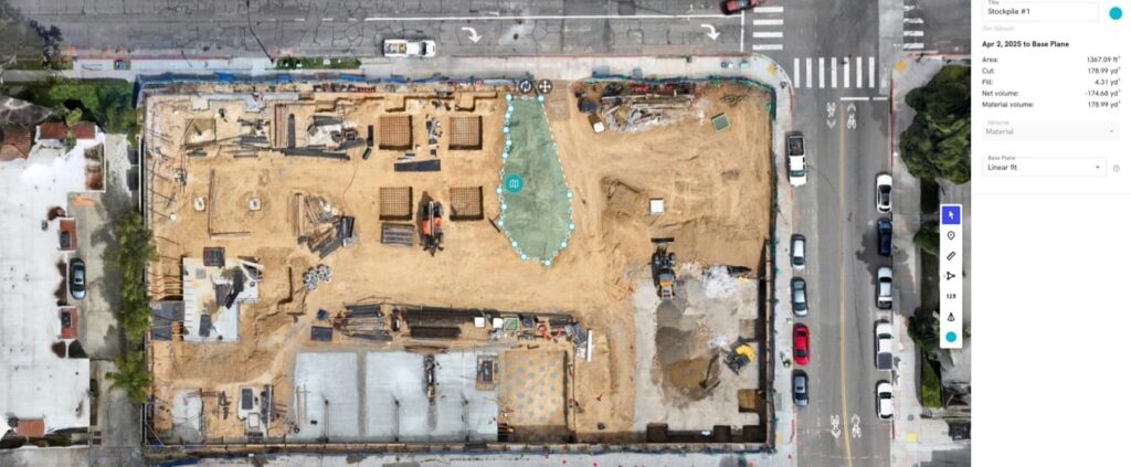
    Orthomosaic maps can be used to measure materials stockpiles.

    That means it can be used to:

    • Measure distances
    • Calculate areas
    • Track progress
    • Compare site conditions over time
    • Support executive reporting

    Think of it as a living blueprint of your project—updated as often as your reporting schedule requires.


    How Is an Orthomosaic Created?

    Although the final product looks like one photograph, it’s actually built from hundreds—or even thousands—of overlapping drone images.

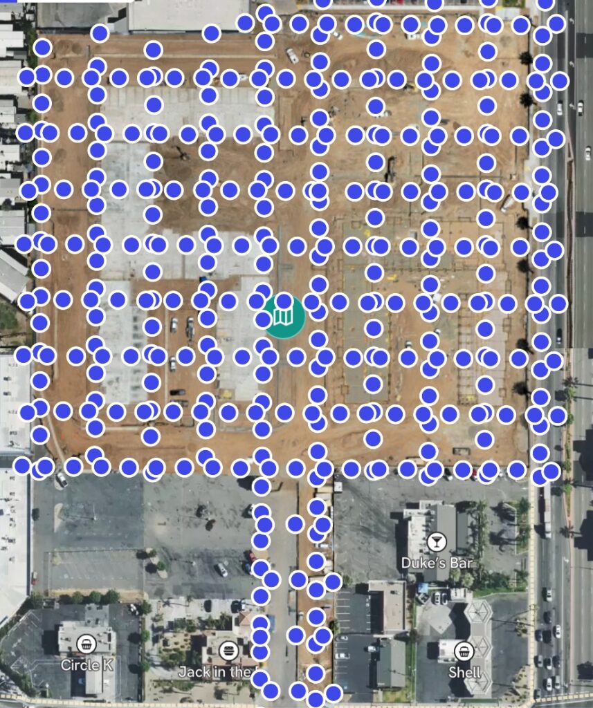
    An orthomosaic consists of hundreds and even thousands of individual photos

    A professional workflow typically includes:

    • Mission planning
    • RTK positioning when appropriate
    • Ground Control Points (when required)
    • High-overlap image capture
    • Photogrammetry processing
    • Quality control review

    The result is a seamless map that provides consistent visibility across the entire project.


    Why General Contractors Value Orthomosaic Mapping

    From our experience, orthomosaics create value because they simplify communication.

    Instead of relying on written descriptions of site conditions, teams can see the entire project in one image.

    Most clients use orthomosaics for:

    Progress Tracking

    Compare this month to last month.

    Site Logistics

    Monitor laydown yards, access roads, and staging areas.

    Earthwork Documentation

    Measure excavation and grading progress.

    Executive Reporting

    Provide Owners with a current visual overview of the project.

    Historical Documentation

    Maintain a complete timeline of site development.


    Orthomosaic Map vs. Standard Drone Photography

    Standard Drone PhotosOrthomosaic Maps
    Individual imagesComplete site map
    Perspective distortionCorrected and measurable
    Difficult to compareEasy month-over-month comparison
    Limited measurementsAccurate distance and area measurements
    Good for marketingExcellent for project management

    Both have value.

    But they solve different problems.


    Mini Case Snapshot

    Project Type: Commercial roadway improvement project

    Challenge: Project stakeholders needed a clearer way to communicate monthly progress across multiple work zones.

    Drone Solution: Monthly orthomosaic mapping combined with standardized aerial photography.

    Outcome: Improved stakeholder communication, faster progress reviews, and a consistent historical record throughout construction.


    Data Accuracy and Professional Use

    From our experience working alongside construction teams and engineers, orthomosaic mapping provides highly accurate, repeatable documentation for progress tracking, reporting, and general measurement.

    However, it’s important to understand where orthomosaics fit within the construction workflow.

    Orthomosaic maps are not intended to replace licensed land surveying, legal boundary determination, or engineering-grade survey deliverables.

    Licensed surveyors remain responsible for:

    • Boundary verification
    • Control networks
    • Engineering and design accuracy
    • Legal documentation

    Most successful projects combine traditional surveying with recurring orthomosaic mapping to improve visibility between survey milestones.


    Why Orthomosaics Improve Project Communication

    One of the biggest benefits we see isn’t technical—it’s communication.

    Everyone—from the superintendent to the Owner—can look at the same map.

    Owner and construction management team review reports

    That shared perspective reduces misunderstandings, improves reporting, and creates more productive conversations.

    Instead of asking,

    “Where exactly is that?”

    people begin asking,

    “What’s our plan for fixing it?”

    That’s a much better conversation.


    Frequently Asked Questions

    What makes an orthomosaic different from an aerial photo?

    An orthomosaic is corrected for distortion and can be measured accurately, while a standard aerial photo cannot.

    Can you measure distances on an orthomosaic?

    Yes. Orthomosaics allow project teams to measure distances, areas, and other site dimensions for construction planning and progress tracking.

    How often should an orthomosaic be created?

    Most commercial projects benefit from monthly orthomosaic updates, with more frequent mapping during critical phases.

    Are orthomosaics accurate?

    Yes. When captured and processed correctly, orthomosaics provide reliable project-level measurements suitable for progress monitoring and documentation.

    Who benefits most from orthomosaic mapping?

    General Contractors, Owners, Developers, Project Managers, and Municipal Agencies all benefit from having a consistent visual record of project progress.


    Executive Takeaway

    One of the best compliments we receive from clients is hearing that an orthomosaic became the first thing they opened before every project meeting.

    That’s because a single, accurate map often replaces hundreds of individual photographs and gives everyone a common understanding of the jobsite.

    At Aerial Decisions, we’ve found that better visibility almost always leads to better conversations—and better conversations lead to better project decisions.

    Disclaimer

    Drone mapping and data services provided by Aerial Decisions are intended for visual documentation, progress tracking, and general measurement purposes only. These services do not replace licensed land surveying, boundary determination, or engineering-grade deliverables.

    From The Editor:

    Do you need to hire a professional drone service provider for your project? To speak to an aerial data specialist, fill out a form, email us or for even faster response times, give us a call at (833) FLY-4YOU or (833) 359-4968. Check out our transparent pricing and watch this space as we expand on the above topics and more over the coming weeks and months.

    If you like this post, feel free to click the share button at the bottom of the page. We appreciate you helping us by spreading the content we share on our blog.

    Drones and Construction podcast on Spotify
    Stream Drones and Construction podcast on your favorite listening platform.

    Showcase Your Company on the Drones and Construction Podcast! If you’d like to be a featured guest on our podcast, send us an email: info@aerialdecisions.com and one of our crew will get right back to you to share the details.

    About Aerial Decisions

    Aerial Decisions is a Los Angeles-based Drone Services Provider (DSP). We specialize in providing cutting-edge drone data collection combined with industry leading software solutions tailored for the commercial construction industry. Our mission is to optimize the way enterprise construction projects are managed by offering precise aerial photography, detailed data analysis, and innovative software tools through a network of FAA-certified and insured drone pilots. Aerial Decisions is not just a drone service provider; we are your strategic partner in commercial construction. Our hands-on approach to understanding your unique requirements and our dedication to excellence ensures that every flight and every data point is optimized for your success. Trust us to be the eyes in the sky that elevate your construction projects to new heights.

  • The ROI of Drones in Construction Projects

    The ROI of Drones in Construction Projects

    The Construction Drone Intelligence Series

    Part 5 – Why Better Construction Intelligence Leads to Better Project Outcomes

    In many of my conversations with construction leaders, I’ve learned that most don’t invest in drone technology because it’s innovative.

    They invest because they want better information.

    Across the commercial construction projects we support throughout Southern California, Owners, Developers, and General Contractors are constantly balancing schedule pressures, cost management, stakeholder expectations, and project risk.

    The most successful teams understand that better decisions start with better visibility.

    That’s where drone technology creates value.

    When integrated into a structured construction workflow, drones can improve reporting, increase visibility, reduce uncertainty, and help teams identify issues earlier. The result isn’t simply better aerial imagery—it’s better project outcomes.

    How Construction Teams Measure ROI

    When evaluating any technology investment, most construction leaders ask a simple question:

    Drone mapping commercial construction project for ROI analysis
    Drone mapping improves commercial construction project ROI analysis

    Will this help us make better decisions or improve project performance?

    For drone programs, ROI typically comes from improvements in:

    • Project visibility
    • Reporting efficiency
    • Risk management
    • Communication
    • Documentation
    • Decision-making speed

    While every project is different, the strongest returns often come from operational improvements rather than direct labor savings.

    Where Drone ROI Actually Comes From

    From our experience at Aerial Decisions, most of the value generated by drone programs comes from creating a more complete picture of what’s happening on the jobsite.

    Improved Progress Visibility

    Recurring drone mapping flights provide measurable documentation of project progress.

    This allows teams to:

    • Validate work completed
    • Compare progress over time
    • Improve schedule discussions
    • Enhance stakeholder confidence

    When everyone is looking at the same information, conversations become more productive.

    Better Reporting

    Many project teams spend significant time gathering information for owner updates, executive reports, and stakeholder meetings.

    Drone-generated deliverables such as:

    • Orthomosaic maps
    • Progress photos
    • Timeline comparisons
    • 3D models

    can simplify reporting workflows while providing a clearer view of site conditions.

    Earlier Issue Identification

    Most construction challenges become more expensive the longer they go unnoticed.

    Recurring aerial documentation can help teams identify:

    • Staging inefficiencies
    • Access constraints
    • Material coordination issues
    • Site condition changes

    Earlier visibility often leads to faster corrective action.

    Stronger Documentation

    Construction projects generate thousands of decisions throughout their lifecycle.

    A structured drone program creates a time-stamped visual record that can support:

    • Progress validation
    • Internal communication
    • Stakeholder reporting
    • Change condition analysis

    Documentation is often one of the most overlooked sources of ROI.

    Hard ROI vs Soft ROI

    One of the biggest mistakes we see is evaluating drone services solely on the cost of the flight.

    The real value often extends far beyond the capture itself.

    Hard ROI

    Examples include:

    • Reduced travel requirements
    • Faster site documentation
    • Reduced manual reporting effort
    • Improved measurement workflows

    These benefits are easier to quantify directly.

    Soft ROI

    Examples include:

    • Better decision-making
    • Improved communication
    • Increased owner confidence
    • Reduced uncertainty
    • Stronger project transparency

    While harder to measure, these benefits often have a greater impact on overall project performance.

    The Cost of Limited Visibility

    Most project teams have experienced situations where a lack of visibility contributed to:

    • Delayed decisions
    • Misaligned expectations
    • Reporting challenges
    • Documentation gaps
    • Unanticipated site conditions

    The purpose of drone technology isn’t simply to collect data.

    It’s to create clarity.

    When stakeholders have access to accurate, current information, they are typically able to make more informed decisions.

    Mini Case Snapshot (From Field Experience)

    • Project Type: Commercial infrastructure project, Southern California
    • Challenge: Stakeholders required recurring progress updates across multiple project phases
    • Drone Method: Monthly drone mapping, orthomosaic generation, and executive reporting deliverables
    • Outcome: Improved reporting consistency, increased stakeholder visibility, and more efficient progress communication

    Data Accuracy and Professional Use

    From our experience working alongside licensed surveyors and construction teams, drone data is most valuable when it is used to enhance visibility and support project decision-making.

    Drone-generated deliverables provide:

    • Accurate, repeatable site documentation
    • Progress visibility
    • Volume analysis
    • Reporting support

    However, it’s important to be clear:

    Drone services are not intended to replace licensed land surveying, legal boundary determination, or engineering-grade deliverables.

    Traditional surveying remains essential for:

    • Boundary verification
    • Control networks
    • Engineering and design accuracy
    • Legal documentation

    Most successful projects use drone data to complement traditional surveying and improve visibility between survey milestones.

    Why Owners and General Contractors Continue Investing in Drone Programs

    Most Owners don’t invest in drones because they want aerial photography.

    They invest because they want:

    • Greater certainty
    • Better visibility
    • Faster reporting
    • Reduced risk
    • Improved project oversight

    From our perspective, that’s where the true ROI of drones in construction is found.

    Not in the flight itself.

    In the quality of decisions that follow.

    FAQs

    Are drones worth the cost in construction?

    Most construction teams find value in drones because they improve visibility, reporting, and project documentation while supporting better decision-making.

    How do drones save money on construction projects?

    Drones can reduce reporting effort, improve communication, support volume calculations, and help identify issues earlier in the project lifecycle.

    What construction projects benefit most from drones?

    Commercial construction, infrastructure, earthwork, and large-scale development projects often see significant value from recurring drone documentation.

    Is drone mapping more cost-effective than frequent site visits?

    Many teams use drone mapping to supplement site visits by providing comprehensive visual documentation and measurable site data.

    Do drones replace surveyors?

    No. Drones complement licensed surveying services but do not replace legal boundary determination or engineering-grade survey deliverables.

    Executive Takeaway

    Most construction teams don’t need more data.

    They need better visibility.

    When implemented correctly, drone programs provide a measurable way to improve reporting, communication, documentation, and project oversight.

    For many commercial construction teams, the ROI of drones isn’t measured by the cost of a flight.

    It’s measured by the quality of the decisions made throughout the life of a project.

    Disclaimer

    Drone mapping and data services provided by Aerial Decisions are intended for visual documentation, progress tracking, and general measurement purposes only. These services do not replace licensed land surveying, boundary determination, or engineering-grade deliverables.

    From The Editor:

    Do you need to hire a professional drone service provider for your project? To speak to an aerial data specialist, fill out a form, email us or for even faster response times, give us a call at (833) FLY-4YOU or (833) 359-4968. Check out our transparent pricing and watch this space as we expand on the above topics and more over the coming weeks and months.

    If you like this post, feel free to click the share button at the bottom of the page. We appreciate you helping us by spreading the content we share on our blog.

    Drones and Construction podcast on Spotify
    Stream Drones and Construction podcast on your favorite listening platform.

    Showcase Your Company on the Drones and Construction Podcast! If you’d like to be a featured guest on our podcast, send us an email: info@aerialdecisions.com and one of our crew will get right back to you to share the details.

    About Aerial Decisions

    Aerial Decisions is a Los Angeles-based Drone Services Provider (DSP). We specialize in providing cutting-edge drone data collection combined with industry leading software solutions tailored for the commercial construction industry. Our mission is to optimize the way enterprise construction projects are managed by offering precise aerial photography, detailed data analysis, and innovative software tools through a network of FAA-certified and insured drone pilots. Aerial Decisions is not just a drone service provider; we are your strategic partner in commercial construction. Our hands-on approach to understanding your unique requirements and our dedication to excellence ensures that every flight and every data point is optimized for your success. Trust us to be the eyes in the sky that elevate your construction projects to new heights.

  • Drone Construction Progress Tracking: How to Improve Project Visibility and Reporting

    Drone Construction Progress Tracking: How to Improve Project Visibility and Reporting

    The Construction Drone Intelligence Series

    Part 4 – How Recurring Drone Missions Improve Reporting, Communication, and Project Oversight

    Most construction teams don’t struggle because they lack information—they struggle because they lack consistent visibility.

    Across many of the Southern California projects we support at Aerial Decisions, General Contractors and Owners are managing increasingly compressed schedules, tighter budgets, and higher stakeholder expectations. In that environment, having a clear understanding of what changed on a jobsite—and when it changed—becomes critically important.

    That’s where drone construction progress tracking creates value.

    When structured correctly, recurring drone mapping flights provide measurable, time-based documentation that helps project teams improve communication, reduce uncertainty, and make faster decisions throughout the lifecycle of a commercial construction project.

    What Is Drone Construction Progress Tracking?

    Drone construction progress tracking is the process of using recurring drone flights to document, measure, and compare jobsite conditions over time.

    Instead of relying solely on written updates or scattered site photos, project teams gain access to:

    • Orthomosaic maps
    • Timeline comparisons
    • 3D site models
    • Volume measurements
    • Visual progress validation
    Measurable aerial jobsite map for tracking progress and site conditions.
    Orthomosaics deliver measurable aerial jobsite maps for tracking progress and site conditions.

    This creates a repeatable record of site conditions that most stakeholders find easier to interpret and act upon.

    Why Construction Teams Use Drone Progress Tracking

    From our experience operating recurring flight programs across commercial construction projects, most teams use drone progress tracking to improve visibility in four key areas.

    1. Executive Reporting

    Most Owners and Project Executives don’t have time to walk jobsites regularly.

    Recurring drone mapping provides:

    • Visual progress summaries
    • Site-wide visibility
    • Easier stakeholder communication

    Many teams find that orthomosaic maps and timeline overlays simplify monthly reporting conversations significantly.

    2. Schedule Validation

    Drone progress tracking helps teams compare:

    • Planned progress vs actual conditions
    • Month-over-month site changes
    • Sequencing progress across trades

    This creates a more objective understanding of project status.

    3. Risk Reduction

    Recurring aerial documentation can help identify:

    • Staging inefficiencies
    • Material coordination issues
    • Access conflicts
    • Site condition changes

    When teams identify issues earlier, they often reduce downstream rework and communication friction.

    4. Historical Documentation

    Most projects benefit from maintaining a visual archive of site conditions over time.

    This documentation can support:

    • Internal reporting
    • Stakeholder communication
    • Progress verification
    • Change condition analysis

    What Deliverables Are Typically Included?

    A properly structured drone progress tracking workflow often includes:

    • High-resolution orthomosaic maps
    • Time-based comparison overlays
    • Progress photo reports
    • 3D site models
    • Digital terrain models (DTM)
    • Volume calculations

    These deliverables transform drone imagery into operational reporting tools—not just visuals.

    Drone Progress Tracking vs Traditional Reporting

    CategoryTraditional ReportingDrone Progress Tracking
    Site VisibilityLimitedFull-site perspective
    Reporting StyleText-heavyVisual + measurable
    Progress ComparisonSubjectiveTime-based validation
    Documentation ConsistencyVariesStandardized
    Stakeholder ClarityModerateHigh
    Historical ArchiveFragmentedCentralized

    Most project teams find that drone progress tracking improves communication efficiency while reducing ambiguity.

    Mini Case Snapshot (From Field Experience)

    • Project Type: Large infrastructure improvement project, Southern California
    • Challenge: Stakeholders needed clearer month-over-month visibility into grading and paving progress
    • Drone Method: Recurring drone mapping flights with orthomosaic comparisons and progress reporting
    • Outcome: Improved reporting clarity, more efficient stakeholder communication, and better visibility into sequencing progress
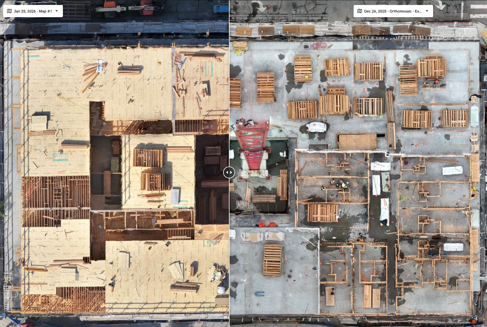
    Construction Progress Comparison
    Construction progress can be easily reviewed using software designed to show progress over time.

    How Drone Progress Tracking Improves Project Management

    From what we’ve seen in the field, recurring drone documentation tends to improve project management in several ways:

    • Faster executive decision-making
    • Reduced reporting ambiguity
    • More consistent communication
    • Improved visibility across teams
    • Better documentation of site changes

    Most importantly, recurring visibility creates alignment between:

    • Owners
    • General Contractors
    • Project Managers
    • Municipal stakeholders
    • Field operations teams

    Data Accuracy and Professional Use

    From our experience working alongside licensed surveyors and construction teams, drone progress tracking is most effective when used as a visibility and reporting layer—not as a replacement for traditional surveying.

    Drone-generated data provides:

    • Accurate, repeatable site documentation
    • Progress visibility
    • Volume analysis
    • Visual reporting support

    At the same time, it’s important to clarify:

    Drone mapping and progress tracking services are not substitutes for licensed land surveying or legal boundary determination.

    Traditional surveying remains essential for:

    • Boundary verification
    • Control networks
    • Engineering-grade deliverables
    • Legal documentation

    Most successful projects use drone progress tracking to improve visibility between formal survey updates and reporting cycles.

    Why This Creates Real ROI

    Most construction stakeholders don’t invest in drone progress tracking because they want aerial visuals.

    They invest because they want:

    • Better visibility
    • Faster reporting
    • Reduced uncertainty
    • Improved communication
    • More informed decisions

    From our perspective at Aerial Decisions, that’s where the real ROI comes from.

    FAQs

    How often should drone progress tracking flights occur?
    Most commercial projects benefit from monthly flights, with higher-frequency capture during critical construction phases.

    What is included in drone construction progress tracking?
    Most workflows include orthomosaic maps, timeline comparisons, progress photos, and measurable site documentation.

    Does drone progress tracking improve reporting?
    Yes. Many project teams use drone data to simplify executive reporting and improve stakeholder visibility.

    Is drone progress tracking accurate enough for construction use?
    Yes, for progress documentation, volume analysis, and site visibility, drone mapping provides reliable project-level accuracy.

    Can drone progress tracking replace surveying?
    No. It complements traditional surveying by improving visibility and documentation between survey milestones.


    Executive Takeaway

    From our experience at Aerial Decisions, drone construction progress tracking has become one of the most effective ways to improve project visibility across commercial construction workflows.

    It helps teams document progress more consistently, communicate more clearly, and make more informed decisions throughout the lifecycle of a project.

    Most importantly, it creates a shared visual understanding of the jobsite—and that clarity tends to improve everything downstream.


    Disclaimer

    Drone mapping and progress tracking services provided by Aerial Decisions are intended for visual documentation, progress tracking, and general measurement purposes only. These services do not replace licensed land surveying, boundary determination, or engineering-grade deliverables.

    From The Editor:

    Do you need to hire a professional drone service provider for your project? To speak to an aerial data specialist, fill out a form, email us or for even faster response times, give us a call at (833) FLY-4YOU or (833) 359-4968. Check out our transparent pricing and watch this space as we expand on the above topics and more over the coming weeks and months.

    If you like this post, feel free to click the share button at the bottom of the page. We appreciate you helping us by spreading the content we share on our blog.

    Drones and Construction podcast on Spotify
    Stream Drones and Construction podcast on your favorite listening platform.

    Showcase Your Company on the Drones and Construction Podcast! If you’d like to be a featured guest on our podcast, send us an email: info@aerialdecisions.com and one of our crew will get right back to you to share the details.

    About Aerial Decisions

    Aerial Decisions is a Los Angeles-based Drone Services Provider (DSP). We specialize in providing cutting-edge drone data collection combined with industry leading software solutions tailored for the commercial construction industry. Our mission is to optimize the way enterprise construction projects are managed by offering precise aerial photography, detailed data analysis, and innovative software tools through a network of FAA-certified and insured drone pilots. Aerial Decisions is not just a drone service provider; we are your strategic partner in commercial construction. Our hands-on approach to understanding your unique requirements and our dedication to excellence ensures that every flight and every data point is optimized for your success. Trust us to be the eyes in the sky that elevate your construction projects to new heights.

  • Drone Mapping Cost vs Traditional Surveying: What Commercial Construction Teams Should Know

    Drone Mapping Cost vs Traditional Surveying: What Commercial Construction Teams Should Know

    The Construction Drone Intelligence Series

    Part 3 – Understanding When Drone Mapping Adds Value—and When Licensed Surveying Is Still Essential

    Most commercial construction teams aren’t trying to replace surveying—they’re trying to gain better visibility, improve decision-making, and manage cost more effectively.

    Across the Southern California projects we support at Aerial Decisions, many General Contractors and Owners are focused on a few key questions:

    • Where can we improve efficiency without sacrificing accuracy?
    • How do we maintain visibility without increasing cost?
    • What tools give us better insight into jobsite conditions?

    Both drone mapping and traditional surveying play important roles in answering those questions. When used strategically, they complement each other and create a more complete picture of the project.


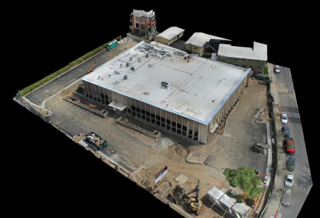
    3D HD Model of a Commercial Building

    What Drone Mapping Provides on a Construction Site

    In commercial construction, drone mapping uses aerial imagery to generate measurable site data such as orthomosaics, 3D models, and volume calculations.

    From our experience operating pilot and visual observer crews in the field, drone mapping is most effective when it is used consistently to support:

    • Construction progress tracking
    • Commercial site documentation
    • Volume measurement
    • Visual reporting on job sites

    It creates a repeatable, scalable way to understand site conditions over time.


    What Traditional Surveying Delivers

    Traditional surveying relies on ground-based equipment such as theodolites, transit levels for angles, measuring wheels and tapes for distances. GNSS systems help to capture precise measurements (as they do with drone mapping).

    Licensed surveyors provide:

    • Boundary verification
    • Control points and control networks
    • High-precision elevation data
    • Engineering and design support
    • Legal documentation

    These deliverables are essential to the integrity of a construction project.


    Drone Mapping vs Traditional Surveying: Cost & Value Comparison

    CategoryDrone MappingTraditional Surveying
    Cost StructureLower per captureHigher per mobilization
    FrequencyMonthly or weekly feasibleLess frequent due to cost
    CoverageFull-site visibilityTargeted measurement points
    SpeedRapid capture (hours)Field-intensive
    AccuracyHigh (project-level)Very high (survey-grade)
    Best UseProgress + reportingControl + compliance

    Where Drone Mapping Improves Cost Efficiency

    From what we’ve seen across commercial construction projects, drone mapping creates cost efficiencies in areas where frequency and visibility matter most.

    Reduced Site Visits

    Aerial capture allows teams to monitor conditions without requiring repeated field walks.

    Faster Data Collection

    Large sites can be documented quickly, often within a single flight.

    Ongoing Progress Visibility

    Recurring flights create a time-based record of site conditions without repeated survey mobilizations.

    Volume Tracking

    Material quantities and stockpiles can be measured more consistently.

    Most teams find that drone mapping becomes a cost-efficient layer of ongoing site intelligence, rather than a one-time deliverable.


    Where Traditional Surveying Remains Essential

    Even with advancements in drone technology, traditional surveying remains critical to most construction projects.

    Licensed surveyors continue to provide:

    • Boundary determination
    • Control networks
    • Engineering-grade accuracy
    • Legal documentation

    These elements are foundational to project execution and compliance.


    Data Accuracy and Professional Use

    From our experience working alongside licensed surveyors on commercial construction projects, the most effective approach is a combination of both drone mapping and traditional surveying.

    Drone mapping provides accurate, repeatable site data that supports:

    • Progress monitoring
    • Volume measurements
    • Site documentation
    • Executive reporting

    At the same time, it’s important to be clear:

    Drone mapping is not a replacement for licensed land surveying or survey-grade deliverables.

    Traditional surveying remains essential for:

    • Boundary determination
    • Control networks
    • Engineering and design accuracy
    • Legal documentation

    Most projects benefit from using drone mapping to fill the visibility gap between survey intervals, improving both efficiency and communication without compromising accuracy requirements.


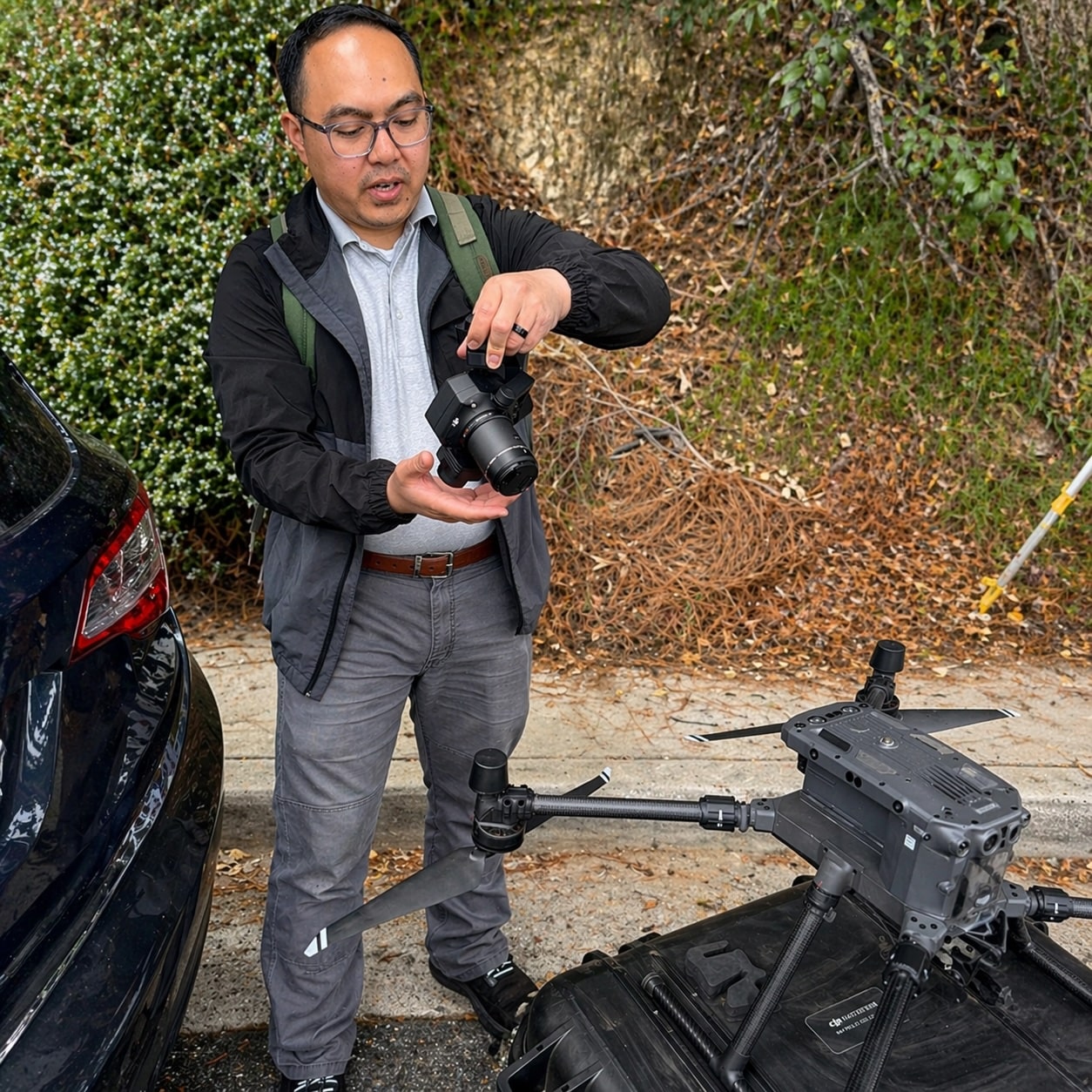
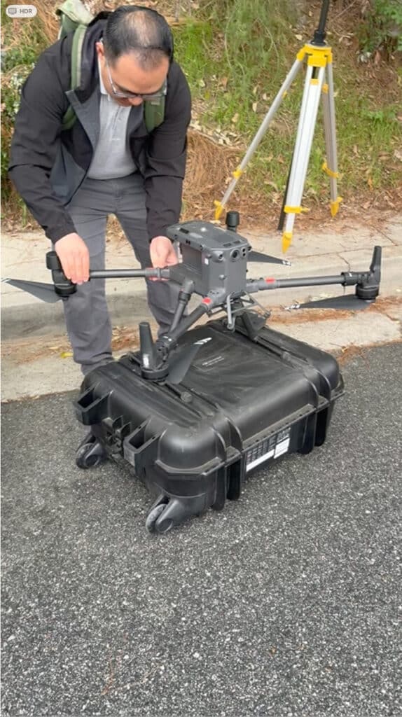
    DJI Matrice 300 RTK
    Aerial Decisions Chief Technical Pilot, Marcus Manahan readies his DJI Matrice 300 RTK for lift off

    Mini Case Snapshot (From Field Experience)

    • Project Type: Large municipal road improvement project, Glendale, California
    • Challenge: Need for consistent progress visibility without increasing survey costs
    • Drone Method: Monthly drone mapping integrated with existing survey control
    • Outcome: Improved reporting clarity, reduced need for repeat survey mobilizations, and better alignment between field teams and city engineers

    How This Impacts ROI on Real Projects

    From our experience, the return on drone mapping is not typically driven by replacing surveying—it comes from improving how teams operate between survey updates.

    Most projects see value through:

    • Reduced redundant site visits
    • Improved communication between stakeholders
    • Earlier identification of potential issues
    • Faster decision-making cycles

    When the right data is available at the right time, both cost and risk are easier to manage.


    A Practical Approach That Works

    Most successful projects take a blended approach:

    • Traditional Surveying: Establishes control, supports design, ensures compliance
    • Drone Mapping: Provides ongoing visibility, documentation, and reporting

    This allows teams to maintain:

    • Precision where it is required
    • Visibility where it adds the most value

    FAQs

    1. Is drone mapping cheaper than traditional surveying?
      Drone mapping is typically more cost-efficient for frequent site monitoring, while traditional surveying is used for high-precision and legal measurements.
    2. Can drone mapping replace a licensed surveyor?
      No. Drone mapping complements surveying but does not replace licensed survey work.
    3. How often should drone mapping be used?
      Most projects benefit from monthly mapping, with more frequent capture during active phases.
    4. Is drone mapping accurate enough for construction use?
      Yes, for progress tracking, documentation, and volume calculations, it provides reliable project-level accuracy.
    5. Who benefits most from combining both methods?
      General Contractors, Owners, Developers, and Project Executives responsible for cost, schedule, and reporting.

    Executive Takeaway

    From our experience at Aerial Decisions, most commercial construction teams see the strongest results when they stop viewing drone mapping and traditional surveying as competing solutions.

    • Drone mapping delivers cost-efficient visibility.
    • Surveying delivers precision and compliance.

    Used together, they provide a more complete, practical, and financially effective way to manage construction projects.


    Disclaimer

    Drone mapping and data services provided by Aerial Decisions are intended for visual documentation, progress tracking, and general measurement purposes only. These services do not replace licensed land surveying, boundary determination, or engineering-grade deliverables.

    From The Editor:

    Do you need to hire a professional drone service provider for your project? To speak to an aerial data specialist, fill out a form, email us or for even faster response times, give us a call at (833) FLY-4YOU or (833) 359-4968. Check out our transparent pricing and watch this space as we expand on the above topics and more over the coming weeks and months.

    If you like this post, feel free to click the share button at the bottom of the page. We appreciate you helping us by spreading the content we share on our blog.

    Drones and Construction podcast on Spotify
    Stream Drones and Construction podcast on your favorite listening platform.

    Showcase Your Company on the Drones and Construction Podcast! If you’d like to be a featured guest on our podcast, send us an email: info@aerialdecisions.com and one of our crew will get right back to you to share the details.

    About Aerial Decisions

    Aerial Decisions is a Los Angeles-based Drone Services Provider (DSP). We specialize in providing cutting-edge drone data collection combined with industry leading software solutions tailored for the commercial construction industry. Our mission is to optimize the way enterprise construction projects are managed by offering precise aerial photography, detailed data analysis, and innovative software tools through a network of FAA-certified and insured drone pilots. Aerial Decisions is not just a drone service provider; we are your strategic partner in commercial construction. Our hands-on approach to understanding your unique requirements and our dedication to excellence ensures that every flight and every data point is optimized for your success. Trust us to be the eyes in the sky that elevate your construction projects to new heights.

  • Photogrammetry in Commercial Construction: Turning Drone Images into Measurable Data

    Photogrammetry in Commercial Construction: Turning Drone Images into Measurable Data

    The Construction Drone Intelligence Series

    Part 2 – How Drone Images Become Accurate, Measurable Construction Data

    Most commercial construction leaders don’t need more photos — they need clarity they can measure.

    Across Southern California projects we support at Aerial Decisions, one of the most common questions we hear from General Contractors and Owners is:

    • Are we progressing according to plan?
    • Are quantities aligning with expectations?
    • Can we validate what actually changed?
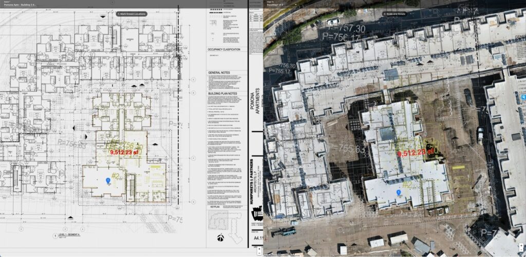
    Construction Map Overlay
    Creating Measurable Data Starts with an Integrated Planning Approach

    Photogrammetry is what allows us to answer those questions with data — not opinion.

    When structured correctly, photogrammetry turns hundreds (sometimes thousands) of drone images into accurate, measurable site models that support better decisions, cleaner reporting, and stronger documentation throughout the lifecycle of a commercial construction project.

    What Is Photogrammetry in Commercial Construction?

    In commercial construction, photogrammetry is the process of capturing overlapping aerial images with a drone and using specialized software to convert those images into accurate 2D maps, 3D models, and measurable datasets such as orthomosaics, point clouds, and digital terrain models.

    Instead of simply viewing a jobsite, teams can:

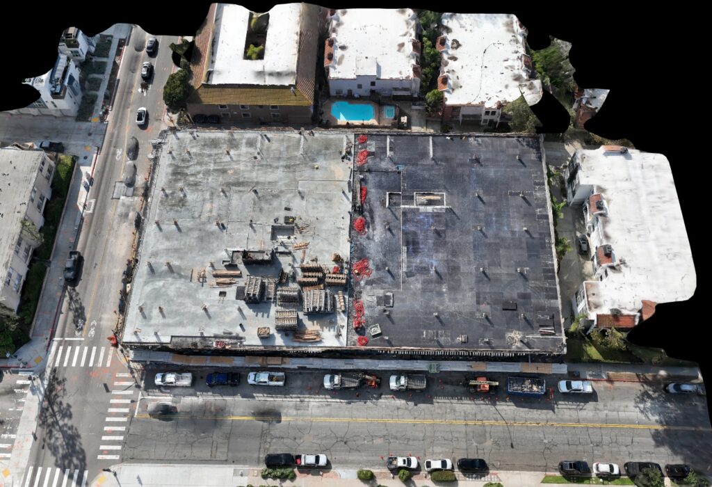
    drone mapping commercial construction site
    3D model from a recent drone mapping commercial construction project
    • Measure distances and areas
    • Calculate volumes
    • Compare time-based progress
    • Document site conditions with precision

    It transforms imagery into usable construction intelligence.

    How Photogrammetry Supports Commercial Construction Workflows

    From our experience operating pilot and visual observer crews across Southern California, photogrammetry provides the most value when it is integrated into repeatable reporting cycles — not treated as a one-off flight.

    Here’s where it most often supports project teams:

    1. Preconstruction & Existing Conditions

    Photogrammetry provides a detailed baseline before work begins. This helps align owners, designers, and contractors early — especially on complex or urban sites.

    2. Earthwork & Volume Verification

    Accurate volume calculations help validate grading progress and reduce uncertainty around material quantities.

    3. Progress Validation

    Side-by-side comparisons allow project teams to visually confirm sequencing and identify potential inefficiencies before they escalate.

    4. Executive & Stakeholder Reporting

    Measurable orthomosaic maps and 3D models create a structured reporting layer that most executives find easier to interpret than narrative-only updates.

    What Photogrammetry Produces

    A properly executed photogrammetry workflow typically generates:

    • Orthomosaic maps (georeferenced 2D aerial maps)
    • 3D site models
    • Point clouds
    • Digital Surface Models (DSM)
    • Digital Terrain Models (DTM)
    • Volume calculations
    Orthomosaics are ortho-rectified images
    Orthomosaics are ortho-rectified images that minimize the impact of the earth’s natural curvature.

    These deliverables allow teams to move beyond visual observation into measurable validation.

    Photogrammetry vs Standard Drone Video

    Category Drone Video Photogrammetry
    Emotional Impact High Moderate
    Measurability None High
    Progress Comparison Limited Structured
    Volume Calculations No Yes
    Reporting Value Visual Data-Driven
    Dispute Support Weak Strong

    Video may support marketing.
    Photogrammetry supports management.

    Most commercial stakeholders prioritize measurable outcomes over cinematic visuals.

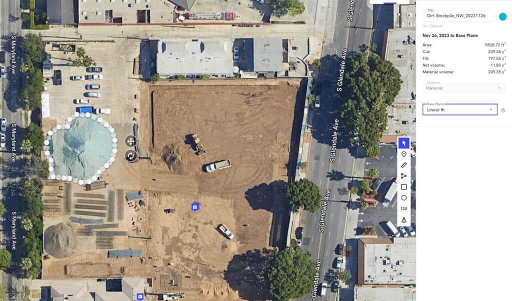
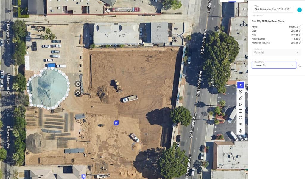
    Stockpile Measurements of a Construction Dirt Pile
    Software Can Convert Regular Drone Images to an Ortho Rectified Image thus Enabling Accurate Stock Pile Measurements

    Mini Case Snapshot (From Field Experience)

    • Project Type: Mid-sized commercial development, Southern California
    • Challenge: Grading quantities required validation before pay application review
    • Drone Method: Recurring photogrammetry flights producing orthomosaics and volume calculations
    • Outcome: Improved confidence in reported quantities and clearer owner-contractor alignment

    Why Photogrammetry Strengthens Risk Control

    In our work supporting commercial construction teams, we’ve seen photogrammetry reduce risk exposure in several ways:

    • Early identification of sequencing inconsistencies
    • Documentation of scope changes
    • Visual confirmation of installed conditions
    • Reduced ambiguity in progress conversations

    When teams rely less on interpretation and more on measurable site data, decision cycles tend to accelerate.

    And accelerated decisions often protect margins.

    How Photogrammetry Fits Into a Modern Drone Program

    Photogrammetry is most effective when it becomes a repeatable intelligence layer across the lifecycle of a build:

    • Monthly mapping cadence
    • Standardized flight plans
    • Time-stamped archive
    • Executive-ready reporting structure
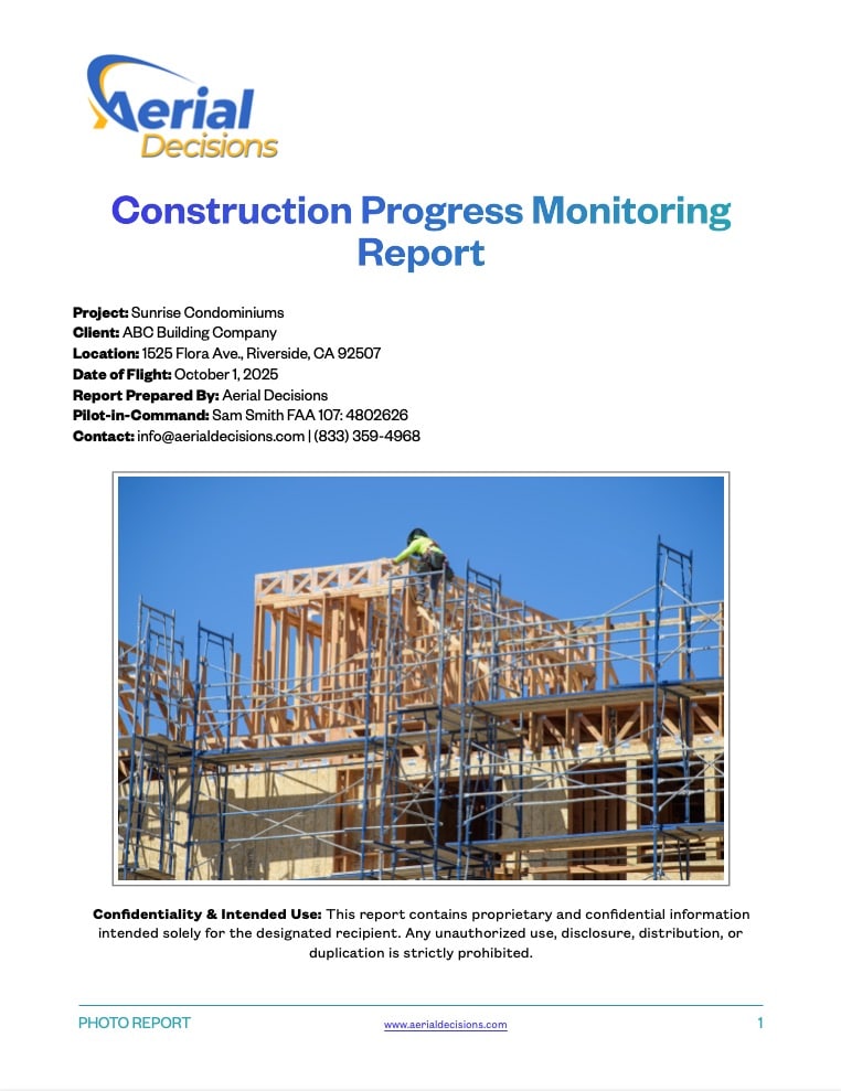
    Construction Monitoring Progress Report
    Construction Monitoring Reports are an Excellent Way to Share Site Progress with Key Stakeholders

    When structured properly, photogrammetry is not a technical add-on.
    It becomes operational infrastructure.

    FAQs

    Is photogrammetry accurate enough for commercial construction projects?
    When properly captured and processed, photogrammetry provides reliable site measurements suitable for progress validation, documentation, and volume analysis.

    Does photogrammetry replace traditional surveying?
    No. It complements survey data by providing frequent visual and measurable updates between formal survey milestones.

    How often should photogrammetry flights occur?
    Most commercial projects benefit from monthly flights, with higher frequency during critical grading or structural phases.

    What software is used for photogrammetry processing?
    Professional workflows use specialized processing platforms that convert overlapping images into orthomosaics, 3D models, and terrain datasets.

    Who benefits most from photogrammetry?
    General Contractors, Owners, Developers, and Project Executives responsible for oversight and reporting.

    Executive Takeaway

    Photogrammetry in commercial construction is not about capturing better images — it’s about converting site conditions into measurable, defensible data. Most construction stakeholders prioritize clarity, risk reduction, and validation. When integrated correctly, photogrammetry provides all three.

    From The Editor:

    Do you need to hire a professional drone service provider for your project? To speak to an aerial data specialist, fill out a form, email us or for even faster response times, give us a call at (833) FLY-4YOU or (833) 359-4968. Check out our transparent pricing at https://aerialdecisions.com/drone-photography-pricing/ and watch this space as we expand on the above topics and more over the coming weeks and months.

    If you like this post, feel free to click the share button at the bottom of the page. We appreciate you helping us by spreading the content we share on our blog.

    Drones and Construction podcast on Spotify
    Stream Drones and Construction podcast on your favorite listening platform.

    Showcase Your Company on the Drones and Construction Podcast! If you’d like to be a featured guest on our podcast, send us an email: info@aerialdecisions.com and one of our crew will get right back to you to share the details.

    About Aerial Decisions

    Aerial Decisions is a Los Angeles-based Drone Services Provider (DSP). We specialize in providing cutting-edge drone data collection combined with industry leading software solutions tailored for the commercial construction industry. Our mission is to optimize the way enterprise construction projects are managed by offering precise aerial photography, detailed data analysis, and innovative software tools through a network of FAA-certified and insured drone pilots. Aerial Decisions is not just a drone service provider; we are your strategic partner in commercial construction. Our hands-on approach to understanding your unique requirements and our dedication to excellence ensures that every flight and every data point is optimized for your success. Trust us to be the eyes in the sky that elevate your construction projects to new heights.

  • Elevating Construction Project Management with Drone Data: What Owners Actually Care About

    Elevating Construction Project Management with Drone Data: What Owners Actually Care About

    Introduction: Construction Owners Don’t Want Pretty Drone Videos — They Want Certainty

    In today’s commercial construction environment, margins are tighter, schedules are compressed, and stakeholder scrutiny is higher than ever.

    While drone footage has become common on job sites, most construction project owners don’t care about cinematic flyovers.

    They care about three things:

    • Are we on schedule?
    • Are we exposed to risk?
    • What changed since last month?

    Modern drone progress monitoring and orthomosaic mapping answer these questions with measurable, defensible data.

    1. Understanding Construction Owner Priorities

    Owners and developers prioritize:

    • Schedule validation
    • Risk identification
    • Scope change documentation
    • Pay application verification
    • Capital protection

    Drone technology becomes valuable only when it directly supports those outcomes.

    A properly structured drone data workflow provides:

    • Weekly or monthly site-wide orthomosaic maps
    • Change detection over time
    • Volume and stockpile measurements
    • High-resolution documentation
    • Visual overlays aligned with plans

    Instead of “look at this footage,” the conversation shifts to:

    “Here is where progress stands compared to last cycle.”

    That shift changes everything.

    Orthomosaic Map

    2. Why Orthomosaic Drone Mapping Delivers More Value Than Video

    A clean, georeferenced orthomosaic map provides far more operational value than cinematic drone video.

    What is an Orthomosaic?

    An orthomosaic is a high-resolution aerial map created by stitching hundreds of drone images together and correcting for distortion so it can be measured accurately.

    Why It Matters:

    • Enables precise distance and area measurements
    • Allows side-by-side time comparison
    • Documents change conditions
    • Supports dispute resolution
    • Improves stakeholder reporting

    In contrast, video footage is emotional.
    Orthomosaic data is defensible.

    For commercial construction stakeholders, defensible wins.

    3. Drone Data Reduces Risk and Protects Margins

    Construction delays, rework, and scope creep erode profitability.

    Drone data supports:

    • Early identification of sequencing issues
    • Material staging inefficiencies
    • Safety exposure zones
    • Improper installations
    • Earthwork miscalculations

    When project managers can see accurate, measurable site conditions, they reduce guesswork.

    And reduced guesswork means:

    • Fewer RFIs
    • Faster decision cycles
    • Cleaner owner conversations
    • Stronger documentation for claims

    That’s where drone ROI in construction becomes real.

    4. Turning Drone Deliverables Into Executive-Level Reporting Tools

    Drone data should not sit in a folder.

    It should be structured as:

    • Time-stamped progress reports
    • Monthly executive dashboards
    • Overlay comparisons (Month 1 vs Month 4)
    • Measurable progress validation

    When structured correctly, drone data improves communication between:

    • Owners
    • Developers
    • General Contractors
    • Lenders
    • Municipal stakeholders

    This isn’t about aerial photography.
    It’s about informed decision-making.

    5. How Drone Progress Monitoring Improves Construction Project Management

    Modern drone workflows support:

    • 2D orthomosaic mapping
    • 3D site models
    • Digital terrain models (DTM)
    • Volume calculations
    • Timeline-based progress comparisons

    For commercial projects, this becomes a repeatable intelligence layer across the lifecycle of the build.

    6. Protecting the Bottom Line with Drone Construction Services

    Owners don’t invest in drone services for visuals.

    They invest in:

    • Cost control
    • Schedule visibility
    • Risk reduction
    • Improved reporting confidence

    When framed correctly, drone services become a financial protection tool, not a marketing expense.

    At Aerial Decisions, we focus on:

    • Commercial construction progress monitoring
    • Infrastructure site mapping
    • Data-driven reporting
    • Measurable deliverables aligned with executive priorities

    Key Takeaways

    • Construction owners prioritize certainty, not aesthetics.
    • Orthomosaic drone mapping provides measurable, defensible data.
    • Drone progress monitoring reduces risk and protects margins.
    • Properly structured drone deliverables improve executive communication.
    • Data-driven drone services create real ROI in commercial construction.

    FAQ – Construction Drone Services

    What are drone services in construction?

    Drone services in construction involve using unmanned aerial systems to capture site data, including orthomosaic maps, 3D models, progress documentation, and volumetric measurements to improve project management and risk mitigation.

    How do drones improve construction project management?

    Drones improve project management by providing accurate site-wide visibility, measurable mapping data, and time-based comparisons that reduce uncertainty and improve decision-making.

    What is an orthomosaic map in construction?

    An orthomosaic map is a high-resolution aerial map created from multiple drone images that are stitched together and corrected for distortion. It allows for accurate measurements and progress tracking across a construction site.

    Are drone services worth the investment for commercial construction?

    Yes. When structured around measurable reporting and risk mitigation, drone services help reduce rework, improve schedule adherence, and provide defensible documentation—protecting overall project margins.

    How often should construction drone progress monitoring be conducted?

    Most commercial projects benefit from bi-weekly or monthly drone mapping flights, depending on project complexity, schedule pace, and stakeholder reporting requirements.

    Can drone data help reduce construction disputes?

    Yes. Time-stamped aerial documentation provides objective evidence of site conditions, helping resolve disputes related to delays, installation errors, or scope changes.

    From The Editor:

    Do you need to hire a professional drone service provider for your project?  To speak to an aerial data specialist, fill out a form, email us or for even faster response times, give us a call at (833) FLY-4YOU or (833) 359-4968.  Check out our transparent pricing at https://aerialdecisions.com/drone-photography-pricing/ and watch this space as we expand on the above topics and more over the coming weeks and months.  

    If you like this post, feel free to click the share button at the bottom of the page.  We appreciate you helping us by spreading the content we share on our blog.

    Drones and Construction podcast on Spotify
    Stream Drones and Construction podcast on your favorite listening platform.

    Showcase Your Company on the Drones and Construction Podcast! If you’d like to be a featured guest on our podcast, send us an email: info@aerialdecisions.com and one of our crew will get right back to you to share the details.

    About Aerial Decisions

    Aerial Decisions is a Los Angeles-based Drone Services Provider (DSP).  We specialize in providing cutting-edge drone data collection combined with industry leading software solutions tailored for the commercial construction industry. Our mission is to optimize the way enterprise construction projects are managed by offering precise aerial photography, detailed data analysis, and innovative software tools through a network of FAA-certified and insured drone pilots.  Aerial Decisions is not just a drone service provider; we are your strategic partner in commercial construction. Our hands-on approach to understanding your unique requirements and our dedication to excellence ensures that every flight and every data point is optimized for your success. Trust us to be the eyes in the sky that elevate your construction projects to new heights.

  • Drone Mapping for Commercial Construction Projects

    Drone Mapping for Commercial Construction Projects

    The Construction Drone Intelligence Series

    Part 1 – How Aerial Data Helps General Contractors Improve Project Visibility and Decision-Making

    When we first started flying drones on commercial construction projects in Southern California, the goal wasn’t flashy visuals—it was clarity. As our pilot and visual observer teams began supporting more General Contractors and Owners, we kept seeing the same problems: inconsistent progress documentation, misalignment between field teams and executives, and too much reliance on subjective reporting.

    Drone mapping changed that.

    From dense urban infill projects to large commercial developments, we’ve seen firsthand how a consistent aerial mapping program gives project teams a shared, objective view of what’s actually happening on site. For executives who don’t have time to walk jobs every week, that visibility matters—and it directly impacts schedule confidence, risk exposure, and decision-making.


    drone mapping commercial construction site
    drone mapping commercial construction site

    What Drone Mapping Means in Commercial Construction

    In commercial construction, drone mapping is the process of capturing aerial imagery and converting it into accurate, measurable site maps—such as orthomosaics and 3D models—that document existing conditions and track progress over time.

    This isn’t about pretty pictures. It’s about producing repeatable, data-driven visuals that project teams, owners, and stakeholders can trust.


    How We See Drone Mapping Used Most Effectively

    Based on our work across Southern California projects, drone mapping delivers the most value in four areas:

    1. Pre-Construction & Site Context

    Before ground is broken, drone mapping helps teams document existing conditions and align expectations early—especially on tight or complex sites.

    commercial construction site aerial map
    Commercial construction site aerial map

    2. Ongoing Progress Documentation

    Recurring flights (monthly or milestone-based) create a visual timeline that supports:

    • Owner updates
    • Schedule reviews
    • Internal coordination meetings

    Instead of debating what’s complete, teams can see it clearly.

    3. Coordination & Risk Reduction

    From staging conflicts to access constraints, aerial maps often reveal issues that are difficult to spot from the ground—before they become expensive problems.

    4. Executive & Owner Reporting

    Many of our GC and owner clients use drone maps as their primary reporting tool. One aerial map often replaces multiple pages of written updates.


    Drone Mapping vs Traditional Jobsite Documentation

    AreaTraditional MethodsDrone Mapping
    Site CoverageGround-level onlyFull site visibility
    ConsistencyVaries by reportRepeatable & standardized
    SafetyRequires site walksRemote data capture
    Owner CommunicationText-heavyVisual & intuitive
    Historical RecordFragmentedTime-based archive

    Mini Case Snapshot (From Our Field Experience)

    • Project Type: Large commercial construction site, Southern California
    • Challenge: Owners needed reliable progress visibility without frequent site visits
    • Drone Method: Monthly drone mapping with orthomosaics and progress overlays
    • Outcome: Faster executive decisions, fewer clarification requests, and improved trust between field teams and ownership

    construction drone orthomosaic
    Construction drone orthomosaic

    Why Drone Mapping Shows Real ROI

    From our perspective, the return on drone mapping isn’t just financial—it’s operational. When everyone is looking at the same visual truth, meetings are shorter, disputes are fewer, and decisions happen faster.

    That kind of clarity compounds over the life of a project.


    FAQs

    Is drone mapping accurate enough for commercial construction projects?
    Yes. When captured correctly, drone maps provide reliable visual and measurement data for progress tracking and site documentation.

    How often should drone mapping be performed?
    Most projects benefit from monthly mapping, with higher frequency during critical construction phases.

    Does drone mapping replace traditional surveying?
    No. Drone mapping complements surveying by adding visual context and frequent updates.

    Is drone mapping safe on active jobsites?
    Yes. It reduces the need for personnel to enter active or hazardous areas while still capturing comprehensive data.

    Who uses drone mapping the most?
    General Contractors, Owners, Developers, and Project Executives responsible for oversight and reporting.


    Key Takeaway

    From our experience at Aerial Decisions, drone mapping has become one of the most effective tools for improving visibility and accountability on commercial construction projects. It doesn’t replace existing workflows—it strengthens them by giving teams a clearer, shared understanding of progress and risk.

    From The Editor:

    Do you need to hire a professional drone service provider for your project?  To speak to an aerial data specialist, fill out a form, email us or for even faster response times, give us a call at (833) FLY-4YOU or (833) 359-4968.  Check out our transparent pricing at https://aerialdecisions.com/drone-photography-pricing/ and watch this space as we expand on the above topics and more over the coming weeks and months.  

    If you like this post, feel free to click the share button at the bottom of the page.  We appreciate you helping us by spreading the content we share on our blog.

    Drones and Construction podcast on Spotify
    Stream Drones and Construction podcast on your favorite listening platform.

    Showcase Your Company on the Drones and Construction Podcast! If you’d like to be a featured guest on our podcast, send us an email: info@aerialdecisions.com and one of our crew will get right back to you to share the details.

    About Aerial Decisions

    Aerial Decisions is a Los Angeles-based Drone Services Provider (DSP).  We specialize in providing cutting-edge drone data collection combined with industry leading software solutions tailored for the commercial construction industry. Our mission is to optimize the way enterprise construction projects are managed by offering precise aerial photography, detailed data analysis, and innovative software tools through a network of FAA-certified and insured drone pilots.  Aerial Decisions is not just a drone service provider; we are your strategic partner in commercial construction. Our hands-on approach to understanding your unique requirements and our dedication to excellence ensures that every flight and every data point is optimized for your success. Trust us to be the eyes in the sky that elevate your construction projects to new heights.

  • Drones and Construction – The 2025 Outlook

    Drones and Construction – The 2025 Outlook

    Disclaimer: This blog post is based on insights from The Hub International 2025 Construction Outlook. While we have repurposed key takeaways and provided our own analysis, all original data and projections are credited to Hub International. For the full report, you can download a free copy here: Hub International 2025 Construction Outlook.

    Hey there, fellow builders and innovators! As a commercial drone service provider specializing in construction progress, I’m excited to share some insights from HUB International’s 2025 Construction Outlook and explore how drones can be a game-changer in navigating the industry’s evolving landscape.

    Facing the 2025 Construction Landscape

    The construction industry is gearing up for a dynamic year in 2025, with projections indicating total new construction spending will reach $2.145 trillion, aiming for $2.340 trillion by 2028. While large-scale infrastructure projects are on the rise, challenges like inflation, climate change, and fluctuating interest rates could impact profitability. Notably, only 16% of construction firms feel adequately insured against profit-threatening risks, highlighting a significant area for improvement.

    Profitability Challenges and Drone Solutions

    With non-residential construction spending expected to increase by just 2% after a 7% gain in 2024, firms must find innovative ways to maintain profitability. Material costs remain volatile, and the looming $2 trillion in commercial real estate debt maturing over the next two years adds to the uncertainty.

    Construction Worker Taking Inventory
    Construction Worker Taking Inventory

    This is where drones come into play. By providing real-time aerial insights, drones can:

    • Monitor Material Usage: Track inventory and reduce waste, helping manage fluctuating material costs.
    • Assess Site Conditions: Quickly evaluate sites after severe weather, enabling prompt responses and minimizing downtime.
    • Enhance Project Planning: Offer detailed topographic maps, aiding in accurate project estimations and budgeting.

    Addressing Labor Shortages with Technology

    The labor shortage continues, with a projected deficit of over 450,000 workers in 2025. The aging workforce and a lack of younger entrants exacerbate this issue.

    Drones can alleviate some labor pressures by:

    • Automating Routine Inspections: Reducing the need for manual checks and allowing skilled workers to focus on critical tasks.
    • Providing Training Tools: Offering aerial footage for training purposes, helping new workers understand site layouts and safety protocols.

    Enhancing Safety and Risk Management

    Severe weather and environmental challenges are increasing, posing risks to both workers and project timelines.

    Drones contribute to safety by:

    • Conducting Hazard Assessments: Identifying potential dangers from a safe distance before workers enter a site.
    • Monitoring Compliance: Ensuring safety protocols are followed through aerial surveillance, reducing the likelihood of accidents.

    Insurance and Risk Mitigation

    Given that a mere 16% of firms feel adequately insured, it’s crucial to explore alternative risk transfer solutions.

    Drones assist in this area by:

    • Documenting Progress: Providing visual records that can be invaluable during insurance claims.
    • Assessing Damage: Quickly surveying sites post-incident to evaluate damage and expedite claims processes.

    Building a Resilient Future

    As we navigate the unpredictable conditions of 2025, integrating drone technology into construction practices offers a proactive approach to risk management and operational efficiency. By leveraging drones, construction firms can enhance profitability, address labor challenges, and strengthen resilience against environmental and economic uncertainties.

    Let’s embrace the skies and build a smarter, safer, and more efficient future together!

    From The Editor:

    Do you need to hire a professional drone service provider for your project?  To speak to an aerial data specialist, fill out a form, email us or for even faster response times, give us a call at (833) FLY-4YOU or (833) 359-4968.  Check out our transparent pricing at https://www.aerialdecisions.com/drone-photography-pricing/ and watch this space as we expand on the above topics and more over the coming weeks and months.  

    If you like this post, feel free to click the share button at the bottom of the page.  We appreciate you helping us by spreading the content we share on our blog.

    Drones and Construction podcast on Spotify
    Stream Drones and Construction podcast on your favorite listening platform.

    Showcase Your Company on the Drones and Construction Podcast! If you’d like to be a featured guest on our podcast, send us an email: info@aerialdecisions.com and one of our crew will get right back to you to share the details.

    About Aerial Decisions

    Aerial Decisions is a Los Angeles-based Drone Services Provider (DSP).  We specialize in providing cutting-edge drone data collection combined with industry leading software solutions tailored for the commercial construction industry. Our mission is to optimize the way enterprise construction projects are managed by offering precise aerial photography, detailed data analysis, and innovative software tools through a network of FAA-certified and insured drone pilots.  Aerial Decisions is not just a drone service provider; we are your strategic partner in commercial construction. Our hands-on approach to understanding your unique requirements and our dedication to excellence ensures that every flight and every data point is optimized for your success. Trust us to be the eyes in the sky that elevate your construction projects to new heights.