Category: Drone Inspections

  • The Future of Business: Top 7 Commercial Drone Applications Across Key Sectors

    The Future of Business: Top 7 Commercial Drone Applications Across Key Sectors

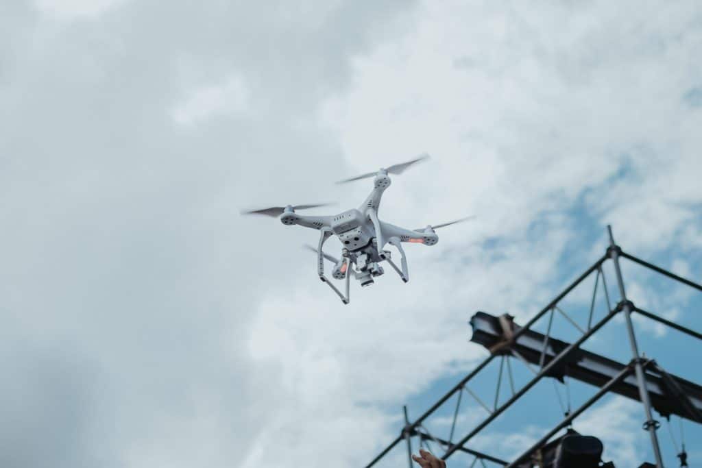
    For many people, drones are often seen as toys for hobbyists or even as threats to privacy and safety. Recent news about unidentified drones buzzing across the East Coast has sparked fears about espionage and airspace violations. These incidents make headlines, but they overshadow a much bigger story: the transformative potential of drones as tools for innovation, commerce, and safety in the United States.

    Instead of focusing solely on the risks, it’s time to recognize the critical role drones are playing in solving challenges that were once insurmountable. From revolutionizing agriculture to enhancing the response to disasters, such as the recent LA fires, drones are not just flying gadgets—they’re essential assets for building a more efficient and secure future.

    As a drone service provider, I’ve seen firsthand how this technology is being adopted across industries. While certain sectors may focus on specific applications—such as the Arts & Entertainment industry prioritizing photography—many industries are leveraging drones in diverse and unexpected ways. Here are the top industries using drones today and how they’re transforming their operations.

    Drone Surveying Oil Pipelines
    Inspecting wind turbines, solar panels, and miles of pipelines once demanded time-consuming and potentially dangerous efforts from workers.

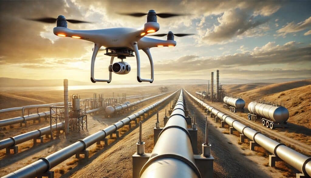
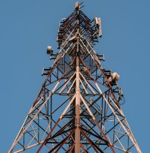
    1. Energy: Inspections and More

    Inspecting wind turbines, solar panels, and extensive pipelines has traditionally been a labor-intensive and hazardous task for workers. The advent of drone technology has revolutionized this process, offering safer, more efficient, and cost-effective inspection methods.

    A notable example is the use of drones equipped with LiDAR (Light Detection and Ranging) technology for power line inspections. According to a case study by CHC Navigation, their AlphaAir 450 UAV LiDAR scanner has been employed to inspect power lines, providing high-precision data and reducing the time required for inspections. 

    In the solar energy sector, drones have significantly increased inspection efficiency. A case study by AgEagle Aerial Systems demonstrated that drone inspections of solar panels mirrored the results of manual inspections with 99% accuracy. However, the drone-based method completed the task in just two hours per site, compared to two days for manual inspections, resulting in a 97% increase in efficiency. 

    These examples highlight how drones are transforming industrial inspections, offering precise data collection while minimizing risks and operational costs.

    agriculture drone spraying field
    Drones can efficiently and precisely apply pesticides, fertilizers, and even water, reducing environmental impact while swiftly covering expansive areas.

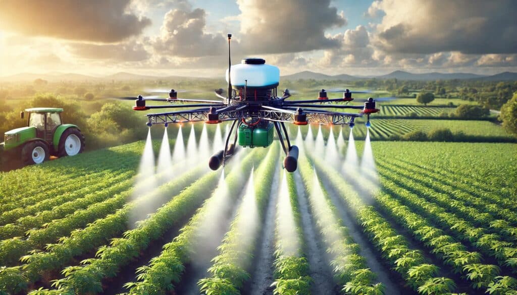
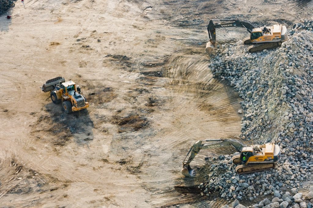
    2. Agriculture: Mapping, Monitoring, and Spraying

    Agriculture is one of the most dynamic industries for drone technology. Farmers use drones for mapping and surveying fields to detect crop stress, soil health, and pest infestations with pinpoint accuracy. This data helps optimize resource use and improve yields, giving farmers actionable insights they never had before.

    Spraying and dispensing are equally transformative. Drones can precisely apply pesticides, fertilizers, and even water, minimizing environmental impact while covering large areas quickly. For farms with challenging terrain or tight planting cycles, drones are the perfect solution to reduce labor costs and increase efficiency.

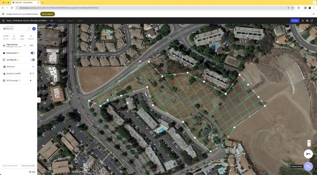
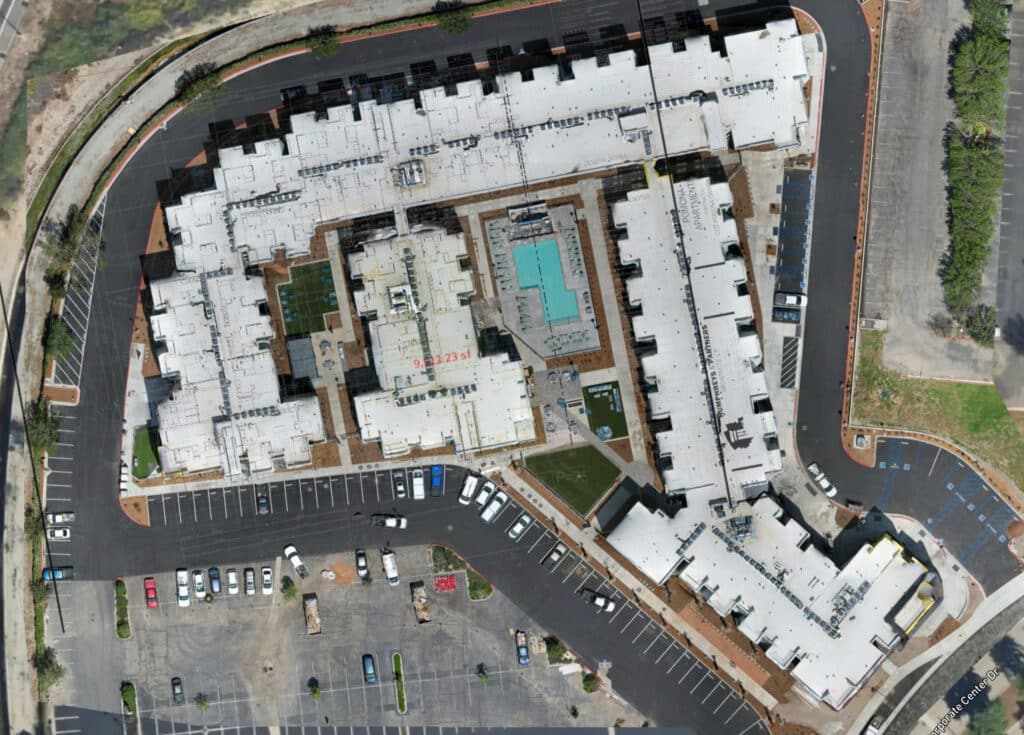
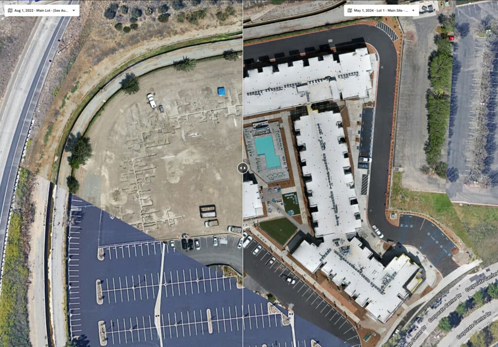
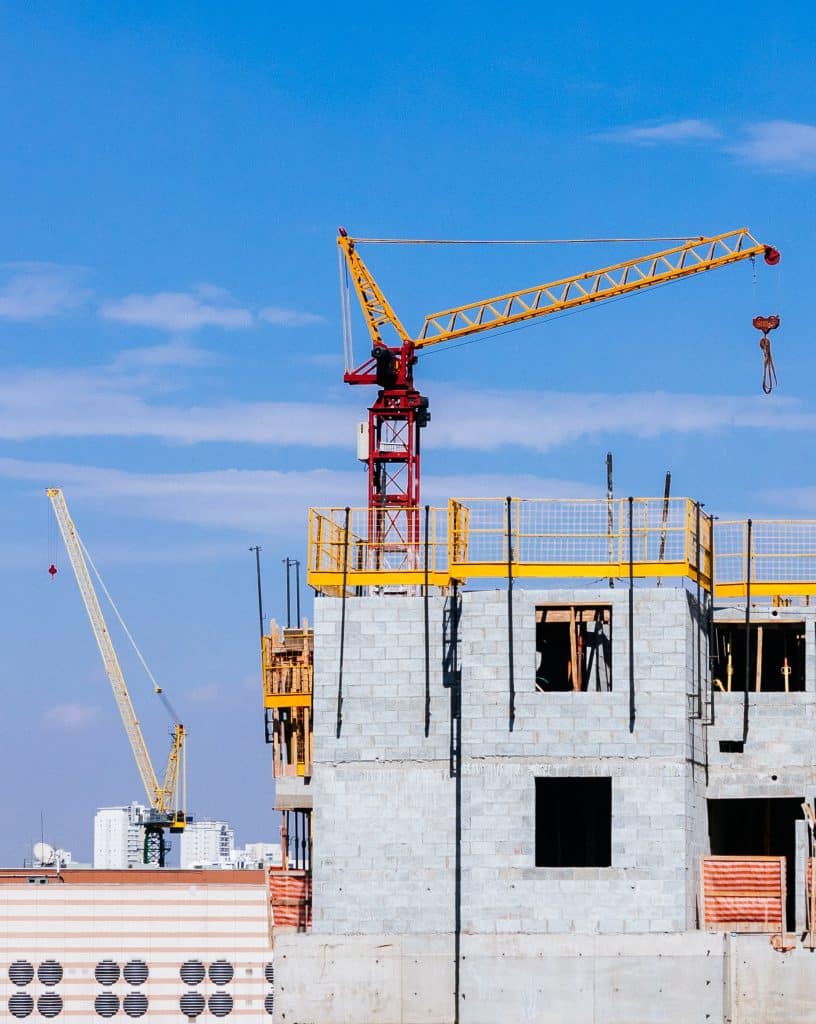
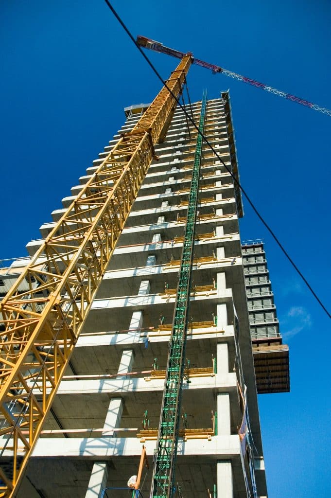
    3. Construction: Progress Tracking and Site Management

    In construction, drones are reshaping project management. Site surveys that once took weeks can now be completed in hours, offering real-time data to track progress and ensure quality. High-resolution imagery and 3D mapping enable better communication across teams and faster identification of potential issues.

    Drones also improve safety by inspecting hard-to-reach areas like scaffolding or high-rise structures, reducing risks to workers. For an industry driven by timelines and budgets, drones are becoming an indispensable tool.

    4. Public Administration and Emergency Services: Mapping, Tracking, and More

    Government agencies and emergency services rely heavily on drones for public safety and resource management. In public administration, drones are primarily used for mapping and surveying urban landscapes, aiding in smarter city planning and disaster preparedness.

    For emergency services, drones equipped with thermal imaging cameras have become life-saving tools. They can locate missing persons, assess damage during natural disasters, and deliver critical supplies to areas that are otherwise inaccessible. The ability to provide real-time visuals in crisis situations makes drones invaluable for saving lives.

    Drones delivering supplies in disaster
    Drones can be an indispensable asset to public service agencies during natural disasters.

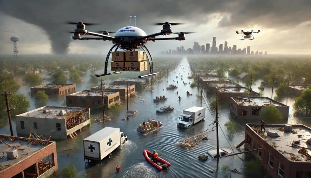
    5. Healthcare and Disaster Relief: Drone Deliveries

    The healthcare sector is at the forefront of integrating drone technology to expedite the delivery of critical medical supplies, especially in remote or disaster-stricken regions. Drones are now transporting defibrillators, vaccines, blood products, and essential medications, ensuring timely medical interventions when every second counts.

    A notable example is Zipline, a California-based company that has established the world’s largest medical drone delivery network. Operating primarily in Rwanda and Ghana, Zipline’s drones have completed over 1.3 million deliveries, covering nearly 100 million miles. These autonomous drones deliver whole blood, platelets, frozen plasma, and cryoprecipitate, significantly reducing delivery times compared to traditional methods. 

    In Rwanda, Zipline’s services have transformed the healthcare logistics landscape. The country’s mountainous terrain and limited infrastructure previously hindered timely medical deliveries. With Zipline’s drone network, medical facilities receive blood products and vaccines swiftly, drastically improving patient outcomes. By October 2020, Zipline had made over 70,000 medical deliveries across Rwanda and Ghana, demonstrating the scalability and reliability of drone delivery systems

    These case studies underscore the transformative potential of drones in healthcare logistics, offering rapid, reliable, and cost-effective delivery solutions that overcome geographical and infrastructural challenges.

    6. Safety & Security: Surveillance and Monitoring

    For security-focused industries, drones are revolutionizing surveillance. They are used to monitor sensitive infrastructure, manage crowds, and conduct large-area reconnaissance. Equipped with advanced cameras and sensors, drones provide a level of situational awareness that static security systems simply can’t match.

    7. Waste Management: Landfill Mapping

    Even industries like waste management are benefiting from drone technology. Landfills use drones to calculate capacity and identify inefficiencies, helping optimize waste management strategies. This reduces environmental impact and ensures compliance with regulatory standards.

    The Takeaway

    Drone technology is no longer a novelty or a luxury—it’s a necessity. Across industries, drones are improving efficiency, enhancing safety, and delivering unprecedented insights. For c-suite leaders, the message is clear: embracing drones isn’t just a technological upgrade; it’s a strategic move to stay competitive in an ever-evolving marketplace.

    Yes, challenges like privacy concerns and airspace safety must be addressed, but they shouldn’t distract us from the immense value drones bring to commerce and public safety. The future of drones is here, and it’s reshaping industries in ways we could only dream of a few years ago. If your business isn’t leveraging drones yet, the question isn’t if you will, but when. Let’s explore how drone technology can elevate your organization to new heights.

    From The Editor:

    Do you need to hire a professional drone service provider for your project?  To speak to an aerial data specialist, fill out a form, email us or for even faster response times, give us a call at (833) FLY-4YOU or (833) 359-4968.  Check out our transparent pricing at https://www.aerialdecisions.com/drone-photography-pricing/ and watch this space as we expand on the above topics and more over the coming weeks and months.  

    If you like this post, feel free to click the share button at the bottom of the page.  We appreciate you helping us by spreading the content we share on our blog.

    Drones and Construction podcast on Spotify
    Stream Drones and Construction podcast on your favorite listening platform.

    Showcase Your Company on the Drones and Construction Podcast! If you’d like to be a featured guest on our podcast, send us an email: info@aerialdecisions.com and one of our crew will get right back to you to share the details.

    About Aerial Decisions

    Aerial Decisions is a Los Angeles-based Drone Services Provider (DSP).  We specialize in providing cutting-edge drone data collection combined with industry leading software solutions tailored for the commercial construction industry. Our mission is to optimize the way enterprise construction projects are managed by offering precise aerial photography, detailed data analysis, and innovative software tools through a network of FAA-certified and insured drone pilots.  Aerial Decisions is not just a drone service provider; we are your strategic partner in commercial construction. Our hands-on approach to understanding your unique requirements and our dedication to excellence ensures that every flight and every data point is optimized for your success. Trust us to be the eyes in the sky that elevate your construction projects to new heights.

  • How Drones and Reality Data Capture are Transforming Construction Projects

    How Drones and Reality Data Capture are Transforming Construction Projects

    As a Drone Service Provider (DSP) focused on the construction industry, we’ve witnessed how drone reality data capture technology is transforming how we approach our clients critical construction projects. From pre-bid site analysis to final closeout inspections, reality capture technologies are collectively streamlining project workflows, enhancing safety, and providing deeper insights throughout each phase of construction. It still surprises me how often I hear industry professionals talk about drones in the limited scope of providing pretty pictures and videos. Nothing could be further from the truth.

    In this post, we explore how drones and reality capture technology are being used during the Pre-Bid & Pre-Construction phase, the active Construction phase, and the Inspection & Closeout phase.

    Flight plan boundaries defined by mapping software
    Flight plan boundaries defined by mapping software

    Pre-Bid & Pre-Construction Phase

    Surveying and Concept & Design
    In the early stages of a project, having accurate and detailed site information is crucial for developing a reliable design. With aerial reality data capture, drones generate high-resolution topographic maps and 3D models that give construction teams an in-depth understanding of site conditions. These data help architects and engineers refine their designs early on, reducing the likelihood of costly revisions later.

    360 Reality Capture for Pre-Construction Planning
    Adding 360 reality capture to the pre-construction phase brings even more clarity to the planning process. By combining aerial drone surveys with 360 walkthroughs, stakeholders can virtually explore the entire site in an immersive, high-resolution format. This is especially useful for off-site team members, enabling them to inspect and interact with the site remotely. These virtual site visits allow for more informed decision-making during the bidding and design phases, while also helping construction managers anticipate potential challenges.

    Site Planning and Procurement
    In addition to design, accurate site data aids in efficient site planning and resource procurement. With real-time aerial data, construction teams can plan for infrastructure placement (e.g., utilities, drainage systems) based on the actual terrain. This information is also valuable for procurement teams, ensuring they order the right quantities of materials based on current site conditions. 360 reality capture offers another layer of transparency here, allowing procurement teams and project managers to virtually inspect site logistics and visualize how equipment and resources are deployed.

    Commercial construction project with floor plan layer
    Commercial construction project with floor plan layer

    Construction Phase

    Earthworks: Cut/Fill Analysis and Stockpile Measurements
    During the construction phase, drones are instrumental in managing earthworks. They perform cut/fill analysis quickly and with high precision, helping your team optimize earthmoving operations. Drones also assist in stockpile measurements, providing real-time data on material availability and consumption, which helps manage resources more effectively and prevents costly delays.

    Tracking Site Progress: As-Designed vs. As-Built
    Drones provide an easy and efficient way to monitor site progress, capturing aerial imagery and data at regular intervals. This allows project managers to compare as-built conditions with the original design, ensuring that the project stays on track and meets specifications. Drone data allows for early detection of deviations which prevents rework and helps you stay on schedule.

    360 Walkthroughs for Site Inspections (Exterior and Interior)
    Beyond aerial data, 360 reality capture offers an immersive experience that is extremely valuable for both exterior and interior site inspections. A 360-degree walkthrough allows team members and clients to virtually “walk” through the site at any time, offering a clear view of construction progress. This is particularly useful for off-site stakeholders who need to stay updated but cannot physically visit the project. These walkthroughs also serve as visual documentation for safety, quality control, and project updates, capturing every detail from various angles.

    Construction site before and after image
    Drone processing software provides time-based site progress comparisons.

    Inspection and Closeout Phase

    Drone Façade Inspections
    In the final stages of construction, inspections become critical to ensuring that all work meets quality standards. Traditionally, façade inspections—especially for tall or hard-to-reach areas—required scaffolding or other heavy equipment. Now, drones equipped with high-resolution cameras can conduct façade inspections more safely and efficiently. Drones capture detailed imagery of exterior surfaces, identifying any defects like cracks, leaks, or structural issues before project closeout.

    360 Reality Capture for Closeout and Inspections
    At the closeout phase, 360 walkthroughs provide an interactive record of the completed project. This is incredibly valuable for final inspections, as it allows stakeholders to review both exterior and interior spaces in detail without being on-site. This virtual documentation also aids in handing over the project to the client, ensuring that they have a comprehensive visual record of the completed work.

    Thermal Imaging for HVAC and Building Inspections
    Drones equipped with thermal imaging cameras are essential for inspecting HVAC systems and detecting heat loss or insulation issues. Thermal imaging ensures that the building is energy-efficient and that there are no hidden defects, such as leaks or poorly installed insulation, that could lead to costly repairs down the line.

    Documentation: 3D As-Builts and Digital Assets
    For closeout documentation, drones provide accurate 3D as-builts that serve as a permanent record of the completed structure. These models are invaluable for future renovations, facility management, and legal documentation. Additionally, 360 walkthroughs are used as digital assets for marketing purposes, which helps you showcase the finished project to future clients or in portfolio presentations.

    Liability Management and Warranty Fulfillment
    Another critical use case for drones and 360 reality capture is liability management. By providing high-resolution documentation of the completed project, you’ll have the necessary evidence to protect your company from insurance claims or disputes that might arise post-construction. This detailed documentation is also crucial for fulfilling warranties, ensuring that you have proof of the project’s condition at the time of handover.

    Summary of Benefits

    By combining the power of aerial reality data capture and 360 walkthrough technology, construction companies can gain significant advantages throughout every phase of the construction lifecycle. From precise surveying and virtual site visits during Pre-Bid & Pre-Construction, to monitoring site progress and streamlining inspections during the Construction phase, these technologies improve efficiency, reduce costs, and provide stakeholders with more transparency and control. Finally, during the Inspection and Closeout phase, drones and 360 walkthroughs ensure comprehensive documentation, helping manage liabilities and ensure warranty compliance.

    What Next?

    If you’re ready to integrate aerial reality data capture and 360 walkthroughs into your construction workflows, reach out to us at Aerial Decisions. We specialize in providing drone and 360 reality capture solutions tailored to your project’s needs. Contact one of our construction sales executives today to set up a free consultation and learn how these technologies can take your projects to the next level.

    About Aerial Decisions

    Aerial Decisions is a Los Angeles-based Drone Services Provider (DSP).  We specialize in providing cutting-edge drone data collection combined with industry leading software solutions tailored for the commercial construction industry. Our mission is to optimize the way enterprise construction projects are managed by offering precise aerial photography, detailed data analysis, and innovative software tools through a network of FAA-certified and insured drone pilots.  Aerial Decisions is not just a drone service provider; we are your strategic partner in commercial construction. Our hands-on approach to understanding your unique requirements and our dedication to excellence ensures that every flight and every data point is optimized for your success. Trust us to be the eyes in the sky that elevate your construction projects to new heights.

  • How Drones are Changing Building Facade Inspections

    How Drones are Changing Building Facade Inspections

    As a Drone Service Provider (DSP) for the commercial real estate sector, we leverage advanced drone technology to offer precise and efficient facade inspections for commercial high-rise buildings. Our drones are equipped with high-resolution cameras and various sensors to capture detailed imagery and data of the building’s exterior.  We then utilize software visualization tools to aid in translating drone imagery into easy to understand data driven visualizations that can help commercial building managers make cost effective decisions that impact the long term sustainability of the properties they manage.

    In this blog post, I will explore the key benefits of using drones for facade inspections.

    drone inspecting building facade
    Drones provide faster, safer and smarter ways to conduct commercial building facade inspections.

    Key Benefits of Using Drones for Facade Inspections

    Cost-Effectiveness

    Traditional methods involving scaffolding and manual inspections can be expensive and time-consuming. Drones can perform inspections more quickly and with fewer resources, lowering overall costs.  Complex building facades often have hidden nooks and crannies that pose a challenge for traditional methods. Our drones navigate tight spaces and reach hard-to-access areas with ease, providing a comprehensive overview of your entire building exterior. No stone goes unturned – you’ll receive a detailed report covering every inch of your facade, ensuring no potential issue goes unnoticed.

    crew on scaffolding inspecting building facade
    Construction crews take significant risks to inspect building exteriors on scaffolding inspecting building facades.

    Enhanced Safety

    Drones eliminate the need for inspectors to physically climb scaffolding or use suspended platforms such as swing stages or man lifts, significantly reducing the risk of accidents and injuries associated with high-rise inspections.  Traditional methods involving scaffolding, rope access, swing stages, man lifts, bucket trucks and manual inspections can be a major drain on your budget. Aerial Decisions’ drone services offer a cost-effective alternative. Drones require minimal set-up, can cover large areas quickly, and eliminate the need for extensive manpower. This translates to faster inspections at a fraction of the cost, freeing up your resources for other priorities.

    Comprehensive Coverage

    Drones can access hard-to-reach areas and provide a complete and detailed view of the building’s facade, ensuring no part of the structure is overlooked.  Our drones are equipped with advanced cameras and sensors, capturing high-resolution images and videos that reveal even the most minute details. 

    High-Resolution Imagery and Data

    Equipped with advanced cameras and sensors, drones capture high-definition images and videos, along with thermal and structural data. This detailed information aids in accurate assessment and diagnosis of potential issues.  We can also integrate thermal imaging and other specialized sensors to gather comprehensive data about the structural integrity of your facade. This detailed information empowers you to make informed decisions regarding repairs, maintenance, and overall building health.

    Real-Time Data and Reporting

    Drones can transmit data in real time, allowing for immediate analysis and quick decision-making. This accelerates the process of identifying and addressing problems, minimizing downtime and disruption.  Our drone technology allows for real-time data transmission. This means you can receive a comprehensive report and high-definition visuals the moment the inspection is complete. This rapid access to information allows for faster analysis and decision-making. Identify problems quickly, take action swiftly, and minimize downtime and disruption to your operations.

    Now that we have covered the Key Benefits of Using Drones for Facade Inspections, let’s explore the types of data that building managers will find useful.

    Types of Data Beneficial to Building Managers

    Video and Images for Visual Record Keeping

    Our high-resolution drone photos and videos capture the facade in stunning detail, revealing more than just a cursory glance ever could. This detailed visual record allows us to pinpoint visible defects like cracks, spalling, water stains, discoloration, and other signs of wear and tear. With this information, you can prioritize repairs and address issues before they escalate into major problems.

    3D Mapping and Modeling

    Drones can create accurate 3D models of the building’s exterior. These models help visualize the facade’s condition and plan for maintenance or repairs.  The 3D model serves as a “digital twin” of the physical building where building managers can compare the digital twin to the actual facade to assess its condition thus Identifying areas that need maintenance, repairs, or upgrades.

    Environmental Data

    Drones can collect data on environmental conditions around the building, such as wind loads and weather patterns, which can affect the facade’s longevity and performance.

    Drones Equipped with Thermal Sensors

    Traditional inspections often miss hidden problems lurking beneath the surface. Our drones are equipped with thermal imaging technology that reveals temperature variations across the facade. These variations can be indicative of a variety of issues, including:

    Water Intrusion

    Because moist areas retain heat differently than dry areas, moisture trapped within the walls will show up as cooler spots in thermal images. Drones equipped with multispectral sensors capture data across different wavelengths of light.

    Insulation Problems

    Poorly insulated areas will show significant temperature differences compared to well-insulated sections. Well-insulated areas retain heat efficiently, resulting in a more uniform temperature across the facade. The thermal camera translates this uniformity into a consistent color on the image.

    Building electrical panels
    Inspecting building electrical panels can help to mitigate fire hazards

    Electrical Faults

    Overheated electrical components can be identified through thermal signatures, enabling prompt repair and preventing potential fire hazards.

    By harnessing the power of thermal imaging, we provide a deeper understanding of your building’s health and help you address potential problems before they become costly repairs.  Ultimately, by utilizing drone technology for facade inspections, commercial high-rise building managers can gain a comprehensive understanding of the building’s exterior condition, prioritize maintenance tasks, and ensure the safety and longevity of the structure.

    Looking for Drone Inspection Case Studies?
    Case Studies: Benefits of Drones in Façade Inspections for Commercial Buildings

    NYC Department of Buildings Study The New York City Department of Buildings conducted a comprehensive study on using drones for façade inspections, highlighting potential time and cost savings. The study emphasized that drones could rapidly differentiate areas needing repair, which would allow for more targeted use of scaffolding and reduce unnecessary expenses. Although NYC laws currently restrict drone usage, the findings suggest significant future savings and efficiencies once regulatory changes are implemented  (DroneDJ) .

    Haag Global’s Use of Drones Haag Global demonstrated the advantages of using drones for façade inspections in a case study from February 2023. They found that drones significantly reduced the time required for inspections and minimized the need for costly equipment like aerial lifts or scaffolding. Drones also improved safety by reducing the need for inspectors to work at heights. High-resolution images and videos captured by drones provided detailed data, enabling more precise assessments and reducing the need for additional hands-on inspections  (Haag Global) .

    Facility Executive Case Study An article in Facility Executive highlighted the adoption of drones for building envelope inspections by companies like Helios Visions. Drones enabled quick capture of high-resolution images and videos, leading to faster and more accurate assessments of façade conditions. This method was significantly cheaper and safer than traditional approaches involving scaffolding or rope access. The case study noted that drones could cover a building’s exterior in a fraction of the time, providing valuable data to identify potential issues before they became critical  (Facility Executive Magazine) .

    From The Editor:

    Do you need to hire a professional drone service provider for your project?  To speak to an aerial data specialist, fill out a form, email us or for even faster response times, give us a call at (833) FLY-4YOU or (833) 359-4968.  Check out our transparent pricing at https://www.aerialdecisions.com/drone-photography-pricing/ and watch this space as we expand on the above topics and more over the coming weeks and months.  

    If you like this post, feel free to click the share button at the bottom of the page.  We appreciate you helping us by spreading the content we share on our blog.

  • Drones Impact on the Construction Industry’s Top Challenges

    Drones Impact on the Construction Industry’s Top Challenges

    We are witnessing firsthand the transformative power of drone technology in revolutionizing some of the biggest challenges in today’s construction industry.  In this blog post, I’ll delve into the five most significant challenges that construction companies face in 2023 and beyond and demonstrate how drones can be the ultimate cost effective solution to overcome these hurdles and pave the way for a more profitable future.

    Drone Flying Over Construction Site
    Drones can easily access hard to reach places helping construction managers quickly deliver critical data to key stakeholders

    Safety and Risk Management

    Ensuring safety on construction sites is a top priority, yet it remains an ongoing challenge. Drones equipped with advanced cameras and sensors can be our most valuable tool in conducting aerial inspections. By collecting real-time data, we enable construction teams to identify potential hazards and adhere to safety protocols diligently. For example, a construction company in Canada used drones to assess a high-rise building’s exterior for signs of wear and tear, facilitating timely maintenance and minimizing safety risks.

    View of Construction Site From Above
    Drones are capable of capturing data that helps project managers scale efficiencies, improve worker safety and reduce costs

    Project Monitoring and Progress Tracking

    Managing large-scale construction projects demands meticulous progress tracking. Drones excel at capturing high-resolution images and generating 3D models, allowing project managers to monitor developments and detect discrepancies promptly. A real-world instance involves a construction project in the UK, where drones were employed to track the construction of a highway expansion, streamlining communication among stakeholders and ensuring on-time completion.

    Drone Service Providers (DSP’s) like Aerial Decisions help reduce costs, boost efficiency, improve worker safety while keeping key stakeholders informed.  Drone progress monitoring adds perspective and production value to any commercial construction project.

    Environmental Sustainability

    The construction industry faces increasing pressure to embrace sustainable practices. Drones play a pivotal role in promoting environmental consciousness by conducting aerial surveys and monitoring ecological impact. With the data collected, construction companies can implement eco-friendly measures and optimize resource utilization. A construction firm in Germany utilized drones to assess the environmental impact of a wind farm project, enabling them to make informed decisions that aligned with green initiatives.

    Cost Overruns and Rising Material Costs

    Construction projects often encounter cost overruns, impacting profitability.  Drones can effectively address these challenges by providing accurate measurements and surveys. This leads to precise budget planning and minimizes unexpected expenses. A construction company in Australia harnessed drone technology to conduct volumetric surveys on a mining site, avoiding cost overruns by precisely estimating the required resources and mitigating project risks.  

    The cost of construction materials has been rising steadily in recent years, and this trend is expected to continue in 2023. This is due to a number of factors, including the increase in demand for materials, the shortage of raw materials, and the rising cost of energy.  Drones are used to collect data on the use of materials and equipment and can even deliver supplies to remote construction sites.

    Image of Construction Management Crew Scaled
    Construction Crew Walk-Through and Safety Check

    Labor Shortages and Productivity

    Labor shortages you ask?  How can drones possibly tackle the demand for human capital?  The construction industry undoubtedly faces a labor shortage, affecting productivity and project timelines.  This is due to a number of factors, including the aging workforce, the lack of interest in construction careers among young people, and the increasing complexity of construction projects. Drones can fill this gap by performing tasks that would otherwise require substantial human effort, thus boosting overall efficiency.

    Drones Even Transport Construction Materials

    An example is a construction company in Japan that utilized drones for material transportation on challenging terrains, enhancing productivity and optimizing labor resources.  Another, more common example, is the use of drones to capture images and video of hard to reach and often unsafe areas of an active construction site that would otherwise require a human to manually observe and record.  This example of drone construction progress monitoring increases both productivity and the safety of the project

    Summary

    Drones are the driving force behind tackling the most pressing challenges in the construction industry in 2023 and beyond. By harnessing drone-captured aerial data, we empower construction companies to streamline operations, enhance safety protocols, and promote environmental sustainability.  Embracing drone technology positions construction businesses for success, leading to improved profitability. From reducing costly errors and ensuring safety compliance to optimizing resource utilization and increasing overall productivity, drones unlock a world of opportunities for the commercial construction industry.

    As a professional Drone Service Provider (DSP), Aerial Decisions is committed to partnering with construction companies to leverage these transformative technologies. Together, we can soar to new heights of efficiency, sustainability, and profitability, shaping a future where innovation and construction excellence go hand in hand.

    Let’s embrace the skies and embark on this thrilling journey toward a more prosperous and sustainable construction industry, powered by the limitless potential of drone technology. The future is now, and it’s time to take flight!

    From The Editor

    Do you need to hire a professional drone service provider for your project?  To speak to an aerial data specialist, fill out a form, email us or for even faster response times, give us a call at (833) FLY-4YOU or (833) 359-4968.  Check out our transparent pricing at https://aerialdecisions.com/drone-photography-pricing/ and watch this space as we expand on the above topics and more over the coming weeks and months.  

    If you like this post, feel free to click the share button at the bottom of the page.  We appreciate you helping us by spreading the content we share on our blog.

  • Vertical Perspectives: Drones in High-Rise Construction

    Vertical Perspectives: Drones in High-Rise Construction

    Drones are popular in the construction industry, and for good reason. They are used for a variety of tasks, including façade inspections, concrete pour monitoring, and structural monitoring at height. This is especially valuable in urban high-rise building construction projects, where traditional methods of building inspection can be dangerous and time-consuming.  

    Commercial Building Construction Roof Crane
    Rooftop cranes perform a variety of functions during commercial high rise construction

    Common Types of Traditional High Rise Inspections

    Visual inspections, where inspectors climb the building or use scaffolding to get a close-up look at the façade, roof, and other exterior surfaces are the most basic and most dangerous.  Magnified inspections use magnification such as binoculars to get a closer look at small details in hard to reach places.  While not necessarily dangerous, finer surface cracks and other facade imperfections are easily missed.  Non-destructive testing (NDT) uses a variety of techniques to inspect the building including ultrasonic testing, which uses sound waves to detect cracks and other defects, and infrared thermography, which uses heat imaging to detect areas of heat loss or gain. Remote visual inspection (RVI) uses cameras and other sensors to inspect the building from a distance. RVI is used to inspect areas that are difficult or dangerous to reach, such as the roof or the exterior walls.

    Unique Challenges of Urban High-Rise Construction

    Urban high-rise building construction projects present a number of unique challenges, including:

    Building Height: High-rise buildings can be hundreds of feet tall, making it difficult and dangerous to inspect them manually.

    Building Access: Access to high-rise buildings is generally restricted, making it difficult to get inspectors to the areas that need to be inspected.

    Weather Conditions: Urban areas can experience extreme weather conditions, such as high winds and rain, which can make manual inspections difficult and dangerous. Professional drone pilots are skilled at navigating complex weather situations. More importantly, FAA certified drone pilots know when bad weather precipitates postponing or abandoning a mission altogether.

    Skyscraper Construction Project
    Commercial buildings employ a variety of equipment to facilitate all phases of a construction project

    How Drones Can Help

    Drones can overcome these challenges and provide a number of benefits for urban high-rise construction projects, including:

    Drone Safety: Drones inspect high-rise buildings without putting inspectors at risk.

    Data Collection Efficiency: Drones inspect high-rise buildings quickly and easily, saving time and money.

    Data Accuracy: Drones provide high-resolution images and videos of high-rise buildings used to identify potential problems.

    Project Documentation: Drones are used to create 3D models of high-rise buildings, which are used for planning and documentation purposes. The data is also used to keep key stakeholders engaged and involved in construction progress.

    Regulatory Considerations

    Before using drones for construction projects, it is important to be aware of the regulatory considerations and airspace restrictions. Drones are regulated by the Federal Aviation Administration (FAA). The FAA regulates drone pilots for commercial applications through a set of rules known as Part 107. Under Part 107, commercial drone pilots must obtain a Remote Pilot Certificate by passing an aeronautical knowledge test. This certificate allows pilots to operate drones for commercial purposes. The regulations outline requirements such as airspace restrictions, operational limitations, daylight-only operations, visual line of sight requirements, and the need to obtain proper authorization for certain activities, such as flying in controlled airspace. Compliance with these regulations ensures safe and responsible drone operations for commercial applications.

    Recent Case Studies

    There are a number of recent case studies that demonstrate the benefits of using drones in high-rise construction projects. For example, in 2018, a drone was used to inspect the façade of the Willis Tower in Chicago. The drone was able to identify a number of potential problems, including loose bricks and missing mortar. These problems were repaired before they caused any damage to the building.

    In another case study, a drone was used to monitor a concrete pour at a high-rise building in New York City. The drone was able to provide real-time footage of the pour, which allowed the construction team to identify any problems early on. This helps to ensure that the concrete pour is completed successfully.

    Conclusion

    Drones are a valuable tool for urban high-rise construction projects. They help to improve safety, efficiency, and accuracy. If you are considering using drones for your next high-rise construction project, it is important to work with a professional Drone Service Provider (DSP). A DSP will help you to comply with all of the regulatory requirements and ensure that your drone flights are safe and successful.

    Hiring a DSP

    Hiring a DSP to handle the highly technical aspects of drone data collection for urban high rise construction is a more efficient, safe and cost effective alternative to manual inspections that include deploying dangerous scaffolding, suspension supports and spider lifts.

    A DSP has the expertise and experience to fly drones safely and efficiently in urban environments.  There are unique considerations for each project including understanding controlled airspace, the impact of weather and wind at altitude, city permitting and traffic and crowd control at the buildings base to name a few.  They also have the necessary equipment and software to collect and process drone data. This will save time and money, and helps to ensure that your high-rise construction project is completed on time and within budget.

    From The Editor:

    Do you need to hire a professional drone service provider for your project?  To speak to an aerial data specialist, fill out a form, email us or for even faster response times, give us a call at (833) FLY-4YOU or (833) 359-4968.  Check out our transparent pricing at https://aerialdecisions.com/drone-photography-pricing/ and watch this space as we expand on the above topics and more over the coming weeks and months.  

    If you like this post, feel free to click the share button at the bottom of the page.  We appreciate you helping us by spreading the content we share on our blog.

  • 5 Benefits of Using Drones for Commercial Building Facade Inspections

    5 Benefits of Using Drones for Commercial Building Facade Inspections

    Drone data collection services provide a reliable and efficient method for inspecting commercial building facades, offering numerous benefits that enhance worker safety, save costs, expedite deliverables, optimize manpower allocation, and keep key stakeholders informed and engaged. 

    In this blog post, we explore these key advantages and showcase the impact of drone inspections through an actual construction defect legal case.

    Image of Apt Building Scaled

    Advantages of Using Drones for Commercial Building Facade Inspections

    Improve Worker Safety

    Traditional methods of inspecting commercial building facades involve manual labor, often requiring workers to use scaffolding or suspended platforms. These methods can pose significant risks, including falls and accidents. By using drones, building owners and inspectors can eliminate or significantly reduce the need for workers to access dangerous heights, thereby improving worker safety and reducing potential injuries or accidents.

    Cost Savings

    Drone data collection services offer cost savings in multiple ways. Drones can capture high-resolution images and videos, eliminating the need for expensive equipment such as scaffolding, high-reach cranes or helicopters. Additionally, drone inspections are more time-efficient, reducing labor costs associated with extended inspection periods. By providing accurate and comprehensive data, drones help identify issues early on, preventing costly repairs and minimizing long-term maintenance expenses.

    Commercial Building Facade - East Corner Inspection
    Commercial Building Facade – East Corner Inspection

    Speed of Deliverables

    Drone inspections enable rapid data collection and analysis. In the past, commercial building owners used scaffolding and time intensive labor to log building inspections. Drones can capture detailed images and videos of building facades efficiently and at high speed. What used to take a week or more, drone data can be processed quickly and turned into actionable insights, allowing stakeholders to make informed decisions promptly. This swift turnaround time accelerates the entire inspection process, enabling building owners to address any identified issues promptly.

    Manpower Allocation

    Using drones for building facade inspections allows for optimal allocation of manpower. Instead of dedicating a significant number of workers to perform manual inspections, these resources can be redirected to other crucial tasks, such as maintenance, repairs, or specialized assessments. By streamlining the inspection process, drone data collection services help organizations allocate their workforce more efficiently, saving time and resources.

    Engaging Key Stakeholders

    Drone inspections facilitate effective communication and engagement among key stakeholders. The comprehensive visual data captured by drones provides a clear understanding of the building’s condition, making it easier to communicate potential issues to internal teams, building owners, insurers, and external contractors. This transparency will help to foster collaboration and ensure all stakeholders are well-informed and engaged throughout the inspection and maintenance processes.

    Construction Defect Cases on the Rise

    Design defects and poor workmanship have risen to become leading causes of engineering claims. Defective products are the single biggest source of engineering claims by frequency, and the second largest by severity, according to AGCS claims analysis. Accounting for 27% of engineering claims, there are almost three times as many defective products claims as storm claims, the next largest cause of engineering claims by frequency.

    Commercial buildings often have hard to reach places that make facade inspections difficult and time consuming.  Compared to more frequently used manual visual inspections, using drones for commercial building facade Inspections can more easily capture high-resolution images and videos, which can be used to create detailed reports of the defects.  Drone data is objective and impartial, which can help to persuade a jury.

    Drones Aid a Construction Defect Claim

    A homeowners association representing a residential development of more than 100 homes filed a construction defect claim against the home builder, a UAV/Drone Service Provider was enlisted to document several construction defects relating to the work of the roofer, including damaged/broken roof tiles, overexposure at rakes and ridges, and liquefaction of self-adhesive flashing.

    High-resolution photos and videos captured by the aerial survey revealed the extent of the damages, thus, a time consuming and costly manual inspection was avoided and the high resolution drone data ultimately led the two sides to agree to a fair settlement.

    Drone data collection services have become a game-changer for commercial building facade inspections. By leveraging drones, building owners and inspectors can benefit from improved worker safety, cost savings, expedited deliverables, optimized manpower allocation, and better engagement with key stakeholders. The construction defect case outlined above demonstrates the significant impact of drone inspections in legal proceedings, providing compelling evidence to support claims and, in many cases, leads to equitable outcomes. 

    From The Editor

    Do you need to hire a professional drone service provider for your project?  To speak to an aerial data specialist, fill out a form, email us or for even faster response times, give us a call at (833) FLY-4YOU or (833) 359-4968.  Check out our transparent pricing at Drone Photography Pricing and watch this space as we expand on the above topics and more over the coming weeks and months.  

    If you like this post, feel free to click the share button at the bottom of the page.  We appreciate you helping us by spreading the content we share on our blog.

  • 3 Advantages of using Drones for Bridge Inspections

    3 Advantages of using Drones for Bridge Inspections

    Bridges and overpasses are a critical part of America’s infrastructure. They facilitate the transportation of people and goods across the country and are essential to the nation’s economy. However, many of these structures are aging, and the need for infrastructure repairs is becoming more pressing.

    According to the American Society of Civil Engineers, the average age of the 614,387 bridges in the United States is 44 years. The ASCE also rated the condition of bridges on a scale of 0-100, with 0 indicating failure and 100 indicating excellent condition. The national average score for bridges was 43, which is considered poor.

    Many bridges and overpasses are in need of repair, with rust, corrosion, and cracks in their structures posing significant safety risks. In 2021, the American Road and Transportation Builders Association’s (ARTBA) Bridge Report revealed that there are 231,000 bridges in the United States that need repair work.

    The need for infrastructure repairs is particularly high in the Northeast and Midwest regions of the country. The ARTBA report found that these regions have the highest percentage of structurally deficient bridges. The state of Iowa has the highest percentage of structurally deficient bridges in the country, with over 4,500 bridges in need of repair. Pennsylvania has the second-highest number of structurally deficient bridges, with over 3,000 in need of repair.

    Image of Pexels Klas Tauberman X
    Bridge with hard to reach inspection points

    Drones Can Easily Locate Important Repairs

    Drones can be a useful tool in inspecting bridges and overpasses.  Aerial drone photography can be especially helpful capturing high-resolution images and videos in tight spaces underneath bridges and overpasses.  The data drones can capture provide valuable information about the condition of a structure. This information can help engineers identify areas that require repair work and develop maintenance plans.

    Drones Increase Workforce Safety

    Drones can also improve safety in bridge inspections. Inspectors often need to climb up to great heights to inspect a bridge, which can be dangerous and time-consuming. With drones, inspectors can remain on the ground and operate the drone remotely. This reduces the need for man-power and makes inspections safer.

    Image of Old Bridge X
    Rural bridge over flowing river

    Drones Reduce Inspection Costs

    The use of drones for bridge inspections can help save money in a number of areas.  The US government estimates that a typical bridge inspection costs between $4,500 and $10,000 per inspection.  Costs include worker compensation (and benefits), equipment (transportation and storage) and traffic management expenses.  According to Drone Deploy, drones can reduce those costs as much as 75% and the California Resources Corporation estimates drone inspections results in a 90% reduction in inspection time.

    In conclusion, the state of bridges and overpasses in the United States is concerning. With the average age of bridges being 44 years and the national average condition score being 43, the need for infrastructure repairs is pressing. 

    Fortunately, the recent Infrastructure Investment and Jobs Act (IIJA; P.L. 117-58), enacted on November 15, 2021, established federal programs specifically to fund bridges and significantly increased the total amount of federal funding that can be used for bridge construction and repair.

    Ultimately, drones can be an effective tool in inspecting bridges and overpasses, improving safety, saving costs, and increasing efficiency in inspections.

    From The Editor:

    Do you need to hire a professional drone service provider?  To speak to an aerial data specialist, fill out a form, email us or for even faster response times, give us a call at (833) FLY-4YOU or (833) 359-4968.  Check out our transparent pricing at Drone Photography Pricing and watch this space as we expand on the above topics and more over the coming weeks and months.  If you like this post, feel free to click the share button at the bottom of the page.  We appreciate you helping us by spreading the content we share on our blog.

  • Why Telecom Managers Use Drones for Cellular Tower Inspections

    Why Telecom Managers Use Drones for Cellular Tower Inspections

    Cellular technology manager’s primary responsibility is to ensure the safety and reliability of cell towers. Regular cell tower drone inspections are crucial to identify and address any potential problems before they become major issues that can impact network performance and safety. While traditional tower inspections are still commonly used, the use of drones has become increasingly popular due to their ability to save time, money and improve human safety.

    Drone Inspections Save Time

    Using drones for cell tower inspections can significantly save time. Drone inspections can be completed much faster than traditional inspections, as they can quickly cover the entire tower without needing to set up complex rigging or scaffoldings. In addition, drones can capture high-quality images and video footage of the tower, allowing for more detailed analysis and faster identification of potential issues. This means that the inspection process can be completed quickly, and any necessary repairs or maintenance can be performed in a timely manner, reducing downtime for the network.

    Image of Cellular Tower X
    Modern cellular or PCS base station

    Drones Improve Cost Savings

    Using drones for cell tower inspections can also save money. Traditional inspections can be expensive, requiring specialized equipment and skilled technicians. Drone inspections are more cost-effective as they require fewer personnel and resources to complete the inspection process. Additionally, drone inspections can identify issues early, which can reduce the cost of repairs and maintenance in the long run.

    Ensure Worker Safety

    Finally, using drones for cell tower inspections can also improve human safety. Typical cellular towers (or PCS Base Stations) range from 50-200 feet.  Traditional inspections often require technicians to climb the tower, which can be a hazardous task. Drones can eliminate the need for technicians to climb the tower, reducing the risk of accidents and injuries. This is especially important in remote or hard-to-reach locations, where the risk of accidents can be even higher.

    In conclusion, cell tower inspections are critical for ensuring the safety and reliability of cellular networks. The use of drones for these inspections offers significant benefits, including time and cost savings, as well as improved human safety. Cellular technology managers are constantly exploring and adopting new technologies like drones to ensure that their networks remain safe, reliable, and cost-effective.

    From The Editor:

    Do you need to hire a professional drone service provider?  To speak to an aerial data specialist, fill out a form, email us or for even faster response times, give us a call at (833) FLY-4YOU or (833) 359-4968.  Check out our transparent pricing at Drone Photography Pricing and watch this space as we expand on the above topics and more over the coming weeks and months.  If you like this post, feel free to click the share button at the bottom of the page.  We appreciate you helping us by spreading the content we share on our blog.