Introduction: Better Information Leads to Better Outcomes
In many of my conversations with construction leaders, I’ve learned that most don’t invest in drone technology because it’s innovative.
They invest because they want better information.
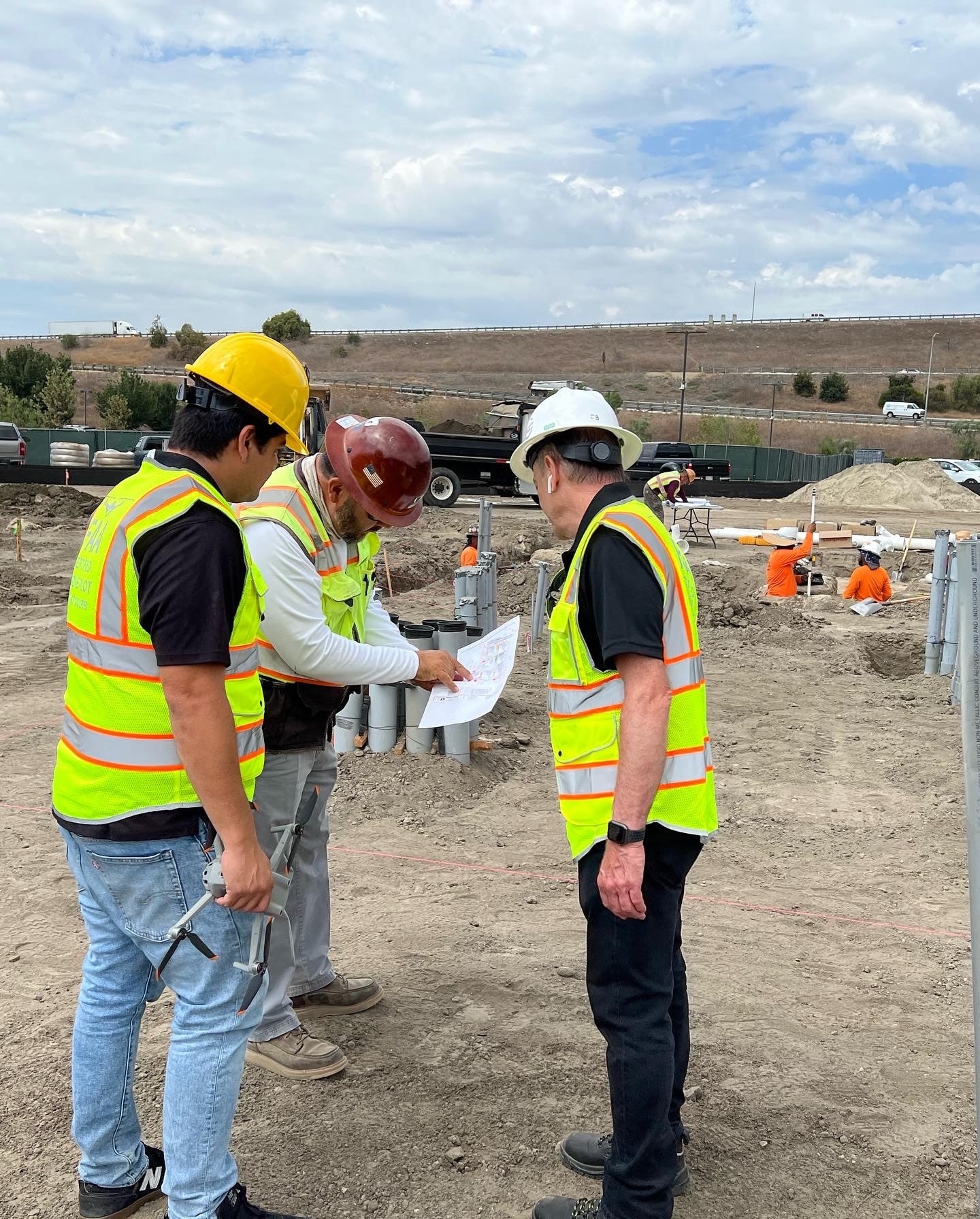
Across the commercial construction projects we support throughout Southern California, Owners, Developers, and General Contractors are constantly balancing schedule pressures, cost management, stakeholder expectations, and project risk.
The most successful teams understand that better decisions start with better visibility.
That’s where drone technology creates value.
When integrated into a structured construction workflow, drones can improve reporting, increase visibility, reduce uncertainty, and help teams identify issues earlier. The result isn’t simply better aerial imagery—it’s better project outcomes.
How Construction Teams Measure ROI
When evaluating any technology investment, most construction leaders ask a simple question:
Will this help us make better decisions or improve project performance?
For drone programs, ROI typically comes from improvements in:
- Project visibility
- Reporting efficiency
- Risk management
- Communication
- Documentation
- Decision-making speed
While every project is different, the strongest returns often come from operational improvements rather than direct labor savings.
Where Drone ROI Actually Comes From
From our experience at Aerial Decisions, most of the value generated by drone programs comes from creating a more complete picture of what’s happening on the jobsite.
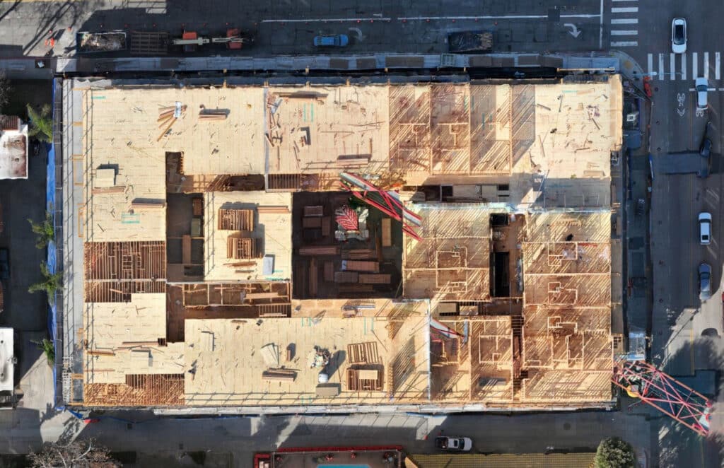
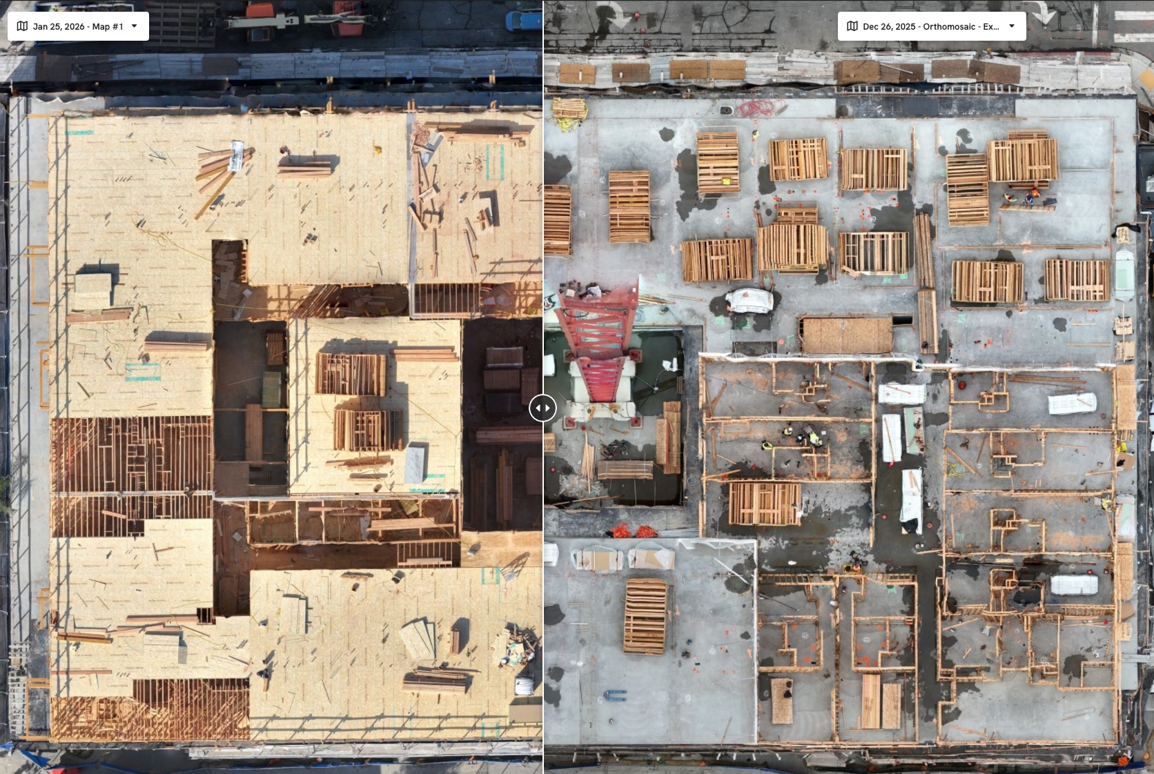
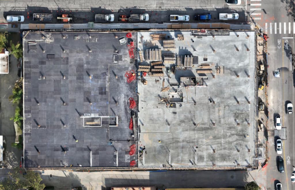
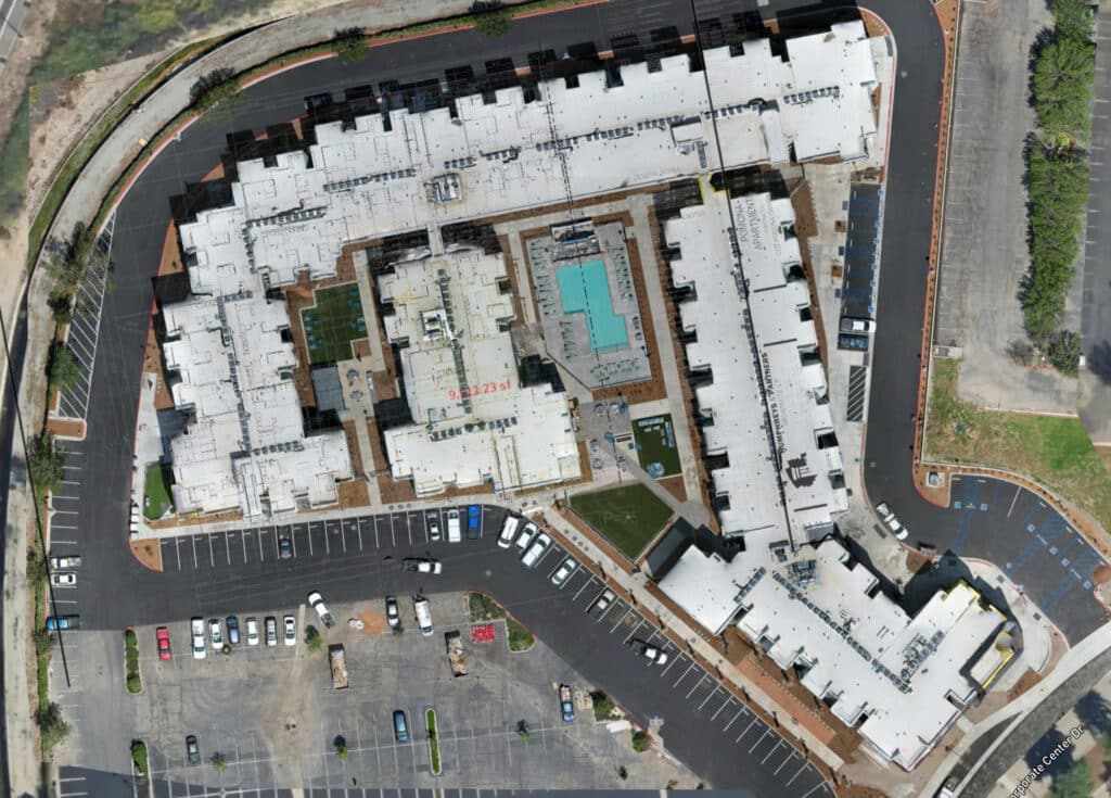
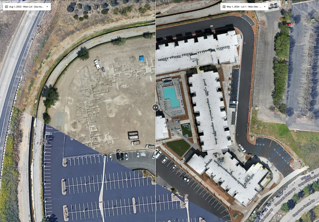
Improved Progress Visibility
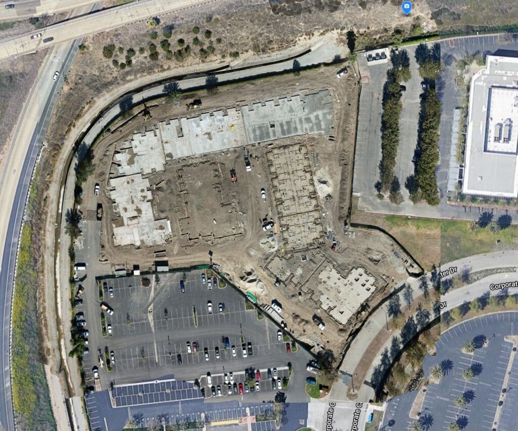
Recurring drone mapping flights provide measurable documentation of project progress.
This allows teams to:
- Validate work completed
- Compare progress over time
- Improve schedule discussions
- Enhance stakeholder confidence
When everyone is looking at the same information, conversations become more productive.

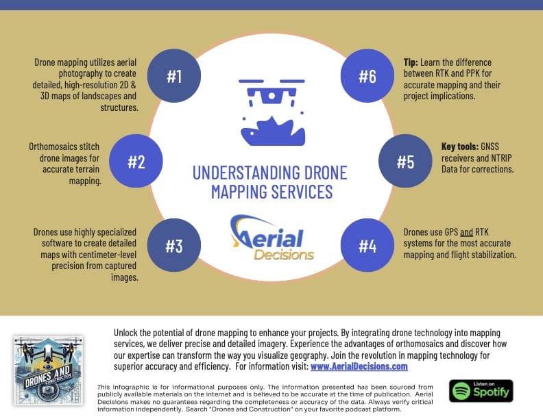
Better Reporting
Many project teams spend significant time gathering information for owner updates, executive reports, and stakeholder meetings.
Drone-generated deliverables such as:
- Orthomosaic maps
- Progress photos
- Timeline comparisons
- 3D models
can simplify reporting workflows while providing a clearer view of site conditions.
Earlier Issue Identification
Most construction challenges become more expensive the longer they go unnoticed.
Recurring aerial documentation can help teams identify:
- Staging inefficiencies
- Access constraints
- Material coordination issues
- Site condition changes
Earlier visibility often leads to faster corrective action.
Stronger Documentation
Construction projects generate thousands of decisions throughout their lifecycle.
A structured drone program creates a time-stamped visual record that can support:
- Progress validation
- Internal communication
- Stakeholder reporting
- Change condition analysis
Documentation is often one of the most overlooked sources of ROI.
Hard ROI vs Soft ROI
One of the biggest mistakes we see is evaluating drone services solely on the cost of the flight.
The real value often extends far beyond the capture itself.

Hard ROI
Examples include:
- Reduced travel requirements
- Faster site documentation
- Reduced manual reporting effort
- Improved measurement workflows
These benefits are easier to quantify directly.
Soft ROI
Examples include:
- Better decision-making
- Improved communication
- Increased owner confidence
- Reduced uncertainty
- Stronger project transparency
While harder to measure, these benefits often have a greater impact on overall project performance.
The Cost of Limited Visibility
Most project teams have experienced situations where a lack of visibility contributed to:
- Delayed decisions
- Misaligned expectations
- Reporting challenges
- Documentation gaps
- Unanticipated site conditions
The purpose of drone technology isn’t simply to collect data.
It’s to create clarity.
When stakeholders have access to accurate, current information, they are typically able to make more informed decisions.
Mini Case Snapshot (From Field Experience)
- Project Type: Commercial infrastructure project, Southern California
- Challenge: Stakeholders required recurring progress updates across multiple project phases
- Drone Method: Monthly drone mapping, orthomosaic generation, and executive reporting deliverables
- Outcome: Improved reporting consistency, increased stakeholder visibility, and more efficient progress communication
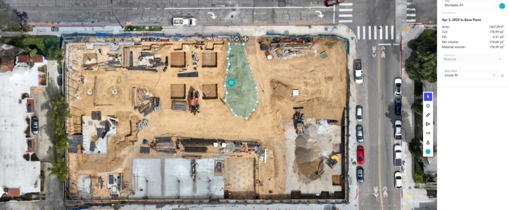
Data Accuracy and Professional Use
From our experience working alongside licensed surveyors and construction teams, drone data is most valuable when it is used to enhance visibility and support project decision-making.
Drone-generated deliverables provide:
- Accurate, repeatable site documentation
- Progress visibility
- Volume analysis
- Reporting support
However, it’s important to be clear:
Drone services are not intended to replace licensed land surveying, legal boundary determination, or engineering-grade deliverables.
Traditional surveying remains essential for:
- Boundary verification
- Control networks
- Engineering and design accuracy
- Legal documentation
Most successful projects use drone data to complement traditional surveying and improve visibility between survey milestones.
Why Owners and General Contractors Continue Investing in Drone Programs
Most Owners don’t invest in drones because they want aerial photography.
They invest because they want:
- Greater certainty
- Better visibility
- Faster reporting
- Reduced risk
- Improved project oversight
From our perspective, that’s where the true ROI of drones in construction is found.
Not in the flight itself.
In the quality of decisions that follow.
FAQs
Are drones worth the cost in construction?
Most construction teams find value in drones because they improve visibility, reporting, and project documentation while supporting better decision-making.
How do drones save money on construction projects?
Drones can reduce reporting effort, improve communication, support volume calculations, and help identify issues earlier in the project lifecycle.
What construction projects benefit most from drones?
Commercial construction, infrastructure, earthwork, and large-scale development projects often see significant value from recurring drone documentation.
Is drone mapping more cost-effective than frequent site visits?
Many teams use drone mapping to supplement site visits by providing comprehensive visual documentation and measurable site data.
Do drones replace surveyors?
No. Drones complement licensed surveying services but do not replace legal boundary determination or engineering-grade survey deliverables.
Executive Takeaway
Most construction teams don’t need more data.
They need better visibility.
When implemented correctly, drone programs provide a measurable way to improve reporting, communication, documentation, and project oversight.
For many commercial construction teams, the ROI of drones isn’t measured by the cost of a flight.
It’s measured by the quality of the decisions made throughout the life of a project.
Disclaimer
Drone mapping and data services provided by Aerial Decisions are intended for visual documentation, progress tracking, and general measurement purposes only. These services do not replace licensed land surveying, boundary determination, or engineering-grade deliverables.
From The Editor:
Do you need to hire a professional drone service provider for your project? To speak to an aerial data specialist, fill out a form, email us or for even faster response times, give us a call at (833) FLY-4YOU or (833) 359-4968. Check out our transparent pricing and watch this space as we expand on the above topics and more over the coming weeks and months.
If you like this post, feel free to click the share button at the bottom of the page. We appreciate you helping us by spreading the content we share on our blog.

Showcase Your Company on the Drones and Construction Podcast! If you’d like to be a featured guest on our podcast, send us an email: info@aerialdecisions.com and one of our crew will get right back to you to share the details.
About Aerial Decisions
Aerial Decisions is a Los Angeles-based Drone Services Provider (DSP). We specialize in providing cutting-edge drone data collection combined with industry leading software solutions tailored for the commercial construction industry. Our mission is to optimize the way enterprise construction projects are managed by offering precise aerial photography, detailed data analysis, and innovative software tools through a network of FAA-certified and insured drone pilots. Aerial Decisions is not just a drone service provider; we are your strategic partner in commercial construction. Our hands-on approach to understanding your unique requirements and our dedication to excellence ensures that every flight and every data point is optimized for your success. Trust us to be the eyes in the sky that elevate your construction projects to new heights.