Category: Uncategorized

  • Drone Construction Progress Tracking: How to Improve Project Visibility and Reporting

    Drone Construction Progress Tracking: How to Improve Project Visibility and Reporting

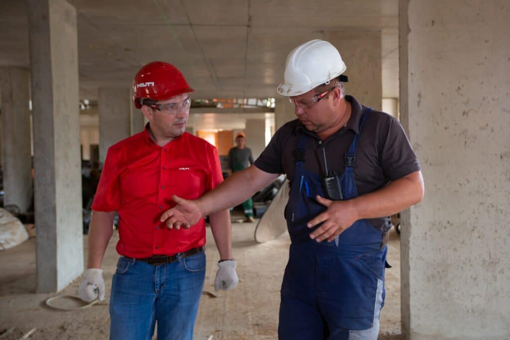
    Introduction: Better Visibility Leads to Better Decisions

    Most construction teams don’t struggle because they lack information—they struggle because they lack consistent visibility.

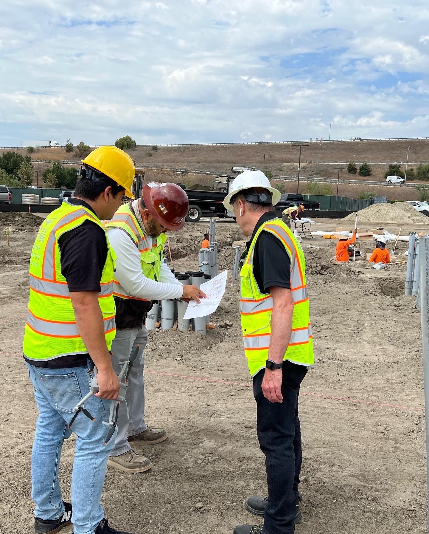
    Across many of the Southern California projects we support at Aerial Decisions, General Contractors and Owners are managing increasingly compressed schedules, tighter budgets, and higher stakeholder expectations. In that environment, having a clear understanding of what changed on a jobsite—and when it changed—becomes critically important.

    That’s where drone construction progress tracking creates value.

    When structured correctly, recurring drone mapping flights provide measurable, time-based documentation that helps project teams improve communication, reduce uncertainty, and make faster decisions throughout the lifecycle of a commercial construction project.

    What Is Drone Construction Progress Tracking?

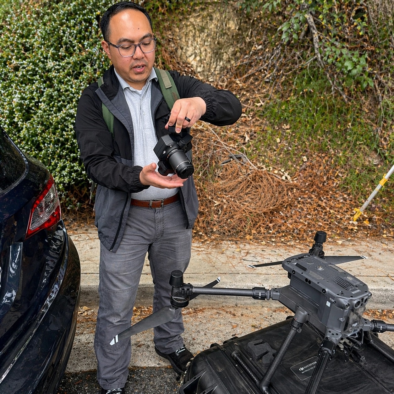
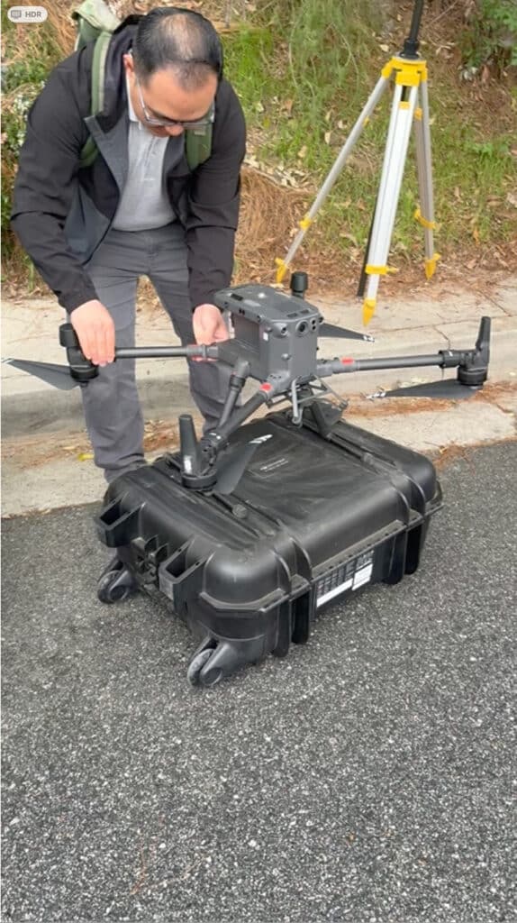
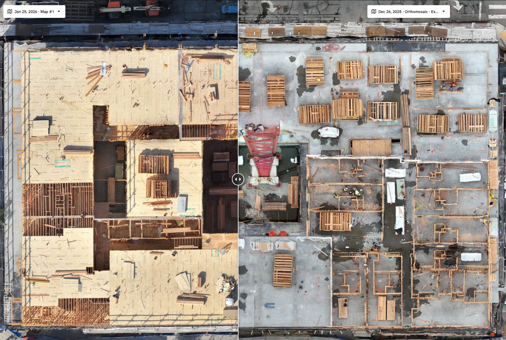
    Drone construction progress tracking is the process of using recurring drone flights to document, measure, and compare jobsite conditions over time.

    Instead of relying solely on written updates or scattered site photos, project teams gain access to:
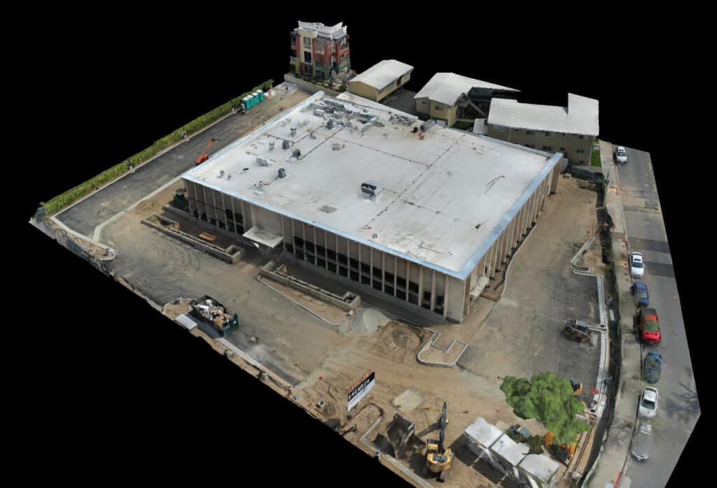
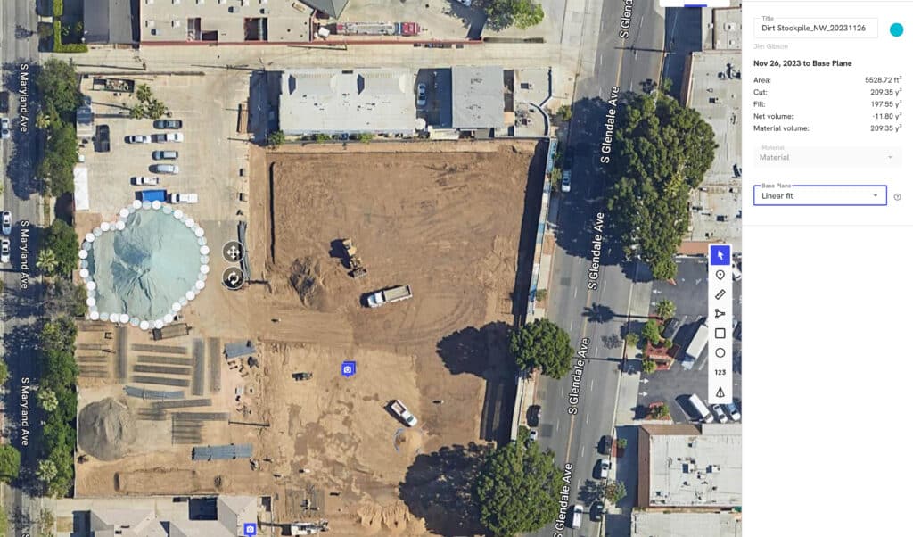
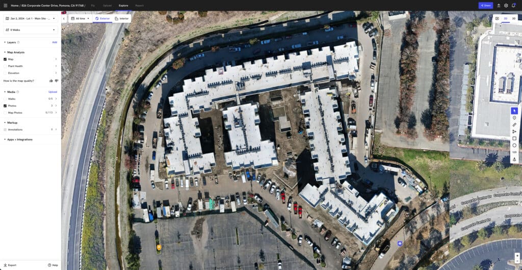
    • Orthomosaic maps
    • Timeline comparisons
    • 3D site models
    • Volume measurements
    • Visual progress validation
    Measurable aerial jobsite map for tracking progress and site conditions.
    Orthomosaics deliver measurable aerial jobsite maps for tracking progress and site conditions.

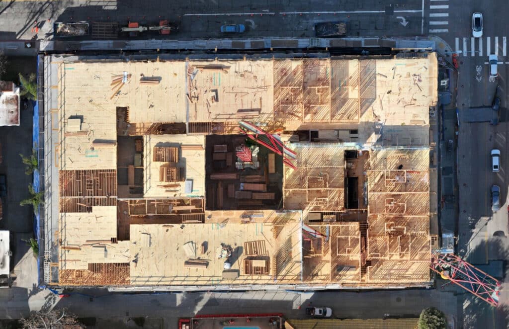
    This creates a repeatable record of site conditions that most stakeholders find easier to interpret and act upon.

    Why Construction Teams Use Drone Progress Tracking

    From our experience operating recurring flight programs across commercial construction projects, most teams use drone progress tracking to improve visibility in four key areas.

    1. Executive Reporting

    Most Owners and Project Executives don’t have time to walk jobsites regularly.

    Recurring drone mapping provides:

    • Visual progress summaries
    • Site-wide visibility
    • Easier stakeholder communication

    Many teams find that orthomosaic maps and timeline overlays simplify monthly reporting conversations significantly.

    2. Schedule Validation

    Drone progress tracking helps teams compare:

    • Planned progress vs actual conditions
    • Month-over-month site changes
    • Sequencing progress across trades

    This creates a more objective understanding of project status.

    3. Risk Reduction

    Recurring aerial documentation can help identify:

    • Staging inefficiencies
    • Material coordination issues
    • Access conflicts
    • Site condition changes

    When teams identify issues earlier, they often reduce downstream rework and communication friction.

    4. Historical Documentation

    Most projects benefit from maintaining a visual archive of site conditions over time.

    This documentation can support:

    • Internal reporting
    • Stakeholder communication
    • Progress verification
    • Change condition analysis

    What Deliverables Are Typically Included?

    A properly structured drone progress tracking workflow often includes:

    • High-resolution orthomosaic maps
    • Time-based comparison overlays
    • Progress photo reports
    • 3D site models
    • Digital terrain models (DTM)
    • Volume calculations

    These deliverables transform drone imagery into operational reporting tools—not just visuals.

    Drone Progress Tracking vs Traditional Reporting

    CategoryTraditional ReportingDrone Progress Tracking
    Site VisibilityLimitedFull-site perspective
    Reporting StyleText-heavyVisual + measurable
    Progress ComparisonSubjectiveTime-based validation
    Documentation ConsistencyVariesStandardized
    Stakeholder ClarityModerateHigh
    Historical ArchiveFragmentedCentralized

    Most project teams find that drone progress tracking improves communication efficiency while reducing ambiguity.

    Mini Case Snapshot (From Field Experience)

    • Project Type: Large infrastructure improvement project, Southern California
    • Challenge: Stakeholders needed clearer month-over-month visibility into grading and paving progress
    • Drone Method: Recurring drone mapping flights with orthomosaic comparisons and progress reporting
    • Outcome: Improved reporting clarity, more efficient stakeholder communication, and better visibility into sequencing progress
    Construction Progress Comparison
    Construction progress can be easily reviewed using software designed to show progress over time.

    How Drone Progress Tracking Improves Project Management

    From what we’ve seen in the field, recurring drone documentation tends to improve project management in several ways:

    • Faster executive decision-making
    • Reduced reporting ambiguity
    • More consistent communication
    • Improved visibility across teams
    • Better documentation of site changes

    Most importantly, recurring visibility creates alignment between:

    • Owners
    • General Contractors
    • Project Managers
    • Municipal stakeholders
    • Field operations teams

    Data Accuracy and Professional Use

    From our experience working alongside licensed surveyors and construction teams, drone progress tracking is most effective when used as a visibility and reporting layer—not as a replacement for traditional surveying.

    Drone-generated data provides:

    • Accurate, repeatable site documentation
    • Progress visibility
    • Volume analysis
    • Visual reporting support

    At the same time, it’s important to clarify:

    Drone mapping and progress tracking services are not substitutes for licensed land surveying or legal boundary determination.

    Traditional surveying remains essential for:

    • Boundary verification
    • Control networks
    • Engineering-grade deliverables
    • Legal documentation

    Most successful projects use drone progress tracking to improve visibility between formal survey updates and reporting cycles.

    Why This Creates Real ROI

    Most construction stakeholders don’t invest in drone progress tracking because they want aerial visuals.

    They invest because they want:

    • Better visibility
    • Faster reporting
    • Reduced uncertainty
    • Improved communication
    • More informed decisions

    From our perspective at Aerial Decisions, that’s where the real ROI comes from.

    FAQs

    How often should drone progress tracking flights occur?
    Most commercial projects benefit from monthly flights, with higher-frequency capture during critical construction phases.

    What is included in drone construction progress tracking?
    Most workflows include orthomosaic maps, timeline comparisons, progress photos, and measurable site documentation.

    Does drone progress tracking improve reporting?
    Yes. Many project teams use drone data to simplify executive reporting and improve stakeholder visibility.

    Is drone progress tracking accurate enough for construction use?
    Yes, for progress documentation, volume analysis, and site visibility, drone mapping provides reliable project-level accuracy.

    Can drone progress tracking replace surveying?
    No. It complements traditional surveying by improving visibility and documentation between survey milestones.


    Executive Takeaway

    From our experience at Aerial Decisions, drone construction progress tracking has become one of the most effective ways to improve project visibility across commercial construction workflows.

    It helps teams document progress more consistently, communicate more clearly, and make more informed decisions throughout the lifecycle of a project.

    Most importantly, it creates a shared visual understanding of the jobsite—and that clarity tends to improve everything downstream.


    Disclaimer

    Drone mapping and progress tracking services provided by Aerial Decisions are intended for visual documentation, progress tracking, and general measurement purposes only. These services do not replace licensed land surveying, boundary determination, or engineering-grade deliverables.

    From The Editor:

    Do you need to hire a professional drone service provider for your project? To speak to an aerial data specialist, fill out a form, email us or for even faster response times, give us a call at (833) FLY-4YOU or (833) 359-4968. Check out our transparent pricing and watch this space as we expand on the above topics and more over the coming weeks and months.

    If you like this post, feel free to click the share button at the bottom of the page. We appreciate you helping us by spreading the content we share on our blog.

    Drones and Construction podcast on Spotify
    Stream Drones and Construction podcast on your favorite listening platform.

    Showcase Your Company on the Drones and Construction Podcast! If you’d like to be a featured guest on our podcast, send us an email: info@aerialdecisions.com and one of our crew will get right back to you to share the details.

    About Aerial Decisions

    Aerial Decisions is a Los Angeles-based Drone Services Provider (DSP). We specialize in providing cutting-edge drone data collection combined with industry leading software solutions tailored for the commercial construction industry. Our mission is to optimize the way enterprise construction projects are managed by offering precise aerial photography, detailed data analysis, and innovative software tools through a network of FAA-certified and insured drone pilots. Aerial Decisions is not just a drone service provider; we are your strategic partner in commercial construction. Our hands-on approach to understanding your unique requirements and our dedication to excellence ensures that every flight and every data point is optimized for your success. Trust us to be the eyes in the sky that elevate your construction projects to new heights.

  • Drone Mapping Cost vs Traditional Surveying: What Commercial Construction Teams Should Know

    Drone Mapping Cost vs Traditional Surveying: What Commercial Construction Teams Should Know

    Introduction: Smarter Cost Control Starts with Better Data

    Most commercial construction teams aren’t trying to replace surveying—they’re trying to gain better visibility, improve decision-making, and manage cost more effectively.

    Across the Southern California projects we support at Aerial Decisions, many General Contractors and Owners are focused on a few key questions:

    • Where can we improve efficiency without sacrificing accuracy?
    • How do we maintain visibility without increasing cost?
    • What tools give us better insight into jobsite conditions?

    Both drone mapping and traditional surveying play important roles in answering those questions. When used strategically, they complement each other and create a more complete picture of the project.


    3D HD Model of a Commercial Building

    What Drone Mapping Provides on a Construction Site

    In commercial construction, drone mapping uses aerial imagery to generate measurable site data such as orthomosaics, 3D models, and volume calculations.

    From our experience operating pilot and visual observer crews in the field, drone mapping is most effective when it is used consistently to support:

    • Construction progress tracking
    • Commercial site documentation
    • Volume measurement
    • Visual reporting on job sites

    It creates a repeatable, scalable way to understand site conditions over time.


    What Traditional Surveying Delivers

    Traditional surveying relies on ground-based equipment such as theodolites, transit levels for angles, measuring wheels and tapes for distances. GNSS systems help to capture precise measurements (as they do with drone mapping).

    Licensed surveyors provide:

    • Boundary verification
    • Control points and control networks
    • High-precision elevation data
    • Engineering and design support
    • Legal documentation

    These deliverables are essential to the integrity of a construction project.


    Drone Mapping vs Traditional Surveying: Cost & Value Comparison

    CategoryDrone MappingTraditional Surveying
    Cost StructureLower per captureHigher per mobilization
    FrequencyMonthly or weekly feasibleLess frequent due to cost
    CoverageFull-site visibilityTargeted measurement points
    SpeedRapid capture (hours)Field-intensive
    AccuracyHigh (project-level)Very high (survey-grade)
    Best UseProgress + reportingControl + compliance

    Where Drone Mapping Improves Cost Efficiency

    From what we’ve seen across commercial construction projects, drone mapping creates cost efficiencies in areas where frequency and visibility matter most.

    Reduced Site Visits

    Aerial capture allows teams to monitor conditions without requiring repeated field walks.

    Faster Data Collection

    Large sites can be documented quickly, often within a single flight.

    Ongoing Progress Visibility

    Recurring flights create a time-based record of site conditions without repeated survey mobilizations.

    Volume Tracking

    Material quantities and stockpiles can be measured more consistently.

    Most teams find that drone mapping becomes a cost-efficient layer of ongoing site intelligence, rather than a one-time deliverable.


    Where Traditional Surveying Remains Essential

    Even with advancements in drone technology, traditional surveying remains critical to most construction projects.

    Licensed surveyors continue to provide:

    • Boundary determination
    • Control networks
    • Engineering-grade accuracy
    • Legal documentation

    These elements are foundational to project execution and compliance.


    Data Accuracy and Professional Use

    From our experience working alongside licensed surveyors on commercial construction projects, the most effective approach is a combination of both drone mapping and traditional surveying.

    Drone mapping provides accurate, repeatable site data that supports:

    • Progress monitoring
    • Volume measurements
    • Site documentation
    • Executive reporting

    At the same time, it’s important to be clear:

    Drone mapping is not a replacement for licensed land surveying or survey-grade deliverables.

    Traditional surveying remains essential for:

    • Boundary determination
    • Control networks
    • Engineering and design accuracy
    • Legal documentation

    Most projects benefit from using drone mapping to fill the visibility gap between survey intervals, improving both efficiency and communication without compromising accuracy requirements.


    DJI Matrice 300 RTK
    Aerial Decisions Chief Technical Pilot, Marcus Manahan readies his DJI Matrice 300 RTK for lift off

    Mini Case Snapshot (From Field Experience)

    • Project Type: Large municipal road improvement project, Glendale, California
    • Challenge: Need for consistent progress visibility without increasing survey costs
    • Drone Method: Monthly drone mapping integrated with existing survey control
    • Outcome: Improved reporting clarity, reduced need for repeat survey mobilizations, and better alignment between field teams and city engineers

    How This Impacts ROI on Real Projects

    From our experience, the return on drone mapping is not typically driven by replacing surveying—it comes from improving how teams operate between survey updates.

    Most projects see value through:

    • Reduced redundant site visits
    • Improved communication between stakeholders
    • Earlier identification of potential issues
    • Faster decision-making cycles

    When the right data is available at the right time, both cost and risk are easier to manage.


    A Practical Approach That Works

    Most successful projects take a blended approach:

    • Traditional Surveying: Establishes control, supports design, ensures compliance
    • Drone Mapping: Provides ongoing visibility, documentation, and reporting

    This allows teams to maintain:

    • Precision where it is required
    • Visibility where it adds the most value

    FAQs

    1. Is drone mapping cheaper than traditional surveying?
      Drone mapping is typically more cost-efficient for frequent site monitoring, while traditional surveying is used for high-precision and legal measurements.
    2. Can drone mapping replace a licensed surveyor?
      No. Drone mapping complements surveying but does not replace licensed survey work.
    3. How often should drone mapping be used?
      Most projects benefit from monthly mapping, with more frequent capture during active phases.
    4. Is drone mapping accurate enough for construction use?
      Yes, for progress tracking, documentation, and volume calculations, it provides reliable project-level accuracy.
    5. Who benefits most from combining both methods?
      General Contractors, Owners, Developers, and Project Executives responsible for cost, schedule, and reporting.

    Executive Takeaway

    From our experience at Aerial Decisions, most commercial construction teams see the strongest results when they stop viewing drone mapping and traditional surveying as competing solutions.

    • Drone mapping delivers cost-efficient visibility.
    • Surveying delivers precision and compliance.

    Used together, they provide a more complete, practical, and financially effective way to manage construction projects.


    Disclaimer

    Drone mapping and data services provided by Aerial Decisions are intended for visual documentation, progress tracking, and general measurement purposes only. These services do not replace licensed land surveying, boundary determination, or engineering-grade deliverables.

    From The Editor:

    Do you need to hire a professional drone service provider for your project? To speak to an aerial data specialist, fill out a form, email us or for even faster response times, give us a call at (833) FLY-4YOU or (833) 359-4968. Check out our transparent pricing and watch this space as we expand on the above topics and more over the coming weeks and months.

    If you like this post, feel free to click the share button at the bottom of the page. We appreciate you helping us by spreading the content we share on our blog.

    Drones and Construction podcast on Spotify
    Stream Drones and Construction podcast on your favorite listening platform.

    Showcase Your Company on the Drones and Construction Podcast! If you’d like to be a featured guest on our podcast, send us an email: info@aerialdecisions.com and one of our crew will get right back to you to share the details.

    About Aerial Decisions

    Aerial Decisions is a Los Angeles-based Drone Services Provider (DSP). We specialize in providing cutting-edge drone data collection combined with industry leading software solutions tailored for the commercial construction industry. Our mission is to optimize the way enterprise construction projects are managed by offering precise aerial photography, detailed data analysis, and innovative software tools through a network of FAA-certified and insured drone pilots. Aerial Decisions is not just a drone service provider; we are your strategic partner in commercial construction. Our hands-on approach to understanding your unique requirements and our dedication to excellence ensures that every flight and every data point is optimized for your success. Trust us to be the eyes in the sky that elevate your construction projects to new heights.

  • 6 Safety Innovations Transforming Construction Sites

    6 Safety Innovations Transforming Construction Sites

    Having spent years in the construction industry, I’ve seen the good, the bad, and the downright risky. These job sites can be brutal, but they don’t have to be. Safety has always been a hot topic, and with the rise of new technology like drones, we’re taking it to a whole new level. But first, we need to review recent construction accidents statistics to put in perspective the importance of implementing a holistic safety protocol..

    The Stats Speak For Themselves:

    Construction Fatalities Statistics 2022
    The construction industry consistently reports a significant number of worker accidents annually, with both fatal and nonfatal incidents contributing to this concern. Recent data indicates a troubling trend of increasing fatalities in the sector.

    Fatal Injuries:

    • 2022: The construction industry experienced 1,069 worker fatalities, equating to a rate of 9.6 deaths per 100,000 full-time equivalent (FTE) workers.
    • 2021: There were 1,034 fatal work injuries in construction, marking an 11% increase from the previous year.
    • 2020: The industry reported 1,034 fatalities, a decrease from 1,102 in 2019.

    Nonfatal Injuries:

    • 2020: Private construction recorded 174,100 total recordable cases of nonfatal injuries and illnesses, with an incidence rate of 2.5 per 100 FTE workers.

    Trends and Analysis:

    The data reveals a concerning upward trend in construction fatalities:

    This escalation suggests that construction accidents have become more frequent in recent years. Factors contributing to this trend may include:

    • Falls, Slips, and Trips: These incidents accounted for over one-third of construction deaths in 2021, with a 5.9% increase from the previous year.
    • Demographic Vulnerabilities: Middle-aged workers (45-64 years) experienced the most fatal injuries between 2016 and 2019. However, workers aged 65 and older had the highest fatal injury rates, at 22 deaths per 100,000 FTEs, more than double the rate for workers under 55.
    • Training and Safety Protocols: Despite efforts to improve safety training, the persistence of high fatality rates indicates potential gaps in safety protocols and their enforcement.

    What’s Being Done?

    Let me walk you through how companies are stepping up their game—and why I believe drones are one of the coolest tools to hit the scene. Here are six key ways companies are addressing construction safety—and how drones are making an impact at every step.

    Construction Workers Inspecting Job Site
    Construction Workers Inspecting Job Site

    Comprehensive Safety Training

    Accidents often happen because workers aren’t aware of the risks or haven’t been trained on how to handle them. Regular safety training helps employees understand how to identify hazards, operate machinery safely, and follow protocols.

    Drone Solution: Incorporating drone footage into training sessions offers workers a bird’s-eye view of the construction site. For example, drones can map out hazardous zones or show real-time visuals of complex structures to help employees understand the risks. Case in point: A study by the Occupational Health and Safety Administration (OSHA) showed that using drones for hazard analysis in training reduced fall-related injuries by 15%.


    Effective Fall Protection Systems

    Falls remain the leading cause of fatal injuries in construction. Guardrails, safety nets, and personal fall arrest systems are critical, but they require regular inspections to stay effective.

    Drone Solution: Drones equipped with high-resolution cameras can inspect safety equipment like guardrails and scaffolding, even in hard-to-reach places, ensuring they’re secure without putting workers in harm’s way. For example, the Minnesota Department of Transport (MnDOT) Bridge Office recently conducted a multiphase, multiyear drone research project. The goal of their study was to determine whether using drones could cut the cost of inspecting bridges and improve safety. In addition, they also looked into the impact it would have on efficiency and accuracy if drones could automatically download data into survey and inspection reports.  MnDOT hopes to use their findings to develop “best practice” guidelines that will provide information on how to use drones to inspect bridges across the state and beyond. 


    Regular Equipment Maintenance

    Malfunctioning equipment is a major safety risk. Companies rely on strict maintenance schedules, but traditional methods often require workers to access dangerous or confined spaces.

    Drone Solution: Drones simplify maintenance by inspecting heavy equipment, cranes, and inaccessible areas. They can capture real-time data and identify signs of wear or damage. For instance, at a project in Singapore, drones reduced equipment downtime by 30% by enabling quick, non-invasive inspections.


    Construction steel workers on scaffolding
    Construction steelworkers perform repetitive climbs that can cause injuries over time.

    Ergonomic Practices

    Repetitive strain injuries and physical overexertion are common on construction sites. Ergonomics involves redesigning tools, tasks, and workstations to reduce physical strain on workers.

    Drone Solution: Drones reduce the need for workers to perform repetitive or physically demanding tasks, such as climbing scaffolding or measuring large distances manually. For example, during a construction project in Melbourne, drones completed surveying tasks in hours instead of days, reducing worker fatigue.


    Enforcing Proper Use of PPE

    Personal protective equipment (PPE) includes helmets, gloves, safety goggles, and high-visibility clothing that protect workers from injuries. Proper usage and compliance are critical.

    Drone Solution: Drones can monitor PPE compliance from above, capturing real-time visuals of workers on-site. Supervisors can use this footage to ensure every worker is wearing the required gear. During a major infrastructure project in the UK, drones helped enforce PPE compliance, reducing non-compliance incidents by 25%.


    Drones as Safety Innovators

    Drones have become a cornerstone of modern construction safety. Beyond inspecting equipment or monitoring PPE, they provide unparalleled access to hazardous areas without risking worker safety.

    For example, during the construction of Allianz Field in Minnesota, drones helped assess structural integrity and site safety, ensuring the project stayed on schedule while minimizing worker exposure to danger.

    Drones also excel in emergency scenarios. If a collapse or fire occurs, drones can quickly assess the area, locate hazards, and provide data for an efficient rescue operation.


    Conclusion

    Construction safety is evolving, and drones are leading the charge. By combining traditional measures like fall protection and PPE with cutting-edge drone technology, we’re creating safer work environments. These tools not only save lives but also improve efficiency, proving that technology and safety go hand in hand. Drones and Construction might be a small part of the bigger picture, but their impact is undeniably transformative.

    From The Editor:

    Do you need to hire a professional drone service provider for your project?  To speak to an aerial data specialist, fill out a form, email us or for even faster response times, give us a call at (833) FLY-4YOU or (833) 359-4968.  Check out our transparent pricing at https://www.aerialdecisions.com/drone-photography-pricing/ and watch this space as we expand on the above topics and more over the coming weeks and months.  

    If you like this post, feel free to click the share button at the bottom of the page.  We appreciate you helping us by spreading the content we share on our blog.

    Drones and Construction podcast on Spotify
    Stream Drones and Construction podcast on your favorite listening platform.

    Showcase Your Company on the Drones and Construction Podcast! If you’d like to be a featured guest on our podcast, send us an email: info@aerialdecisions.com and one of our crew will get right back to you to share the details.

    About Aerial Decisions

    Aerial Decisions is a Los Angeles-based Drone Services Provider (DSP).  We specialize in providing cutting-edge drone data collection combined with industry leading software solutions tailored for the commercial construction industry. Our mission is to optimize the way enterprise construction projects are managed by offering precise aerial photography, detailed data analysis, and innovative software tools through a network of FAA-certified and insured drone pilots.  Aerial Decisions is not just a drone service provider; we are your strategic partner in commercial construction. Our hands-on approach to understanding your unique requirements and our dedication to excellence ensures that every flight and every data point is optimized for your success. Trust us to be the eyes in the sky that elevate your construction projects to new heights.

  • How Drones & Software Enhance Inventory Control

    As a veteran Drone Service Provider (DSP) that specializes in construction progress monitoring, we’ve grown to appreciate just how much our commercial construction clients rely on us delivering the capabilities of generating regular stockpile measurements.  Stockpile measurements are critical for organizing and managing material and critical supplies ordering and replenishing, essential components for the ongoing production of any construction project.

    What are Stockpile Measurements used for?

    Inventory Management: Stockpile measurements help construction project managers and key team members keep track of the quantity of materials available on-site. This information is essential for ensuring that there is an adequate supply of materials to support ongoing construction activities without delays.

    Resource Planning: By knowing the volume of materials in stockpiles, construction project teams can plan resource allocation more effectively. This includes determining when to order more materials to replenish stockpiles and avoid shortages that could halt construction progress.

    Cost Management: Accurate stockpile measurements allow project managers to better manage costs by preventing over-ordering or under-ordering of materials. This helps to optimize budgets and avoid unnecessary expenses.

    Space Optimization: Understanding the volume of materials in stockpiles helps optimize the layout of the construction site. By strategically arranging stockpiles, managers can maximize available space and improve workflow efficiency.

    Quality Control: Regular stockpile measurements enable internal teams to monitor the quality of materials over time. This helps to identify any issues such as degradation or contamination early on, allowing for timely corrective action to maintain construction quality standards.

    Internal team members depend heavily on accurate stockpile measurements to make informed decisions about material usage and ordering. By having precise data on the quantity and status of materials on-site, construction project managers can anticipate when supplies are running low and proactively order more, thereby avoiding costly delays in construction timelines. Furthermore, these measurements aid in optimizing storage space and preventing overstocking, which can tie up capital and create unnecessary clutter on the site.

    Stockpile Measurements of a Construction Dirt Pile
    Software Can Convert Regular Drone Images to an Ortho Rectified Image thus Enabling Accurate Stock Pile Measurements

    How Drones Have Changed the Stockpile Measurement Game

    Traditionally, obtaining stockpile measurements involved manual methods that were time-consuming and prone to errors. However, the advent of drone technology has revolutionized this process, providing a faster, more accurate, and less labor-intensive solution. Tools like DroneDeploy have become invaluable in streamlining data collection by allowing us to quickly capture high-resolution aerial imagery, called Orthomosaics, of construction sites. 

    The integration of drone technology into stockpile and inventory management has brought about several significant advantages for our clients. One of the most notable benefits is the ability to collect volumetric data in near real-time. Drones equipped with advanced sensors can capture detailed information about stockpile quantities without the need for manual measurement or site visits. This enables construction project managers to monitor stockpile levels remotely and make informed decisions promptly.

    Orthomosaic of Commercial Construction Site
    Orthomosaics are Invaluable Tools for Construction Project Managers

    Drones Deliver Highly Sharable Data

    Additionally, drone technology facilitates the sharing of mission-critical data with internal stakeholders located in different offices, across the country, or even across the ocean. Through cloud-based platforms like DroneDeploy, volumetric data can be uploaded and shared seamlessly, fostering collaboration and ensuring that all team members have access to the same accurate information. This level of accessibility and transparency is essential for maintaining alignment and driving project success.

    In summary, volumetric or stockpile measurement data collection depends on drone technology to create efficiencies at scale. By leveraging drones and innovative tools like DroneDeploy, construction project managers can streamline the process of gathering and analyzing stockpile data, leading to better decision-making and more effective management of materials and critical supplies. This not only saves time and resources but also enhances overall project outcomes, ultimately contributing to the success of commercial construction endeavors.

    From The Editor

    Do you need to hire a professional drone service provider for your project?  To speak to an aerial data specialist, fill out a form, email us or for even faster response times, give us a call at (833) FLY-4YOU or (833) 359-4968.  Check out our transparent pricing at https://aerialdecisions.com/drone-photography-pricing/ and watch this space as we expand on the above topics and more over the coming weeks and months.  

    If you like this post, feel free to click the share button at the bottom of the page.  We appreciate you helping us by spreading the content we share on our blog.