Author: Jim Gibson

  • Beyond GPS: Mastering Drone Mapping Accuracy

    Beyond GPS: Mastering Drone Mapping Accuracy

    As a drone pilot, I’ve always been fascinated by the incredible perspective a drone provides. It’s like having a bird’s eye view with the ability to freeze time and dissect every detail below. But beyond the stunning visuals, drones are powerful tools for creating maps that are more than just pretty pictures—they’re accurate, data-driven representations of the world. Let me guide you through the world of drone mapping, keeping it simple and fun.

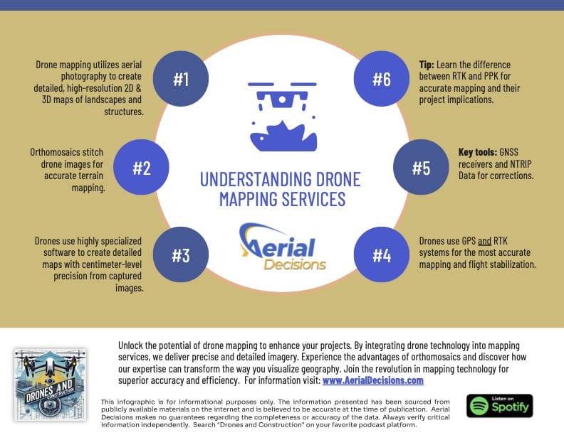
    UNDERSTANDING DRONE MAPPING SERVICES INFOGRAPHIC
    Understanding the Key Principles of Drone Mapping is Essential to Delivering Accurate Maps.

    What Is Drone Mapping?

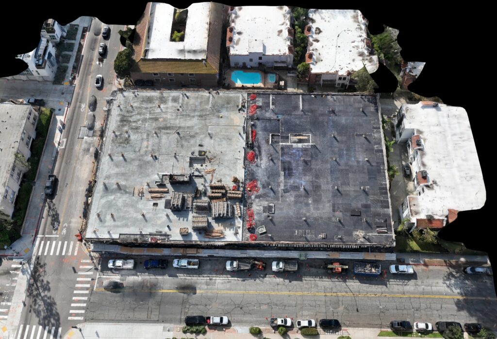
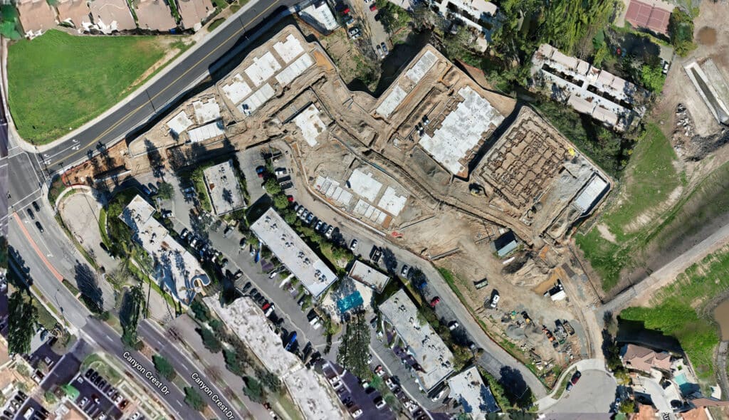
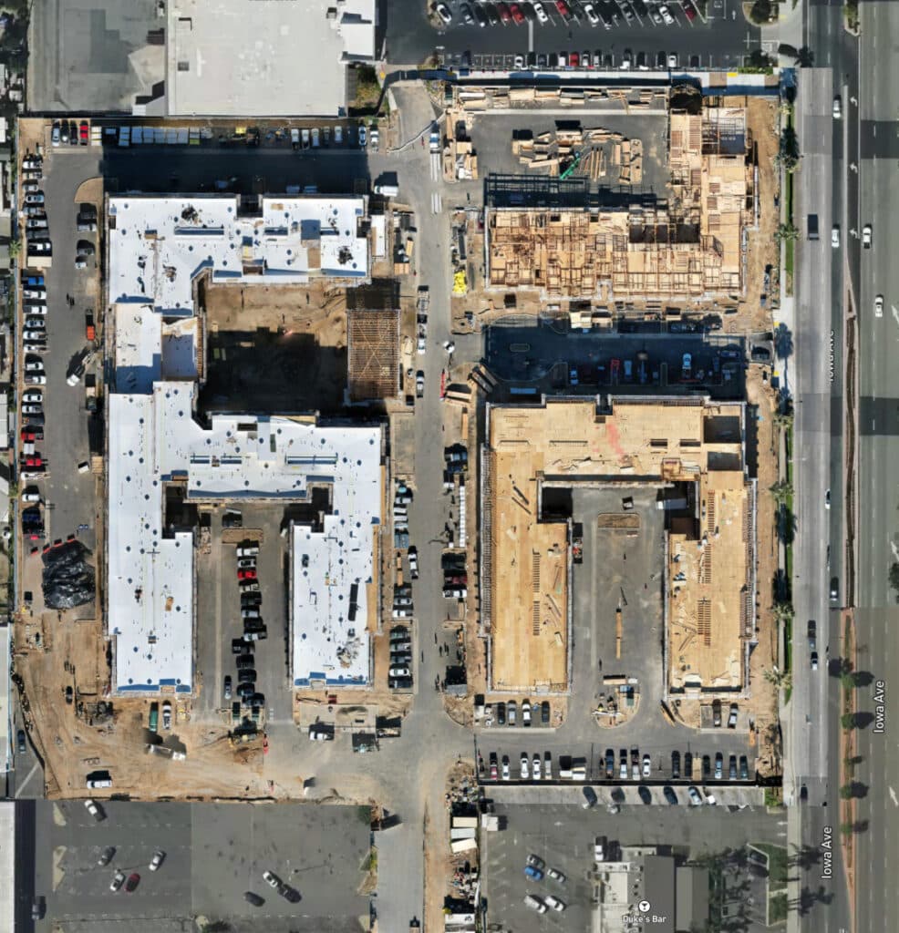
    Imagine you’re putting together a jigsaw puzzle, but instead of individual pieces, you have photos taken from the sky. Drone mapping stitches these photos together to create a seamless, detailed picture of the land below. This is what we call an orthomosaic. It’s like a high-tech quilt made from aerial images, corrected for perspective and distortion, so everything lines up perfectly.

    Drone mapping isn’t just about making maps; it’s about precision and accuracy. Whether you’re in construction, agriculture, or environmental monitoring, a well-made map is like a crystal ball, revealing insights that help you make better decisions.

    Orthomosaics are ortho-rectified images
    Orthomosaics are ortho-rectified images that minimize the impact of the earth’s natural curvature.

    What Are Orthomosaics, and Why Are They Important?

    Orthomosaics are the bread and butter of drone mapping. Think of them as the difference between a hand-drawn treasure map and a detailed GPS-enabled city map. While the treasure map might get you in the ballpark, the city map ensures you find the exact address.

    These stitched-together images are incredibly accurate, allowing you to measure areas, calculate volumes, and even identify small changes over time. For example, in construction, orthomosaics help track progress and ensure everything is on track—literally and figuratively.

    How Are Drone Maps Created?

    Creating a drone map is like baking a cake. You need the right ingredients, tools, and a good recipe. The first ingredient is, of course, the drone. Most drones come with GPS systems that help them fly accurately and stay stable in the air. It’s like the autopilot on an airplane, ensuring a smooth ride. GPS alone, however, is like baking a cake without measuring the ingredients—it might look okay, but it won’t be precise.

    This is where additional tools come in. Drones equipped with RTK (Real-Time Kinematic) modules are game-changers. RTK acts like a kitchen scale, measuring everything down to the gram. It provides real-time corrections to the drone’s position, ensuring centimeter-level accuracy. But even RTK isn’t enough without Ground Control Points (GCPs). These are like the landmarks on your treasure map, anchoring your data to the real world.

    To make everything work together, you also need a GNSS receiver and, in most cases, access to an NTRIP (Networked Transport of RTCM via Internet Protocol) subscription. It’s a mouthful, I know, but think of NTRIP as your recipe’s secret ingredient—a little extra something that makes your map exceptionally accurate.

    RTK vs. PPK: What’s the Difference?

    RTK and PPK (Post-Processed Kinematic) are like two chefs with different cooking styles. RTK is all about instant results. It’s like cooking with a pressure cooker, delivering fast, accurate data corrections in real time. PPK, on the other hand, is more like slow cooking. You gather the data during your flight and process it later for even more refined accuracy.

    Both methods have their strengths. RTK is ideal for real-time applications, while PPK shines when you need the highest level of precision. The choice between the two depends on your project’s needs, much like choosing between quick weeknight meals and a gourmet weekend feast.

    A Word of Caution: Accuracy vs. Survey-Grade

    Here’s a crucial point for drone pilots and service providers: avoid claiming that your maps are “survey-grade” unless you’re a licensed surveyor. It’s like calling a home-cooked meal a Michelin-starred dish. While your maps might be highly accurate, using the term “survey-grade” can lead to legal trouble with government agencies and professional surveyors. Instead, focus on highlighting your maps’ precision and practical applications.

    Why Accuracy Matters

    Accurate maps are more than just a nice-to-have; they’re the foundation for decision-making. Imagine a construction site where measurements are off by even a few inches. Those inches could translate into costly mistakes. With tools like RTK, PPK, and GCPs, we ensure our maps are as accurate as possible, providing our clients with reliable data they can trust.

    Final Thoughts

    Drone mapping is an incredible blend of art and science. It’s about taking raw data from the sky and transforming it into actionable insights. By understanding tools like RTK and PPK and embracing best practices, we can create maps that are not only accurate but also impactful.

    To my fellow drone pilots, remember that accuracy is key, but honesty is just as important. Always communicate clearly about what your maps can and cannot do. And to anyone considering drone mapping services, know that you’re not just getting a map—you’re getting a tool to unlock the potential of your project.

    Thanks for joining me on this journey into drone mapping. Whether you’re a seasoned pro or just starting out, I hope this has given you a clearer picture of what’s possible. Fly safe and map responsibly!

    From The Editor:

    Do you need to hire a professional drone service provider for your project?  To speak to an aerial data specialist, fill out a form, email us or for even faster response times, give us a call at (833) FLY-4YOU or (833) 359-4968.  Check out our transparent pricing at https://www.aerialdecisions.com/drone-photography-pricing/ and watch this space as we expand on the above topics and more over the coming weeks and months.  

    If you like this post, feel free to click the share button at the bottom of the page.  We appreciate you helping us by spreading the content we share on our blog.

    Drones and Construction podcast on Spotify
    Stream Drones and Construction podcast on your favorite listening platform.

    Showcase Your Company on the Drones and Construction Podcast! If you’d like to be a featured guest on our podcast, send us an email: info@aerialdecisions.com and one of our crew will get right back to you to share the details.

    About Aerial Decisions

    Aerial Decisions is a Los Angeles-based Drone Services Provider (DSP).  We specialize in providing cutting-edge drone data collection combined with industry leading software solutions tailored for the commercial construction industry. Our mission is to optimize the way enterprise construction projects are managed by offering precise aerial photography, detailed data analysis, and innovative software tools through a network of FAA-certified and insured drone pilots.  Aerial Decisions is not just a drone service provider; we are your strategic partner in commercial construction. Our hands-on approach to understanding your unique requirements and our dedication to excellence ensures that every flight and every data point is optimized for your success. Trust us to be the eyes in the sky that elevate your construction projects to new heights.
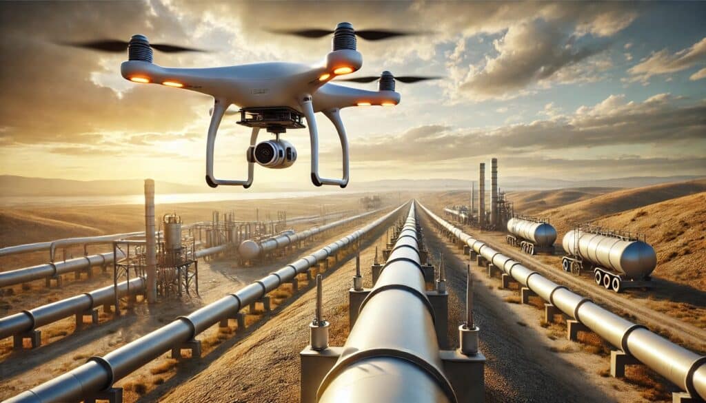
  • Drones and Construction: The Secret to Perfect Earthworks and Utilities

    Drones and Construction: The Secret to Perfect Earthworks and Utilities

    As a construction engineer or general contractor, you know one thing is certain: precision is everything. Whether you’re balancing cut-and-fill volumes, analyzing substructure conditions, or mapping utility layouts, a single mistake can snowball into delays, cost overruns, or worse—a full-on rework. That’s where drones and construction are stepping in to completely change the game.

    I’ve seen firsthand how drones are transforming commercial construction projects. They’re not just high-tech gadgets; they’re tools that help us work smarter, faster, and more accurately than ever before. Let me break down how drones are reshaping key areas like earthworks, substructure analysis, and utilities reporting—and why you should consider bringing them into your next project.


    Construction Earthworks
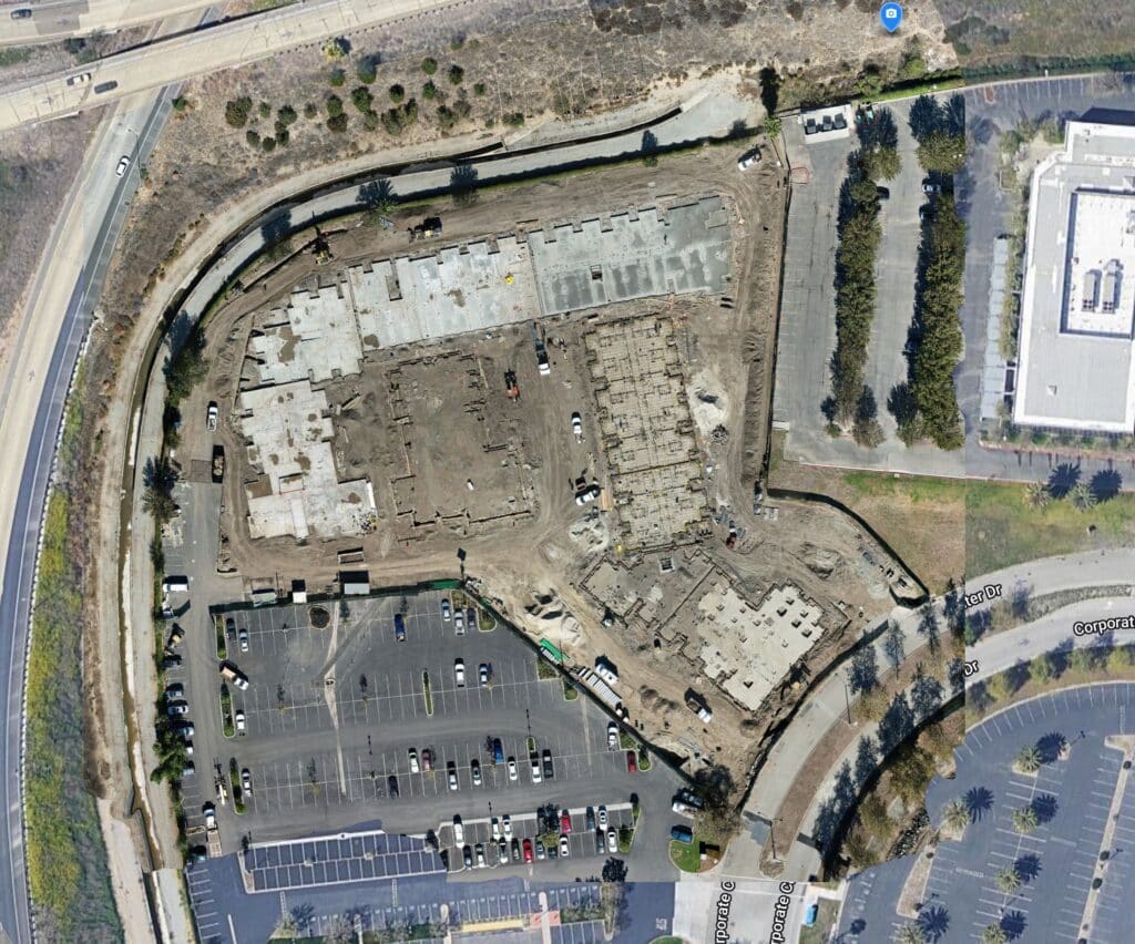
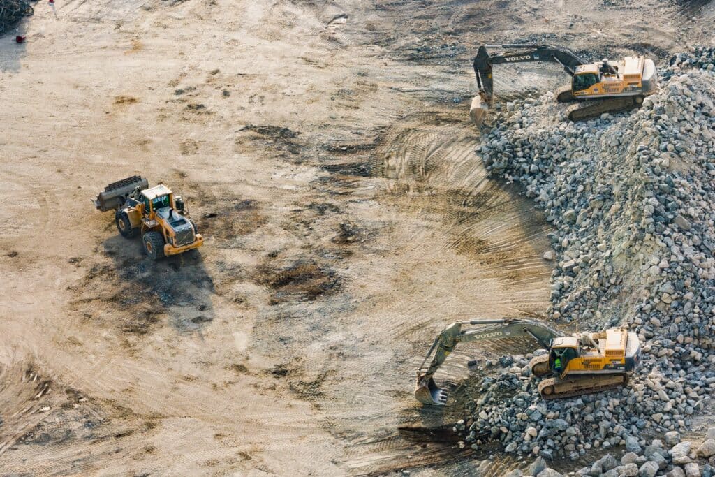
    Large-scale grading for a commercial development

    Earthworks: Faster Surveys, Better Data

    You know the headaches of manual surveying: it’s time-consuming, sometimes risky, and prone to inaccuracies. Drones take these pain points and crush them. With a drone, you can capture high-resolution aerial data in hours, not days.

    I remember reviewing a case where a construction company was building a new hospital and needed precise elevation maps to balance cut-and-fill volumes. Using drones, they created 3D models that nailed the math—reducing survey time by a third and improving accuracy by 15%. Imagine what you could do with those time savings.


    Construction sub-structure analysis

    Substructure Analysis: See What’s Beneath the Surface

    Foundations can be tricky, especially in urban environments or areas with complex subsurface conditions. That’s where drones equipped with LiDAR or thermal imaging shine.

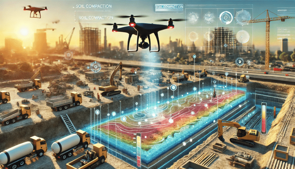
    Take Allianz Field in St. Paul, Minnesota. During construction, drones provided an overhead view of progress, but their real magic was in subsurface analysis. They caught early signs of soil compaction issues—issues that could’ve led to major setbacks. The result? No rework and significant savings on time and money.

    By integrating drones into substructure analysis, you’re not just avoiding mistakes—you’re likely preventing them entirely.


    Utilities Reporting: Mapping Without the Guesswork

    If you’ve ever dealt with as-built utility layouts, you know they can be a nightmare. Buried pipelines, overlapping networks—just thinking about it gives me a headache. Drones simplify all that.

    On one project, a drone with thermal imaging revealed a hidden underground water leak that would’ve caused massive delays if left undetected. It wasn’t just a win for accuracy—it saved the team tens of thousands of dollars in repairs and downtime.

    By using drones for utility mapping, you can reduce guesswork and bring clarity to some of the murkiest aspects of construction.


    Drone over construction site
    If you’re not using drones in your construction work-flows just yet, it’s time to start.

    Why It’s Time to Go Drone

    Drones aren’t just a shiny new toy; they’re tools that deliver measurable ROI. Faster surveys, fewer mistakes, and better data mean projects stay on schedule and on budget. For earthworks, substructure analysis, and utilities reporting, drones are changing how we build—period.

    So, here’s my advice: if you’re not using drones yet, it’s time to start. The construction industry is moving fast, and those who embrace tech like this are the ones staying ahead of the curve.

    If you’re curious about how drones could make your next project more accurate, efficient, and cost-effective, let’s talk. Trust me, you won’t look back.

    Drones and Construction Case Studies

    Drones have become indispensable in modern construction, offering unparalleled accuracy in surveying, mapping, and analytics. Their integration into earthworks, substructure analysis, and utilities reporting has led to significant improvements in efficiency and precision. Below are real-world case studies illustrating these advancements:

    Earthworks: Precision and Progress Monitoring

    • Case Study: Brasfield & Gorrie’s Hospital Construction
      • Project Overview: During the construction of a hospital, Brasfield & Gorrie utilized drone-generated 3D models to create elevation maps of the site.
      • Results: The drone-based aerial survey reduced the time taken to survey by a third, enabling faster data collection and higher ROI.
      • Source: Drone Mapping in Construction – Commercial UAV News

    Substructure Analysis: Enhancing Data Integrity

    • Case Study: Allianz Field Stadium Construction

    Utilities Reporting and Analytics: Improving Infrastructure Coordination

    • Case Study: Road Maintenance Survey in Malaysia

    These case studies demonstrate the transformative impact of drones and construction are marrying together to enhance accuracy and efficiency in construction projects. By leveraging drone technology, project engineers can achieve precise measurements, real-time monitoring, and improved decision-making across various construction phases.

    Conclusion

    Construction safety is evolving, and drones are leading the charge. By combining traditional measures like fall protection and PPE with cutting-edge drone technology, we’re creating safer work environments. These tools not only save lives but also improve efficiency, proving that technology and safety go hand in hand. Drones and Construction might be a small part of the bigger picture, but their impact is undeniably transformative.

    From The Editor:

    Do you need to hire a professional drone service provider for your project?  To speak to an aerial data specialist, fill out a form, email us or for even faster response times, give us a call at (833) FLY-4YOU or (833) 359-4968.  Check out our transparent pricing at https://www.aerialdecisions.com/drone-photography-pricing/ and watch this space as we expand on the above topics and more over the coming weeks and months.  

    If you like this post, feel free to click the share button at the bottom of the page.  We appreciate you helping us by spreading the content we share on our blog.

    Drones and Construction podcast on Spotify
    Stream Drones and Construction podcast on your favorite listening platform.

    Showcase Your Company on the Drones and Construction Podcast! If you’d like to be a featured guest on our podcast, send us an email: info@aerialdecisions.com and one of our crew will get right back to you to share the details.

    About Aerial Decisions

    Aerial Decisions is a Los Angeles-based Drone Services Provider (DSP).  We specialize in providing cutting-edge drone data collection combined with industry leading software solutions tailored for the commercial construction industry. Our mission is to optimize the way enterprise construction projects are managed by offering precise aerial photography, detailed data analysis, and innovative software tools through a network of FAA-certified and insured drone pilots.  Aerial Decisions is not just a drone service provider; we are your strategic partner in commercial construction. Our hands-on approach to understanding your unique requirements and our dedication to excellence ensures that every flight and every data point is optimized for your success. Trust us to be the eyes in the sky that elevate your construction projects to new heights.
  • 6 Safety Innovations Transforming Construction Sites

    6 Safety Innovations Transforming Construction Sites

    Having spent years in the construction industry, I’ve seen the good, the bad, and the downright risky. These job sites can be brutal, but they don’t have to be. Safety has always been a hot topic, and with the rise of new technology like drones, we’re taking it to a whole new level. But first, we need to review recent construction accidents statistics to put in perspective the importance of implementing a holistic safety protocol..

    The Stats Speak For Themselves:

    Construction Fatalities Statistics 2022
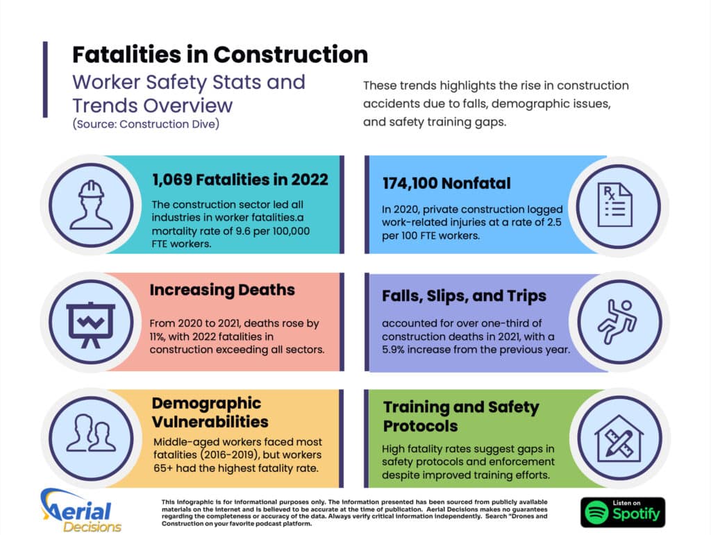
    The construction industry consistently reports a significant number of worker accidents annually, with both fatal and nonfatal incidents contributing to this concern. Recent data indicates a troubling trend of increasing fatalities in the sector.

    Fatal Injuries:

    • 2022: The construction industry experienced 1,069 worker fatalities, equating to a rate of 9.6 deaths per 100,000 full-time equivalent (FTE) workers.
    • 2021: There were 1,034 fatal work injuries in construction, marking an 11% increase from the previous year.
    • 2020: The industry reported 1,034 fatalities, a decrease from 1,102 in 2019.

    Nonfatal Injuries:

    • 2020: Private construction recorded 174,100 total recordable cases of nonfatal injuries and illnesses, with an incidence rate of 2.5 per 100 FTE workers.

    Trends and Analysis:

    The data reveals a concerning upward trend in construction fatalities:

    This escalation suggests that construction accidents have become more frequent in recent years. Factors contributing to this trend may include:

    • Falls, Slips, and Trips: These incidents accounted for over one-third of construction deaths in 2021, with a 5.9% increase from the previous year.
    • Demographic Vulnerabilities: Middle-aged workers (45-64 years) experienced the most fatal injuries between 2016 and 2019. However, workers aged 65 and older had the highest fatal injury rates, at 22 deaths per 100,000 FTEs, more than double the rate for workers under 55.
    • Training and Safety Protocols: Despite efforts to improve safety training, the persistence of high fatality rates indicates potential gaps in safety protocols and their enforcement.

    What’s Being Done?

    Let me walk you through how companies are stepping up their game—and why I believe drones are one of the coolest tools to hit the scene. Here are six key ways companies are addressing construction safety—and how drones are making an impact at every step.

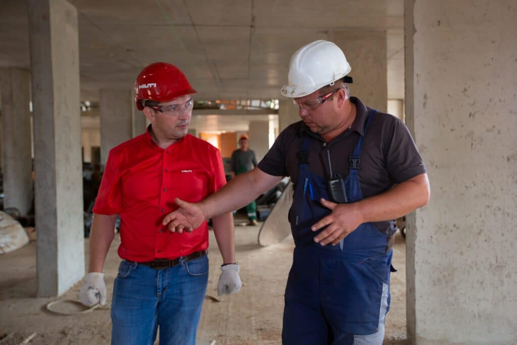
    Construction Workers Inspecting Job Site
    Construction Workers Inspecting Job Site

    Comprehensive Safety Training

    Accidents often happen because workers aren’t aware of the risks or haven’t been trained on how to handle them. Regular safety training helps employees understand how to identify hazards, operate machinery safely, and follow protocols.

    Drone Solution: Incorporating drone footage into training sessions offers workers a bird’s-eye view of the construction site. For example, drones can map out hazardous zones or show real-time visuals of complex structures to help employees understand the risks. Case in point: A study by the Occupational Health and Safety Administration (OSHA) showed that using drones for hazard analysis in training reduced fall-related injuries by 15%.


    Effective Fall Protection Systems

    Falls remain the leading cause of fatal injuries in construction. Guardrails, safety nets, and personal fall arrest systems are critical, but they require regular inspections to stay effective.

    Drone Solution: Drones equipped with high-resolution cameras can inspect safety equipment like guardrails and scaffolding, even in hard-to-reach places, ensuring they’re secure without putting workers in harm’s way. For example, the Minnesota Department of Transport (MnDOT) Bridge Office recently conducted a multiphase, multiyear drone research project. The goal of their study was to determine whether using drones could cut the cost of inspecting bridges and improve safety. In addition, they also looked into the impact it would have on efficiency and accuracy if drones could automatically download data into survey and inspection reports.  MnDOT hopes to use their findings to develop “best practice” guidelines that will provide information on how to use drones to inspect bridges across the state and beyond. 


    Regular Equipment Maintenance

    Malfunctioning equipment is a major safety risk. Companies rely on strict maintenance schedules, but traditional methods often require workers to access dangerous or confined spaces.

    Drone Solution: Drones simplify maintenance by inspecting heavy equipment, cranes, and inaccessible areas. They can capture real-time data and identify signs of wear or damage. For instance, at a project in Singapore, drones reduced equipment downtime by 30% by enabling quick, non-invasive inspections.


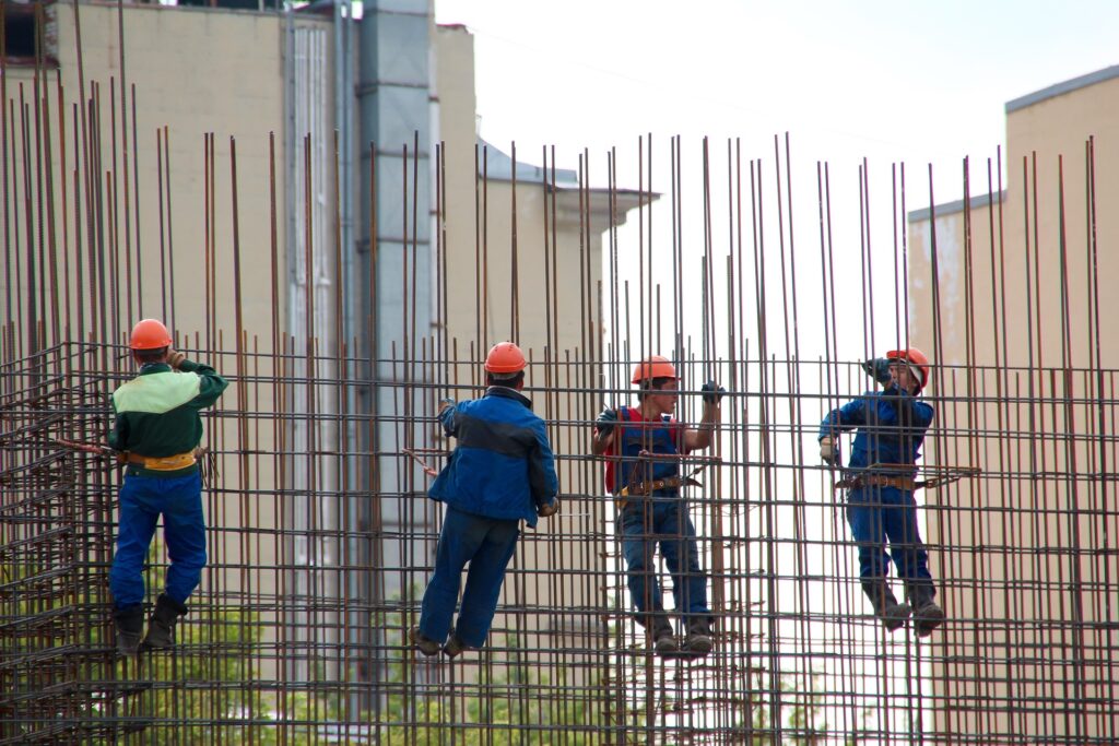
    Construction steel workers on scaffolding
    Construction steelworkers perform repetitive climbs that can cause injuries over time.

    Ergonomic Practices

    Repetitive strain injuries and physical overexertion are common on construction sites. Ergonomics involves redesigning tools, tasks, and workstations to reduce physical strain on workers.

    Drone Solution: Drones reduce the need for workers to perform repetitive or physically demanding tasks, such as climbing scaffolding or measuring large distances manually. For example, during a construction project in Melbourne, drones completed surveying tasks in hours instead of days, reducing worker fatigue.


    Enforcing Proper Use of PPE

    Personal protective equipment (PPE) includes helmets, gloves, safety goggles, and high-visibility clothing that protect workers from injuries. Proper usage and compliance are critical.

    Drone Solution: Drones can monitor PPE compliance from above, capturing real-time visuals of workers on-site. Supervisors can use this footage to ensure every worker is wearing the required gear. During a major infrastructure project in the UK, drones helped enforce PPE compliance, reducing non-compliance incidents by 25%.


    Drones as Safety Innovators

    Drones have become a cornerstone of modern construction safety. Beyond inspecting equipment or monitoring PPE, they provide unparalleled access to hazardous areas without risking worker safety.

    For example, during the construction of Allianz Field in Minnesota, drones helped assess structural integrity and site safety, ensuring the project stayed on schedule while minimizing worker exposure to danger.

    Drones also excel in emergency scenarios. If a collapse or fire occurs, drones can quickly assess the area, locate hazards, and provide data for an efficient rescue operation.


    Conclusion

    Construction safety is evolving, and drones are leading the charge. By combining traditional measures like fall protection and PPE with cutting-edge drone technology, we’re creating safer work environments. These tools not only save lives but also improve efficiency, proving that technology and safety go hand in hand. Drones and Construction might be a small part of the bigger picture, but their impact is undeniably transformative.

    From The Editor:

    Do you need to hire a professional drone service provider for your project?  To speak to an aerial data specialist, fill out a form, email us or for even faster response times, give us a call at (833) FLY-4YOU or (833) 359-4968.  Check out our transparent pricing at https://www.aerialdecisions.com/drone-photography-pricing/ and watch this space as we expand on the above topics and more over the coming weeks and months.  

    If you like this post, feel free to click the share button at the bottom of the page.  We appreciate you helping us by spreading the content we share on our blog.

    Drones and Construction podcast on Spotify
    Stream Drones and Construction podcast on your favorite listening platform.

    Showcase Your Company on the Drones and Construction Podcast! If you’d like to be a featured guest on our podcast, send us an email: info@aerialdecisions.com and one of our crew will get right back to you to share the details.

    About Aerial Decisions

    Aerial Decisions is a Los Angeles-based Drone Services Provider (DSP).  We specialize in providing cutting-edge drone data collection combined with industry leading software solutions tailored for the commercial construction industry. Our mission is to optimize the way enterprise construction projects are managed by offering precise aerial photography, detailed data analysis, and innovative software tools through a network of FAA-certified and insured drone pilots.  Aerial Decisions is not just a drone service provider; we are your strategic partner in commercial construction. Our hands-on approach to understanding your unique requirements and our dedication to excellence ensures that every flight and every data point is optimized for your success. Trust us to be the eyes in the sky that elevate your construction projects to new heights.
  • Outsourcing vs. Building Your Own Construction Drone Team

    Outsourcing vs. Building Your Own Construction Drone Team

    Drones and Construction: What’s Best for Your Construction Business?

    The construction industry is complex, with tight schedules, high costs, and significant safety risks. To thrive in this environment, companies need tools that streamline workflows, enhance safety, and improve decision-making. Enter drones. These high-tech tools are no longer futuristic gadgets—they’re becoming a must-have for construction companies looking to stay competitive. Here’s why:

    Drones and Construction
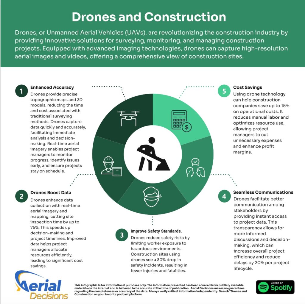
    Drones, or Unmanned Aerial Vehicles (UAVs), are revolutionizing the construction industry by providing innovative solutions for surveying, monitoring, and managing construction projects.

    Enhanced Progress Monitoring

    Drones provide a bird’s-eye view of your project, offering real-time progress reports. Weekly drone flights can capture high-resolution imagery that’s easy to compare against project timelines and goals. This kind of transparency keeps teams accountable and ensures everyone is on the same page—reducing delays and miscommunication.

    Accurate and Efficient Surveying

    Traditional surveying methods are time-consuming and prone to human error. Drones, equipped with advanced sensors like LiDAR or photogrammetry software, can survey large sites in minutes instead of days. They deliver centimeter-level accuracy, making them ideal for creating topographic maps, calculating volumes of materials, or marking out boundaries.

    Improved Safety

    Construction sites are inherently risky, but drones help minimize hazards by performing tasks that would otherwise put workers in danger. For instance, instead of sending a worker to inspect a roof or monitor progress in a hazardous area, a drone can gather the necessary data remotely. This reduces the likelihood of accidents and ensures compliance with safety regulations.

    Cost Savings

    While drones require an initial investment, they save money in the long run. By streamlining workflows, reducing delays, and preventing costly errors, drones can significantly lower operational costs. According to industry reports, companies using drones for site management have reported up to 20% savings in project costs.

    Better Decision-Making

    Drones deliver high-quality data that empowers construction managers to make informed decisions. From 3D models and thermal imaging to site progress videos, drones offer actionable insights that help optimize resources, reduce waste, and improve project outcomes.

    Faster Documentation and Reporting

    Clients and stakeholders often want detailed updates on project progress. Drones make it easy to create visual reports with aerial imagery, videos, and progress data. These polished updates not only impress stakeholders but also build trust and transparency.

    Competitive Advantage

    Finally, drones are becoming a differentiator in the construction industry. Companies that adopt drone technology gain a competitive edge, showcasing their commitment to innovation, safety, and efficiency.

    Drones have reshaped the construction industry by enhancing progress monitoring, surveying, mapping, and safety management. But if you’re an executive in construction, the question isn’t if you should adopt drone technology—it’s how. Should you outsource services to a professional provider or build an internal team? Let’s break down both options in detail to help you decide.

    Outsourcing Drone Services

    Immediate Expertise at Your Fingertips

    When outsourcing, you’re hiring professionals who are already certified, experienced, and equipped with the latest drone technology. These providers specialize in delivering construction-focused services, such as photogrammetry, thermal imaging, or volumetric calculations, and they know how to interpret the data to improve workflows.

    You don’t have to worry about FAA regulations, insurance, or troubleshooting technical glitches—providers handle all of this for you.

    Cost-Effectiveness Without Sacrificing Quality

    Outsourcing eliminates hefty upfront investments in drones, software, and training. With predictable fees, it’s easier to budget for project-specific needs. Plus, you don’t incur hidden costs like equipment depreciation or re-certifying employees when regulations change.

    Operational Flexibility and Scalability

    Need high-resolution maps for one project and thermal scans for another? Outsourcing allows you to adjust services on-demand. This scalability ensures you’re paying only for what you need when you need it.

    The Downsides

    However, outsourcing does have its limitations. You’ll have less control over drone operations and data handling. In some cases, you may face delays if the service provider has limited availability or their processes don’t align perfectly with your project timelines.

    Building an Internal Drone Team

    Control and Customization

    By creating your own drone team, you gain full control over operations, ensuring workflows are tailored to your specific needs. Your team can design data collection processes that integrate seamlessly with existing systems, such as project management software.

    Developing Internal Expertise

    Your team’s expertise grows over time, fostering innovation and knowledge specific to your company’s unique challenges. An in-house team can adapt faster to on-the-ground needs without waiting for third-party availability.

    Costs: Upfront and Recurring

    This is where it gets tricky. The initial setup includes purchasing drones (often $10,000+ per unit for professional models), software licenses, training programs, and certifications. Add recurring expenses for maintenance, insurance, and staying compliant with FAA regulations.

    For example, each FAA Part 107 certification for your pilots requires fees and renewals, and software licenses can run thousands annually. Long-term, the costs could balance out—but only if your drones are in constant use.

    Operational Challenges

    Building an in-house team requires not just money but time. Hiring, training, and integrating drone operations into your workflow can take 6–12 months. Furthermore, technology evolves rapidly. Keeping up with hardware upgrades and software updates becomes your responsibility.

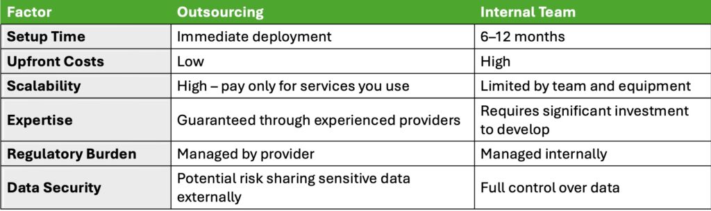
    Build or Buy Analysis
    Should you outsource services to a professional provider or build an internal team?

    Making the Decision

    Frequency of Drone Use: If your projects require frequent drone operations, building a team could save money in the long term. For occasional needs, outsourcing is far more practical.

    Budget Considerations: For companies without significant upfront capital or the desire to take on ongoing expenses, outsourcing is the smarter choice.

    Control Needs: If data security and operational customization are critical to your business, an in-house team might be worth the investment.

    Scalability: Outsourcing provides unmatched flexibility. Need 10 drones for one project and none the next? No problem.

    Summary: The Pros and Cons

    Outsourcing Drone Services

    Pros: Cost-effective, fast setup, high expertise, flexible scaling.

    Cons: Less control, potential delays, data security risks.

    Building an Internal Drone Team

    Pros: Total control, customized workflows, internal expertise.

    Cons: High upfront costs, long setup time, resource-intensive maintenance.

    Final Thoughts

    There’s no one-size-fits-all answer to the “build or buy” question. Instead, the right choice depends on your company’s priorities, project frequency, and budget. If you’re not ready for the steep learning curve and investment of an in-house team, start by outsourcing. As your drone needs grow, you can always revisit the idea of building your internal team. With a strategic approach, you’ll maximize the ROI of this game-changing technology, no matter which path you take.

    From The Editor:

    Do you need to hire a professional drone service provider for your project?  To speak to an aerial data specialist, fill out a form, email us or for even faster response times, give us a call at (833) FLY-4YOU or (833) 359-4968.  Check out our transparent pricing at https://www.aerialdecisions.com/drone-photography-pricing/ and watch this space as we expand on the above topics and more over the coming weeks and months.  

    If you like this post, feel free to click the share button at the bottom of the page.  We appreciate you helping us by spreading the content we share on our blog.

    About Aerial Decisions

    Aerial Decisions is a Los Angeles-based Drone Services Provider (DSP).  We specialize in providing cutting-edge drone data collection combined with industry leading software solutions tailored for the commercial construction industry. Our mission is to optimize the way enterprise construction projects are managed by offering precise aerial photography, detailed data analysis, and innovative software tools through a network of FAA-certified and insured drone pilots.  Aerial Decisions is not just a drone service provider; we are your strategic partner in commercial construction. Our hands-on approach to understanding your unique requirements and our dedication to excellence ensures that every flight and every data point is optimized for your success. Trust us to be the eyes in the sky that elevate your construction projects to new heights.

  • 4 Hidden Culprits Behind Commercial Construction Inefficiencies

    4 Hidden Culprits Behind Commercial Construction Inefficiencies

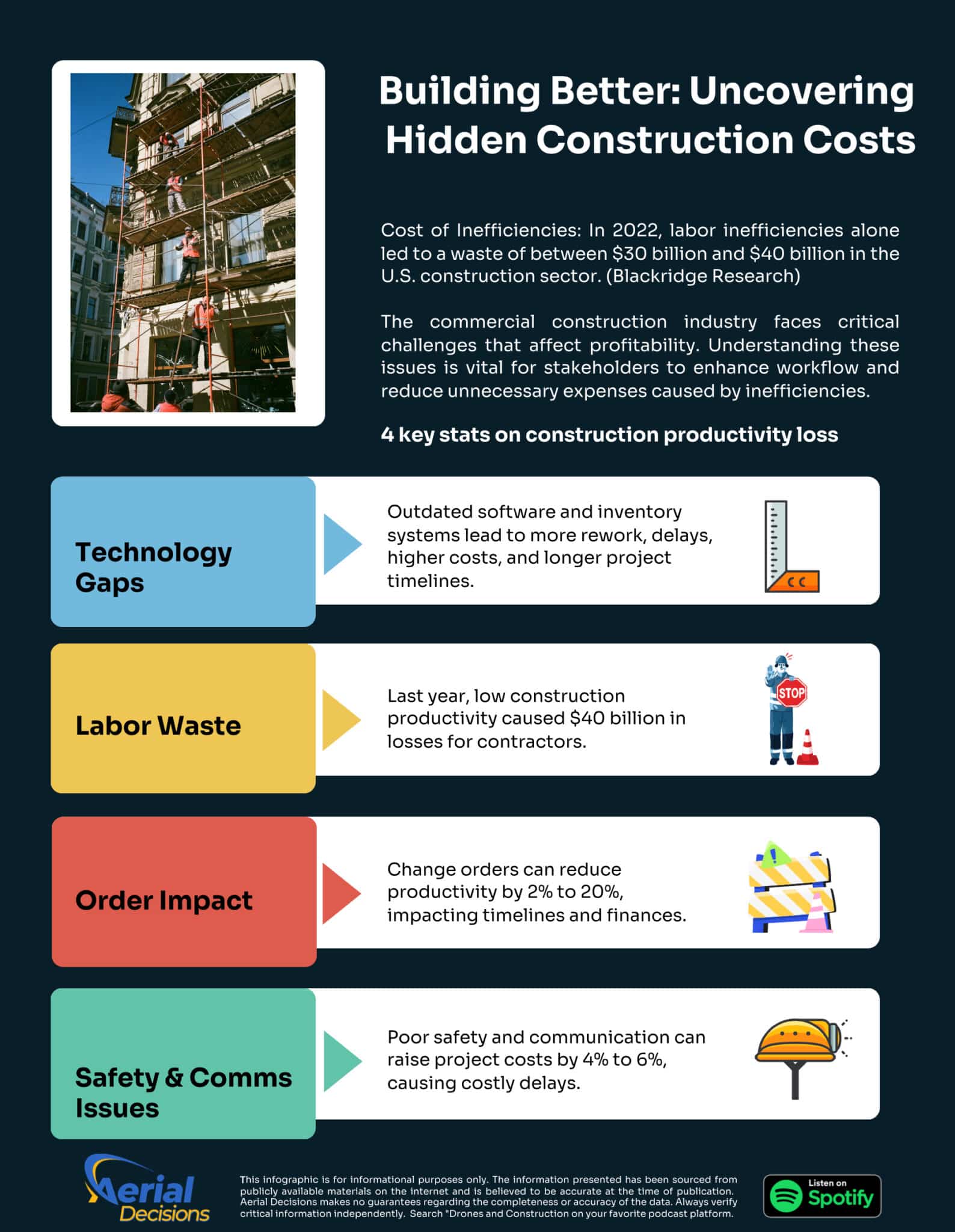
    The commercial construction industry is no stranger to challenges. While building the infrastructure and commercial spaces that keep society moving is rewarding, it’s also incredibly complex. Projects often face hidden costs in delays, cost overruns, and inefficiencies that can wreak havoc on budgets and timelines. At the root of many of these issues are four main pillars of waste: Technology GapsLabor InefficienciesChange Order Impact, and Safety and Communication Issues.

    The good news? By addressing these areas head-on, the construction industry can not only minimize waste but also thrive in an increasingly competitive landscape.

    Hidden Construction Costs and Waste Infographic

    1. Technology Gaps

    Let’s start with technology—or the lack of it. Despite the rapid growth of tools like drones, Building Information Modeling (BIM), and cloud-based platforms, many construction companies still rely on outdated systems or, worse, manual processes. These gaps lead to a cascade of problems:

    • Inefficient Inventory Management: Without real-time tracking, materials go missing or arrive late, stalling progress.
    • Poor Project Oversight: Teams using outdated methods like paper blueprints or spreadsheets lack the ability to catch errors early.
    • Inconsistent Data: When everyone is working off different systems, communication breaks down, and mistakes happen.

    For example, firms using drones to survey sites can spot issues like grading errors before they become costly mistakes. Similarly, BIM technology allows teams to simulate the entire construction process, identifying potential conflicts in design or scheduling before they occur.


    2. Labor Waste

    Labor is one of the most significant costs in construction, but inefficiencies often lead to massive waste. A report from 2022 (FMI Corp) revealed that the construction industry lost up to $40 billion in productivity due to poor labor management. What causes this?

    • Idle Time: Workers are often stuck waiting for materials or instructions.
    • Skill Mismatches: Inexperienced workers may take longer to complete tasks or make mistakes that require rework.
    • Disorganized Schedules: Poor planning can result in crews standing around without clear direction.

    Adopting advanced scheduling tools and workforce management platforms can help optimize labor. For instance, AI-powered software can predict when workers are needed and automate shift assignments, ensuring the right people are in the right place at the right time.


    3. Change Order Impact

    If there’s one thing that sends projects off the rails, it’s change orders. Whether it’s a last-minute design tweak or an unforeseen issue, change orders disrupt workflows, inflate costs, and extend timelines.

    • Direct Costs: Every change means extra materials, additional labor, and sometimes expensive rework.
    • Ripple Effects: Adjusting one aspect of a project often impacts multiple others, leading to delays and further costs.
    • Lost Productivity: Teams must pause work while waiting for new instructions or materials.

    The solution? Better planning upfront. Technology like BIM allows stakeholders to visualize the project from start to finish, reducing the likelihood of unexpected changes. Additionally, cloud-based platforms ensure that everyone is on the same page, so when changes do happen, they’re implemented as efficiently as possible.


    4. Safety and Communication Issues

    Construction sites are inherently risky, and safety concerns can lead to delays and wasted resources. Add poor communication to the mix, and you’ve got a recipe for disaster.

    • Safety Delays: Accidents or unsafe conditions can shut down work and require costly interventions.
    • Miscommunication: If crews don’t have the latest updates, tasks get repeated or done incorrectly.
    • Low Morale: Poor communication and unsafe conditions can lead to higher turnover and less engaged workers.

    Investing in tools like wearable safety tech and real-time communication apps can make a world of difference. For example, wearable devices can alert workers to hazards on-site, while collaboration platforms ensure that everyone—from the office to the field—has access to the latest information.


    Turning Challenges Into Opportunities

    The commercial construction industry is at a crossroads. While the four pillars of waste—Technology Gaps, Labor Waste, Change Order Impact, and Safety and Communication Issues—present real challenges, they also offer enormous opportunities for improvement.

    By embracing modern technology, optimizing labor, managing change orders effectively, and prioritizing safety and communication, construction leaders can not only reduce waste but also deliver projects more efficiently and profitably.

    The key is innovation. With tools like drones, AI-driven scheduling systems, and cloud-based platforms, the industry can move away from inefficiency and toward smarter, faster, and more sustainable building practices. It’s not just about keeping up—it’s about leading the way into a brighter future for construction.

    What Next?

    In my next post, I’ll lean into how drones and software technologies are reshaping the commercial construction industry. Until then, check out our new podcast series, “Drones and Construction“, streaming on your favorite podcast station.

    Listen to Drones and Construction on Spotify

    From the Editor

    Do you need to hire a professional drone service provider for your project?  To speak to an aerial data specialist, fill out a form, email us or for even faster response times, give us a call at (833) FLY-4YOU or (833) 359-4968.  Check out our transparent pricing at https://www.aerialdecisions.com/drone-photography-pricing/ and watch this space as we expand on the above topics and more over the coming weeks and months.  

    If you like this post, feel free to click the share button at the bottom of the page.  We appreciate you helping us by spreading the content we share on our blog.

    About Aerial Decisions

    Aerial Decisions is a Los Angeles-based Drone Services Provider (DSP).  We specialize in providing cutting-edge drone data collection combined with industry leading software solutions tailored for the commercial construction industry. Our mission is to optimize the way enterprise construction projects are managed by offering precise aerial photography, detailed data analysis, and innovative software tools through a network of FAA-certified and insured drone pilots.  Aerial Decisions is not just a drone service provider; we are your strategic partner in commercial construction. Our hands-on approach to understanding your unique requirements and our dedication to excellence ensures that every flight and every data point is optimized for your success. Trust us to be the eyes in the sky that elevate your construction projects to new heights.

  • Drones and Construction Podcast: Real Stories from Industry Innovators

    Drones and Construction Podcast: Real Stories from Industry Innovators

    Aerial Decisions is excited to announce the launch of Season 1 of our brand-new podcast series, “Drones and Construction.” This engaging series is dedicated to exploring the revolutionary impact of drone technology in the commercial construction industry.

    Podcast Topics

    In this podcast, we delve into key areas where drones are transforming the way construction projects are managed, including:

    • Surveying and Mapping: Enhancing precision and efficiency.
    • Progress Monitoring: Keeping projects on track with real-time updates.
    • Drone Inspections: Critical building inspections to save time, money and increase safety.
    • Inventory Control: Streamlining materials management.
    • Safety and Security: Improving job site safety and monitoring.
    Drones and Construction Podcast Host
    Drones and Construction Podcast Host (image courtesy of Chatgpt)

    Each episode features live interviews with construction industry leaders and innovators who are using drones to improve workflows, streamline communication with stakeholders, and deliver projects on time and within budget. You’ll hear firsthand accounts of challenges, successes, and the remarkable ways drones are reshaping the industry.

    Whether you’re a seasoned professional or just starting in the construction field, “Drones and Construction” offers valuable insights, tips, and inspiring stories to help you stay ahead of the curve in this rapidly evolving space.

    Now Streaming Everywhere!

    You can listen to our new podcast on all major streaming platforms, including Spotify, Apple Podcasts, Amazon Music, and iHeartRadio. Simply search for “Drones and Construction” on your favorite podcast app, and don’t forget to subscribe, leave a comment, and share with your network—it helps us grow our podcast community!

    c
    Join Drones and Construction’s Podcast and Share Your Expertise!

    Want to be on our Show?

    Do you consider yourself a thought leader in the commercial construction space? Are you interested in getting your firm in front of more people? We have an opportunity for you to join our podcast as a guest and share your views on the present and future-state of the commercial construction industry. It’s also a great way to generate more brand visibility for you and your company. Our format is casual, fun, and stress-free, offering an engaging atmosphere where great stories and insights come to life. Tune in today and discover how drones are shaping the future of construction! If you’re interested in being featured as a guest on our show, we’d love to hear from you. Email us at info@aerialdecisions.com, and someone from our team will get back to you right away.

    From the Editor

    Do you need to hire a professional drone service provider for your project?  To speak to an aerial data specialist, fill out a form, email us or for even faster response times, give us a call at (833) FLY-4YOU or (833) 359-4968.  Check out our transparent pricing at https://www.aerialdecisions.com/drone-photography-pricing/ and watch this space as we expand on the above topics and more over the coming weeks and months.  

    If you like this post, feel free to click the share button at the bottom of the page.  We appreciate you helping us by spreading the content we share on our blog.

    About Aerial Decisions

    Aerial Decisions is a Los Angeles-based Drone Services Provider (DSP).  We specialize in providing cutting-edge drone data collection combined with industry leading software solutions tailored for the commercial construction industry. Our mission is to optimize the way enterprise construction projects are managed by offering precise aerial photography, detailed data analysis, and innovative software tools through a network of FAA-certified and insured drone pilots.  Aerial Decisions is not just a drone service provider; we are your strategic partner in commercial construction. Our hands-on approach to understanding your unique requirements and our dedication to excellence ensures that every flight and every data point is optimized for your success. Trust us to be the eyes in the sky that elevate your construction projects to new heights.

  • How Drones and Reality Data Capture are Transforming Construction Projects

    How Drones and Reality Data Capture are Transforming Construction Projects

    As a Drone Service Provider (DSP) focused on the construction industry, we’ve witnessed how drone reality data capture technology is transforming how we approach our clients critical construction projects. From pre-bid site analysis to final closeout inspections, reality capture technologies are collectively streamlining project workflows, enhancing safety, and providing deeper insights throughout each phase of construction. It still surprises me how often I hear industry professionals talk about drones in the limited scope of providing pretty pictures and videos. Nothing could be further from the truth.

    In this post, we explore how drones and reality capture technology are being used during the Pre-Bid & Pre-Construction phase, the active Construction phase, and the Inspection & Closeout phase.

    Flight plan boundaries defined by mapping software
    Flight plan boundaries defined by mapping software

    Pre-Bid & Pre-Construction Phase

    Surveying and Concept & Design
    In the early stages of a project, having accurate and detailed site information is crucial for developing a reliable design. With aerial reality data capture, drones generate high-resolution topographic maps and 3D models that give construction teams an in-depth understanding of site conditions. These data help architects and engineers refine their designs early on, reducing the likelihood of costly revisions later.

    360 Reality Capture for Pre-Construction Planning
    Adding 360 reality capture to the pre-construction phase brings even more clarity to the planning process. By combining aerial drone surveys with 360 walkthroughs, stakeholders can virtually explore the entire site in an immersive, high-resolution format. This is especially useful for off-site team members, enabling them to inspect and interact with the site remotely. These virtual site visits allow for more informed decision-making during the bidding and design phases, while also helping construction managers anticipate potential challenges.

    Site Planning and Procurement
    In addition to design, accurate site data aids in efficient site planning and resource procurement. With real-time aerial data, construction teams can plan for infrastructure placement (e.g., utilities, drainage systems) based on the actual terrain. This information is also valuable for procurement teams, ensuring they order the right quantities of materials based on current site conditions. 360 reality capture offers another layer of transparency here, allowing procurement teams and project managers to virtually inspect site logistics and visualize how equipment and resources are deployed.

    Commercial construction project with floor plan layer
    Commercial construction project with floor plan layer

    Construction Phase

    Earthworks: Cut/Fill Analysis and Stockpile Measurements
    During the construction phase, drones are instrumental in managing earthworks. They perform cut/fill analysis quickly and with high precision, helping your team optimize earthmoving operations. Drones also assist in stockpile measurements, providing real-time data on material availability and consumption, which helps manage resources more effectively and prevents costly delays.

    Tracking Site Progress: As-Designed vs. As-Built
    Drones provide an easy and efficient way to monitor site progress, capturing aerial imagery and data at regular intervals. This allows project managers to compare as-built conditions with the original design, ensuring that the project stays on track and meets specifications. Drone data allows for early detection of deviations which prevents rework and helps you stay on schedule.

    360 Walkthroughs for Site Inspections (Exterior and Interior)
    Beyond aerial data, 360 reality capture offers an immersive experience that is extremely valuable for both exterior and interior site inspections. A 360-degree walkthrough allows team members and clients to virtually “walk” through the site at any time, offering a clear view of construction progress. This is particularly useful for off-site stakeholders who need to stay updated but cannot physically visit the project. These walkthroughs also serve as visual documentation for safety, quality control, and project updates, capturing every detail from various angles.

    Construction site before and after image
    Drone processing software provides time-based site progress comparisons.

    Inspection and Closeout Phase

    Drone Façade Inspections
    In the final stages of construction, inspections become critical to ensuring that all work meets quality standards. Traditionally, façade inspections—especially for tall or hard-to-reach areas—required scaffolding or other heavy equipment. Now, drones equipped with high-resolution cameras can conduct façade inspections more safely and efficiently. Drones capture detailed imagery of exterior surfaces, identifying any defects like cracks, leaks, or structural issues before project closeout.

    360 Reality Capture for Closeout and Inspections
    At the closeout phase, 360 walkthroughs provide an interactive record of the completed project. This is incredibly valuable for final inspections, as it allows stakeholders to review both exterior and interior spaces in detail without being on-site. This virtual documentation also aids in handing over the project to the client, ensuring that they have a comprehensive visual record of the completed work.

    Thermal Imaging for HVAC and Building Inspections
    Drones equipped with thermal imaging cameras are essential for inspecting HVAC systems and detecting heat loss or insulation issues. Thermal imaging ensures that the building is energy-efficient and that there are no hidden defects, such as leaks or poorly installed insulation, that could lead to costly repairs down the line.

    Documentation: 3D As-Builts and Digital Assets
    For closeout documentation, drones provide accurate 3D as-builts that serve as a permanent record of the completed structure. These models are invaluable for future renovations, facility management, and legal documentation. Additionally, 360 walkthroughs are used as digital assets for marketing purposes, which helps you showcase the finished project to future clients or in portfolio presentations.

    Liability Management and Warranty Fulfillment
    Another critical use case for drones and 360 reality capture is liability management. By providing high-resolution documentation of the completed project, you’ll have the necessary evidence to protect your company from insurance claims or disputes that might arise post-construction. This detailed documentation is also crucial for fulfilling warranties, ensuring that you have proof of the project’s condition at the time of handover.

    Summary of Benefits

    By combining the power of aerial reality data capture and 360 walkthrough technology, construction companies can gain significant advantages throughout every phase of the construction lifecycle. From precise surveying and virtual site visits during Pre-Bid & Pre-Construction, to monitoring site progress and streamlining inspections during the Construction phase, these technologies improve efficiency, reduce costs, and provide stakeholders with more transparency and control. Finally, during the Inspection and Closeout phase, drones and 360 walkthroughs ensure comprehensive documentation, helping manage liabilities and ensure warranty compliance.

    What Next?

    If you’re ready to integrate aerial reality data capture and 360 walkthroughs into your construction workflows, reach out to us at Aerial Decisions. We specialize in providing drone and 360 reality capture solutions tailored to your project’s needs. Contact one of our construction sales executives today to set up a free consultation and learn how these technologies can take your projects to the next level.

    About Aerial Decisions

    Aerial Decisions is a Los Angeles-based Drone Services Provider (DSP).  We specialize in providing cutting-edge drone data collection combined with industry leading software solutions tailored for the commercial construction industry. Our mission is to optimize the way enterprise construction projects are managed by offering precise aerial photography, detailed data analysis, and innovative software tools through a network of FAA-certified and insured drone pilots.  Aerial Decisions is not just a drone service provider; we are your strategic partner in commercial construction. Our hands-on approach to understanding your unique requirements and our dedication to excellence ensures that every flight and every data point is optimized for your success. Trust us to be the eyes in the sky that elevate your construction projects to new heights.

  • Regulations for Using Drones on Construction Sites in 2024

    Regulations for Using Drones on Construction Sites in 2024

    As a commercial drone pilot, I’ve seen firsthand how drones can revolutionize construction projects. From site surveys to progress tracking, drones offer unparalleled efficiency and accuracy. However, integrating drones into your construction workflow isn’t as simple as buying the latest technology. Understanding and adhering to 2024 FAA drone regulations is crucial to avoid legal and safety issues.

    Understanding FAA Drone Regulations

    The Federal Aviation Administration (FAA) regulates all drone operations in the U.S., and construction companies must navigate these regulations to operate drones legally and safely. Key FAA regulations include restrictions on flying in controlled airspace, maintaining a maximum altitude of 400 feet, and keeping the drone within the operator’s line of sight. These rules are designed to ensure that drones do not interfere with other air traffic and to minimize the risk of accidents.

    The FAA also requires that drones used for commercial purposes, such as on construction sites, must be registered, and the operator must hold a Remote Pilot Certificate under Part 107. This certification ensures that the operator understands the airspace regulations, weather patterns, and other critical factors that impact safe drone operation. The FAA’s Aloft Air Control app is a valuable tool for checking local airspace restrictions before any flight.

    Part 107 Test Center
    The Part 107 certification is an integral first step to learning the FAA’s drone rules of the road.

    The Importance of Part 107 Certification

    Part 107 certification is more than just a legal requirement; it’s a badge of professionalism and safety. To obtain this certification, operators must pass a knowledge test covering topics like airspace classifications, aviation weather, and emergency procedures. This certification demonstrates that the operator has the necessary knowledge to conduct safe and compliant drone operations.

    For construction companies, hiring a Part 107-certified operator means you’re working with someone who understands the complexities of drone flight. It also protects your company from potential legal repercussions, as operating without proper certification can result in fines or other penalties from the FAA. The FAA’s Part 107 Guide offers detailed information on the certification process.

    Drone fine letter
    No one wants to receive a fine letter from the FAA.

    Penalties and Risks of Non-Compliance

    Operating a drone without adhering to 2024 FAA drone regulations can result in significant penalties. Fines can reach up to $27,500 for civil violations and $250,000 for criminal violations, not to mention potential jail time. But the risks extend beyond legal penalties. Non-compliant drone operations can lead to accidents, putting your workers and the public at risk. This, in turn, can lead to lawsuits and increased insurance premiums.

    Moreover, many insurance providers require proof of FAA compliance before they’ll cover drone operations. Operating outside the law could invalidate your insurance coverage, leaving your company exposed to financial risk in the event of an accident. While there are many commercial drone insurance options to choose from, one I personally use is Droneinsurance.com (now part of Skywatch.ai). I like them for their simple plans (annual, monthly or pay as you go) and their helpful customer service. For more information on drone insurance, check out DroneInsurance.com.

    Ongoing Changes in Drone Regulation

    The drone regulation landscape is continually evolving as technology advances and drone usage increases. Staying informed about these changes is critical for maintaining compliance. The FAA regularly updates its regulations, and new rules can impact where and how you can operate drones. It’s essential to regularly review FAA updates and participate in continuous education to ensure your operations remain compliant. You can stay updated by visiting the FAA’s UAS Newsroom.

    Risk vs. Reward: DIY Drone Operation in a Commercial Setting

    It might be tempting to handle drone operations in-house to save on costs, but the risks often outweigh the rewards. While DIY drone operation may appear cost-effective initially, the potential legal liabilities, safety concerns, and insurance complications can lead to significant unforeseen expenses. In contrast, professional drone service providers invest heavily in understanding and adhering to all 2024 drone regulations and safety protocols, minimizing risks to your company.

    The Value of Professional Drone Service Providers (DSPs)

    As a professional drone service provider, I’ve invested time and resources into obtaining the necessary certifications and staying abreast of regulatory changes. This expertise allows me to navigate the complex regulatory landscape, ensuring that your construction projects benefit from drone technology without the associated risks.

    Professional providers bring experience and specialized knowledge that can prevent costly mistakes, making them a valuable partner in integrating drones into your construction workflow.

    Conclusion

    There is no doubt integrating drones into your construction projects can offer significant benefits, but it requires a deep understanding of the 2024 FAA drone regulations and compliance. The risks of operating without this knowledge are too great to ignore. That’s why I always recommend consulting with an established drone service provider who can help you navigate these complexities, ensuring your operations are safe, legal, and efficient.

    For the latest information on drone regulations and how to integrate drones into your construction workflows, consider reaching out to a professional drone service provider. It’s an investment in peace of mind and project success.

    From The Editor:

    Do you need to hire a professional drone service provider for your project?  To speak to an aerial data specialist, fill out a form, email us or for even faster response times, give us a call at (833) FLY-4YOU or (833) 359-4968.  Check out our transparent pricing at https://www.aerialdecisions.com/drone-photography-pricing/ and watch this space as we expand on the above topics and more over the coming weeks and months.  

    If you like this post, feel free to click the share button at the bottom of the page.  We appreciate you helping us by spreading the content we share on our blog.

  • What is the Future of Drones in Construction?

    What is the Future of Drones in Construction?

    In the rapidly evolving landscape of commercial construction, drone technology has emerged as a game-changer. The adoption of drones in project management is no longer a novelty but a growing necessity, driven by the need for enhanced efficiency, safety, and cost-effectiveness. But just how prevalent is this technology in the construction industry today, and what are the implications of adopting—or delaying—the use of drones?

    The First Time I Saw Drones in Construction

    I remember the first time I saw a drone zip through the air over a construction site. It was like watching a sci-fi movie—except this was real, and it wasn’t just about impressing the crowd. That little gadget was gathering data faster than I could finish my second cup of coffee. It mapped the site, identified potential issues, and even gave us a live feed that made me feel like I was in a high-stakes video game. I thought, “This is it. This is the future.”

    Turns out, I wasn’t the only one thinking this way. By 2024, about 20% of the big construction firms had jumped on the drone bandwagon. Why? Because these flying machines are changing the game. The construction drone market is expected to hit $6.99 billion by the end of this year, and experts are predicting it’ll soar to $12.27 billion by 2028. That’s some serious growth.

    Features and Benefits Driving Early Drone Adoption

    Early adopters of drone technology in construction have been quick to leverage its many advantages. Drones provide real-time aerial footage and comprehensive site mapping, which are invaluable for pre-planning, progress tracking, and safety inspections. For instance, drones can create 3D maps and orthomosaic images that offer precise measurements and detailed visual data. This capability allows project managers to identify potential issues before they escalate, ultimately reducing the risk of costly delays and rework.

    Additionally, drones improve site safety by minimizing the need for workers to enter hazardous areas. Instead of sending a worker to inspect the edge of a sinkhole or the roof of a condemned building, a drone can perform the task safely from the air. This not only protects workers but also ensures that safety inspections are thorough and frequent.

    The Cost of Ignoring the Future

    Here’s where it gets serious, though. If you’re dragging your feet on adopting drones for construction, you might want to reconsider. Sure, traditional methods have worked fine for years, but the cost of sticking to the old ways is creeping up. Drones cut down on labor, reduce the need for expensive equipment like cranes, and can survey a site faster than I can finish that aforementioned cup of coffee (seriously, coffee is a theme here).

    But the real kicker? The opportunity cost. If you’re not using drones, your competitors probably are, and they’re reaping the benefits—better project timelines, improved safety records, and lower costs. Meanwhile, you’re stuck with outdated methods and probably a bit more mud on your boots than necessary.

    Looking Ahead: The Future of Drones in Construction

    As a Drone Service Provider (DSP), I’m excited about the future of this technology in the construction industry. The rapid growth of the construction drone market is a clear indication that drones are not just a passing trend but a fundamental shift in how projects are managed and executed.

    Construction Worker Measuring Rebar
    Construction worker evaluates stockpile needs

    For construction companies looking to maintain a competitive edge, the integration of drone services is no longer optional—it’s essential. The ability to deliver real-time, accurate data, enhance safety, and reduce costs makes drones an invaluable asset on any construction site.

    In the coming years, I anticipate that we’ll see even more innovative applications of drone technology in construction, from AI-driven analytics to fully automated site monitoring. The sky, quite literally, is the limit.

    If you’re in the construction industry and haven’t yet explored how drones can benefit your projects, now is the time to start. The future is here, and it’s flying high.

    From The Editor:

    Do you need to hire a professional drone service provider for your project?  To speak to an aerial data specialist, fill out a form, email us or for even faster response times, give us a call at (833) FLY-4YOU or (833) 359-4968.  Check out our transparent pricing at www.aerialdecisions.com and watch this space as we expand on the above topics and more over the coming weeks and months.  

    If you like this post, feel free to click the share button at the bottom of the page.  We appreciate you helping us by spreading the content we share on our blog.

  • The Future of Drones in Building Information Modeling (BIM)

    The Future of Drones in Building Information Modeling (BIM)

    Hey there! I’m always excited to share with you how drones are making waves in the construction industry, especially when it comes to Building Information Modeling (BIM). As a Drone Service Provider (DSP), We’ve seen firsthand the incredible impact these flying marvels have on project planning, design, and management. Let’s dive into how drones are currently being used to integrate with BIM software and why this synergy is a game-changer for construction.

    Understanding BIM

    First things first, let’s talk about BIM. Building Information Modeling (BIM) is an intelligent, model-based process that gives you insights and tools to plan, design, construct, and manage buildings and infrastructure more efficiently. Think of it as a super-detailed digital blueprint that helps everyone involved in a project stay on the same page. The beauty of BIM is that it integrates diverse data to facilitate better decision-making and coordination among stakeholders.

    The Role of Drones in Construction

    Now, enter drones. These little guys have become indispensable in construction. From site surveys and inspections to progress tracking, drones do it all. They can quickly gather vast amounts of data, access hard-to-reach areas, and provide high-resolution imagery and 3D mapping. It’s like having a bird’s-eye view of your project whenever you need it.

    Here is the image of a construction engineer at his computer, examining an engineering diagram of a commercial skyscraper.
    A typical construction engineer at his computer, examining an engineering diagram of a commercial skyscraper.

    Integration of Drones with BIM

    Here’s where things get really exciting. When we integrate drone-captured data with BIM models, the results are astounding. Drones can capture aerial images and videos, generate 3D point clouds, and create real-time updates for BIM models. Using tools and software like Autodesk’s ReCap and Bentley’s ContextCapture, we can seamlessly incorporate drone data into BIM workflows. This integration brings a whole new level of detail and accuracy to BIM models.

    Advantages of Drone-BIM Integration

    Let me tell you about some of the amazing benefits we’ve seen:

    1. Enhanced Accuracy: Drones provide high-precision data, which means our BIM models are incredibly accurate.
    2. Improved Visualization: Real-time updates and detailed 3D maps give us a better visual understanding of the project, making planning and design more efficient.
    3. Efficient Monitoring: With drones, we can monitor construction sites in real time, ensuring our BIM models are continuously updated.
    4. Streamlined Communication: The detailed and accurate data from drones improve communication and collaboration among project stakeholders, reducing errors and delays.
    3-D image of the multifunctional community recreational center under construction
    3-D image of the multifunctional community recreational center under construction

    Future Potential and Innovations

    Looking ahead, the future of Drones in Building Information Modeling is bright. Advancements in AI, machine learning, and autonomous flight technology will further enhance what drones can do. Imagine drones performing more complex tasks autonomously—it’s not far off! These innovations will bring even greater efficiencies and cost savings to the construction industry.

    Challenges and Considerations

    Of course, integrating drones with BIM isn’t without its challenges. Construction managers have had to tackle technical and operational issues, like data processing and integration. Regulatory and legal considerations are also a big deal, as drone pilots, in-house and outsourced, must all comply with local and federal aviation laws. But with best practices and standard operating procedures, we’ve been able to navigate these challenges successfully.

    Conclusion

    In a nutshell, drones are revolutionizing BIM by providing detailed, real-time data that enhances the accuracy and efficiency of construction projects. Staying updated with these technological advancements is crucial for harnessing the full potential of drone-BIM integration.

    So, there you have it! Drones and BIM are a match made in construction heaven, and I’m thrilled to be a part of this exciting journey. If you’re in the construction industry, it’s time to explore how drones can transform your projects. Happy building!

    Additional Resources

    Visuals and Media

    From The Editor:

    Do you need to hire a professional drone service provider for your project?  To speak to an aerial data specialist, fill out a form, email us or for even faster response times, give us a call at (833) FLY-4YOU or (833) 359-4968.  Check out our transparent pricing at https://www.aerialdecisions.com/drone-photography-pricing/ and watch this space as we expand on the above topics and more over the coming weeks and months.  

    If you like this post, feel free to click the share button at the bottom of the page.  We appreciate you helping us by spreading the content we share on our blog.