Category: Construction Progress Monitoring

  • The Future of Drones in Building Information Modeling (BIM)

    The Future of Drones in Building Information Modeling (BIM)

    Hey there! I’m always excited to share with you how drones are making waves in the construction industry, especially when it comes to Building Information Modeling (BIM). As a Drone Service Provider (DSP), We’ve seen firsthand the incredible impact these flying marvels have on project planning, design, and management. Let’s dive into how drones are currently being used to integrate with BIM software and why this synergy is a game-changer for construction.

    Understanding BIM

    First things first, let’s talk about BIM. Building Information Modeling (BIM) is an intelligent, model-based process that gives you insights and tools to plan, design, construct, and manage buildings and infrastructure more efficiently. Think of it as a super-detailed digital blueprint that helps everyone involved in a project stay on the same page. The beauty of BIM is that it integrates diverse data to facilitate better decision-making and coordination among stakeholders.

    The Role of Drones in Construction

    Now, enter drones. These little guys have become indispensable in construction. From site surveys and inspections to progress tracking, drones do it all. They can quickly gather vast amounts of data, access hard-to-reach areas, and provide high-resolution imagery and 3D mapping. It’s like having a bird’s-eye view of your project whenever you need it.
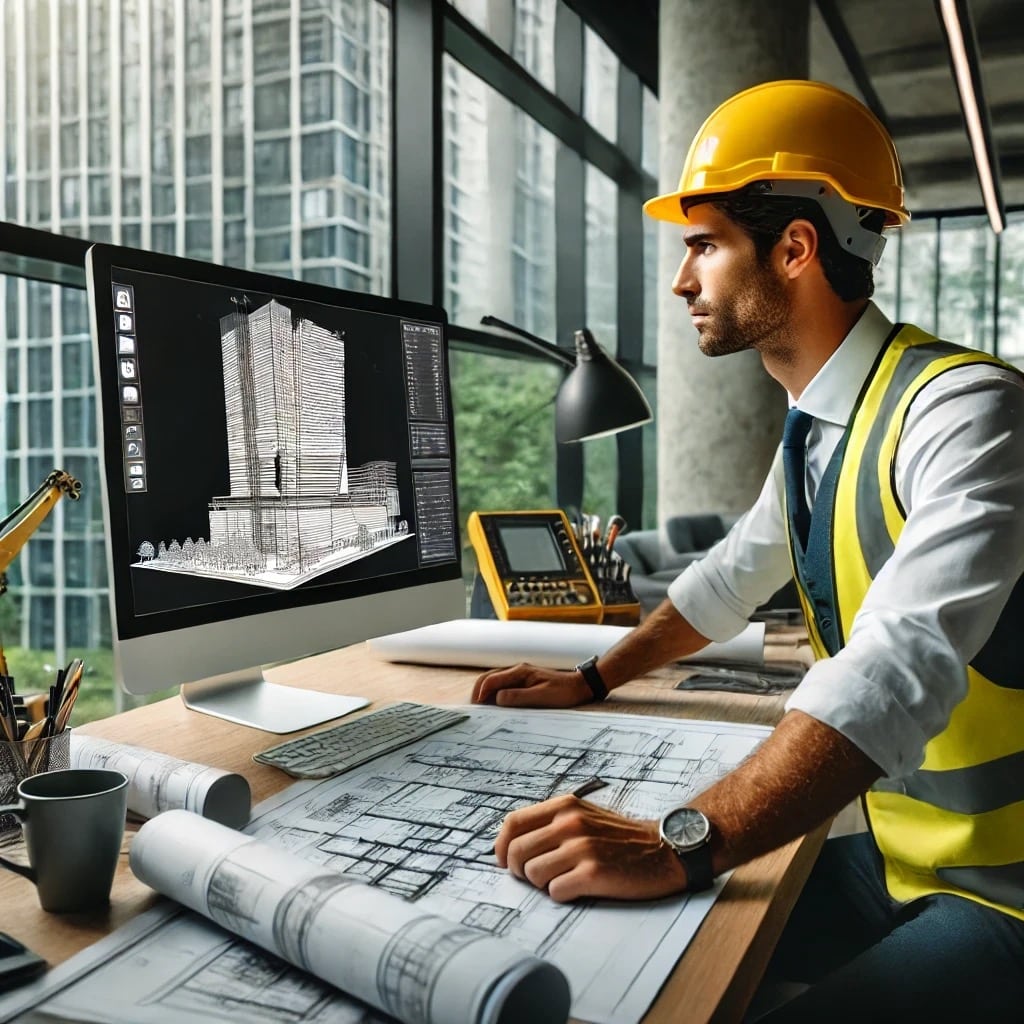
    Here is the image of a construction engineer at his computer, examining an engineering diagram of a commercial skyscraper.
    A typical construction engineer at his computer, examining an engineering diagram of a commercial skyscraper.

    Integration of Drones with BIM

    Here’s where things get really exciting. When we integrate drone-captured data with BIM models, the results are astounding. Drones can capture aerial images and videos, generate 3D point clouds, and create real-time updates for BIM models. Using tools and software like Autodesk’s ReCap and Bentley’s ContextCapture, we can seamlessly incorporate drone data into BIM workflows. This integration brings a whole new level of detail and accuracy to BIM models.

    Advantages of Drone-BIM Integration

    Let me tell you about some of the amazing benefits we’ve seen:

    1. Enhanced Accuracy: Drones provide high-precision data, which means our BIM models are incredibly accurate.
    2. Improved Visualization: Real-time updates and detailed 3D maps give us a better visual understanding of the project, making planning and design more efficient.
    3. Efficient Monitoring: With drones, we can monitor construction sites in real time, ensuring our BIM models are continuously updated.
    4. Streamlined Communication: The detailed and accurate data from drones improve communication and collaboration among project stakeholders, reducing errors and delays.
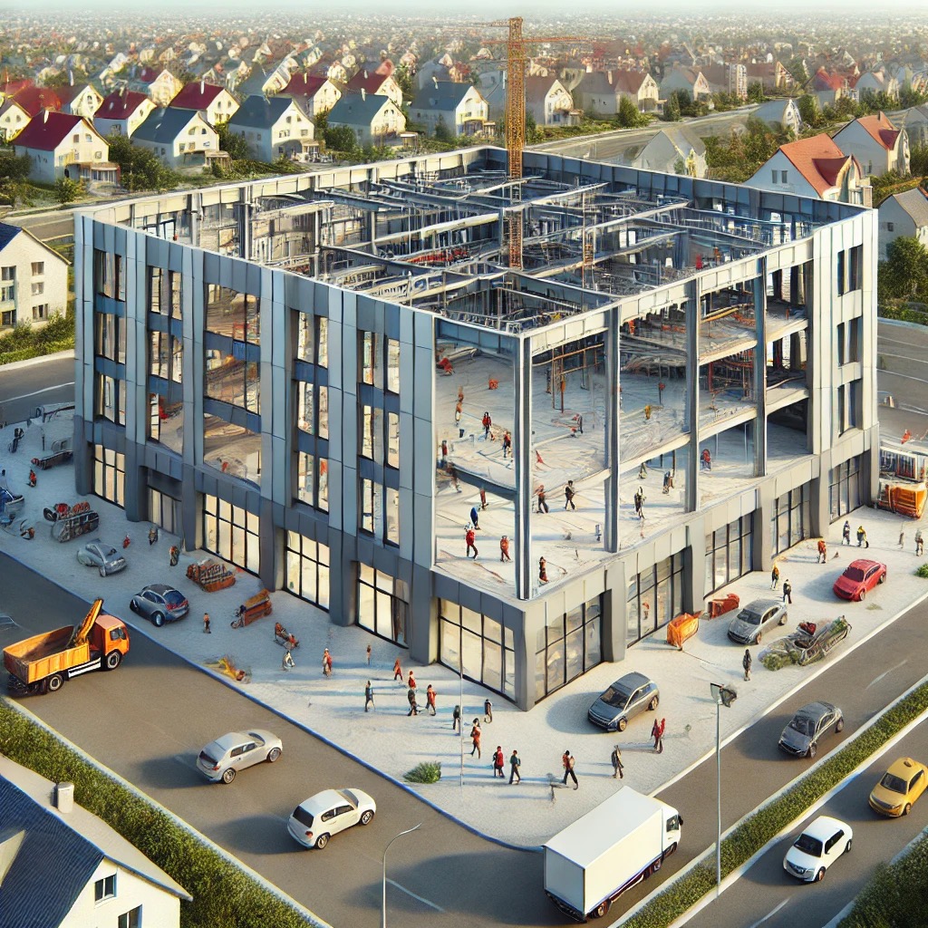
    3-D image of the multifunctional community recreational center under construction
    3-D image of the multifunctional community recreational center under construction

    Future Potential and Innovations

    Looking ahead, the future of Drones in Building Information Modeling is bright. Advancements in AI, machine learning, and autonomous flight technology will further enhance what drones can do. Imagine drones performing more complex tasks autonomously—it’s not far off! These innovations will bring even greater efficiencies and cost savings to the construction industry.

    Challenges and Considerations

    Of course, integrating drones with BIM isn’t without its challenges. Construction managers have had to tackle technical and operational issues, like data processing and integration. Regulatory and legal considerations are also a big deal, as drone pilots, in-house and outsourced, must all comply with local and federal aviation laws. But with best practices and standard operating procedures, we’ve been able to navigate these challenges successfully.

    Conclusion

    In a nutshell, drones are revolutionizing BIM by providing detailed, real-time data that enhances the accuracy and efficiency of construction projects. Staying updated with these technological advancements is crucial for harnessing the full potential of drone-BIM integration.

    So, there you have it! Drones and BIM are a match made in construction heaven, and I’m thrilled to be a part of this exciting journey. If you’re in the construction industry, it’s time to explore how drones can transform your projects. Happy building!

    Additional Resources

    Visuals and Media

    From The Editor:

    Do you need to hire a professional drone service provider for your project?  To speak to an aerial data specialist, fill out a form, email us or for even faster response times, give us a call at (833) FLY-4YOU or (833) 359-4968.  Check out our transparent pricing at https://www.aerialdecisions.com/drone-photography-pricing/ and watch this space as we expand on the above topics and more over the coming weeks and months.  

    If you like this post, feel free to click the share button at the bottom of the page.  We appreciate you helping us by spreading the content we share on our blog.
  • Top Drone Software Features for the Construction Industry

    Top Drone Software Features for the Construction Industry

    I love introducing prospective clients to the benefits of advanced drone software for commercial construction and seeing their excitement as they realize its potential for their projects. There’s a spark in their eyes when they understand how helpful drones can be, and you can see their minds racing with all the potential benefits.

    Drone software for construction progress monitoring is advancing as fast as, if not faster than, drone technology itself. Project managers who leverage leading drone software can significantly enhance their project management and efficiency across all phases of construction: pre-construction, construction, and post-construction.

    Why Hire a Drone Service Provider Using Advanced Drone Software?

    Advanced drone software is revolutionizing construction progress monitoring with its sophisticated capabilities. Here are five key features that project managers can utilize to better manage ongoing construction projects through all three phases:

    Enhanced Data Accuracy and Detail

    Pre-construction: During the initial phase, drone software helps in generating inch-accurate topographical surveys and 3D models of the site. This precise data is crucial for site planning and assessing site conditions before breaking ground.

    Construction: As the project progresses, drones capture high-resolution imagery to document key structural elements and track daily progress. This ensures that every detail is accurately recorded and monitored.

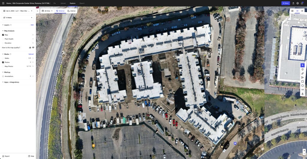
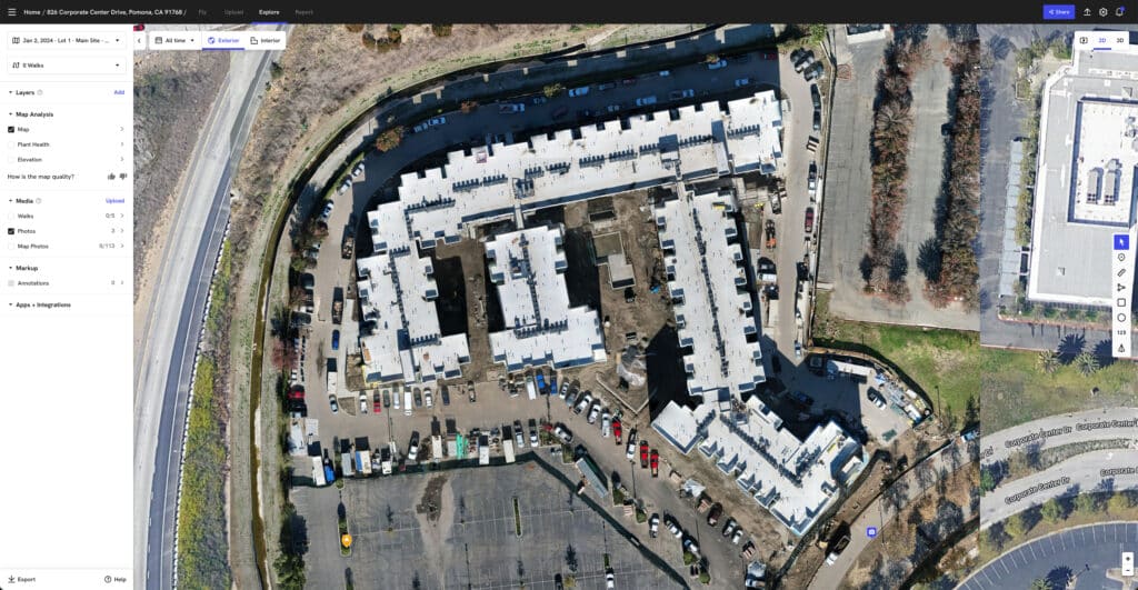
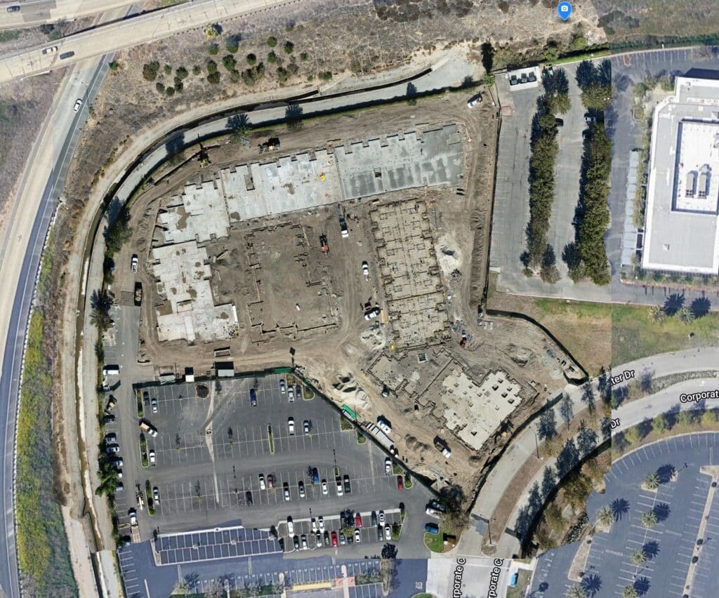
    Orthomosaic of Commercial Construction Site
    Orthomosaics are Invaluable Tools for Construction Project Managers

    Post-Construction: At the project’s conclusion, drone software provides detailed documentation of the completed structure, including as-built 3D models that reflect the final state of the project for handover to clients and stakeholders.

    Improved Efficiency and Cost Savings

    Pre-construction: Automated site surveys and volumetric measurements of stockpiles and earthworks reduce the need for time-consuming manual labor. This accelerates the site preparation phase and optimizes resource allocation.

    Construction: During the build, regular drone flights streamline progress monitoring, allowing for real-time adjustments and minimizing delays. This reduces costs associated with project overruns and labor inefficiencies.

    Post-Construction: Efficient final inspections and comprehensive documentation ensure a smooth handover process, saving time and reducing costs related to post-project corrections and adjustments.

    Real-Time Progress Monitoring

    Pre-construction: Drone progress monitoring can be done weekly, bi-weekly, or monthly depending on the project’s needs. Initial site assessments and planning can be continuously updated with real-time data from regular drone flights, ensuring that any changes in site conditions are promptly addressed.

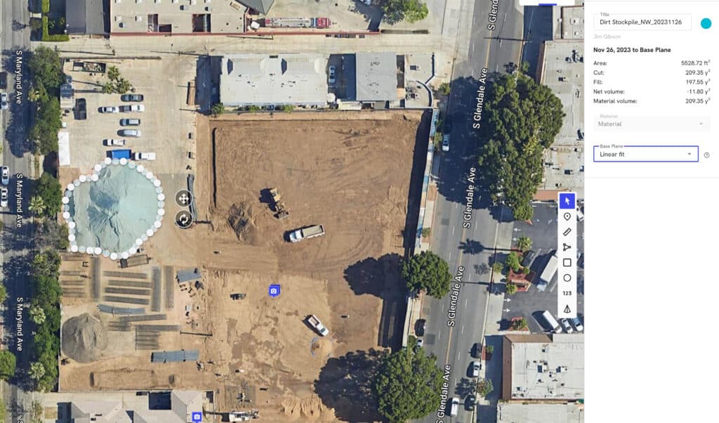
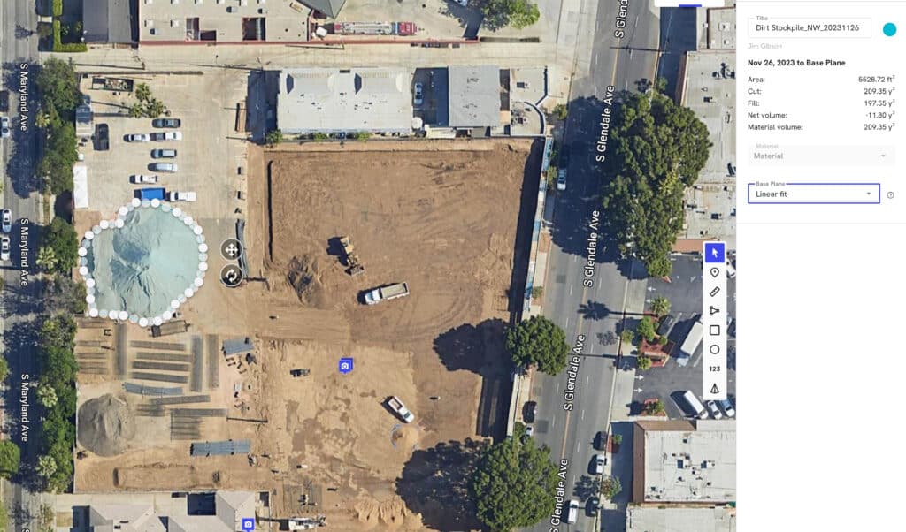
    Construction site stockpile measurements
    Drone processing software can easily assist project managers measure site inventory

    Construction: Throughout the construction phase, advanced drone software enables frequent and consistent monitoring, providing real-time updates and progress reports. Stockpile measurements and materials inventory are easy to measure and share with internal teams responsible for monitoring and re-ordering important equipment and supplies. This helps project managers quickly identify and rectify issues, ensuring the project remains on schedule.

    Post-Construction: After construction is complete, real-time data from drones can be used to verify that all aspects of the project meet the required specifications, ensuring quality and completeness.

    Enhanced Safety for Company Personnel

    Pre-construction: Drones can safely survey potentially hazardous areas of the site, identifying risks before construction begins and helping to plan safer workflows.

    Construction: During the build, drones reduce the need for personnel to access dangerous or hard-to-reach areas for inspections, which are typically done using scaffolding, swing stages, man lifts, or bucket trucks. This minimizes the risk of accidents and enhances overall site safety.

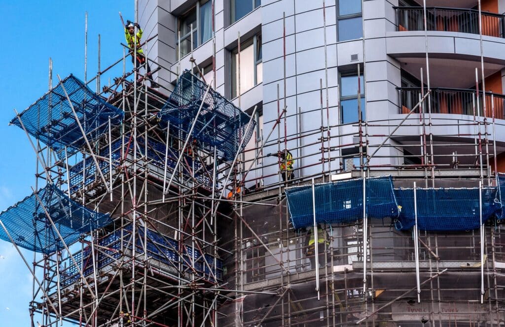
    crew on scaffolding inspecting building facade
    Construction crews take significant risks to inspect building exteriors on scaffolding inspecting building facades.

    Post-Construction: Final inspections using drones can safely document the condition of elevated or hazardous areas, ensuring thorough safety assessments without exposing workers to risks.

    Better Stakeholder Communication and Collaboration

    Pre-construction: High-resolution images and 3D models created during the planning phase can be shared with all stakeholders to ensure everyone has a clear understanding of the project scope and site conditions from the outset.

    Construction: Regularly updated progress reports, including orthomosaic maps and 3D models, enhance communication among project teams and stakeholders, ensuring that everyone is informed and aligned throughout the build.

    Engineer Working on Construction Plans on Computer
    Architects and Engineers Use a Variety of Software Applications to Manage Commercial Construction Projects

    Post-Construction: Detailed final reports and visual documentation facilitate effective communication during the project handover, ensuring that clients and stakeholders have a comprehensive understanding of the completed work.

    Here are three case studies highlighting the success of commercial construction companies using drone data collection software like DroneDeploy:

    McCarthy Building Companies

    McCarthy Building Companies, a leading construction firm, has significantly benefited from integrating drones into their project workflows. By using drone data, they improved communication on-site and with stakeholders, keeping projects on track and under budget. Ryan Moret, Field Solutions Manager at McCarthy, emphasized that drones provide valuable aerial insights that improve progress tracking and help catch problems early, preventing costly delays. McCarthy Building Companies Case Study

    Brasfield & Gorrie General Contractors

    Brasfield & Gorrie, one of the largest privately held construction firms in the U.S., implemented drones to enhance their operational efficiency. They reported a dramatic reduction in the time and cost associated with traditional surveying methods. Hunter Cole from Brasfield & Gorrie noted that using drones reduced a process that typically took 2-3 weeks and tens of thousands of dollars to just 1-4 days with minimal investment in equipment and software. The Rise of Drones in Construction

    Chasco Constructors

    Chasco Constructors leveraged drones to monitor progress across 17 job sites in Texas. This approach allowed them to track the construction process more efficiently, ensuring timely completion and adherence to project specifications. The integration of drone technology helped Chasco save time and resources, highlighting the practical benefits of real-time aerial data in large-scale construction management. Chasco Case Study

    These case studies illustrate how leading construction companies are successfully using drone project analysis software to improve project management, enhance safety, and achieve significant cost and time savings.

    Conclusion

    By hiring a drone service provider that uses advanced drone software, you’ll be leveraging cutting-edge technology to enhance data accuracy, improve efficiency, ensure safety, and foster better communication throughout all phases of construction. Let us help you take your construction project management to the next level with our comprehensive drone services. Reach out to us today to learn more about how we can support your project with our advanced drone solutions.

    From The Editor

    Do you need to hire a professional drone service provider for your project?  To speak to an aerial data specialist, fill out a form, email us or for even faster response times, give us a call at (833) FLY-4YOU or (833) 359-4968.  Check out our transparent pricing at www.aerialdecisions.com and watch this space as we expand on the above topics and more over the coming weeks and months.  

    If you like this post, feel free to click the share button at the bottom of the page.  We appreciate you helping us by spreading the content we share on our blog.
  • Drone Construction Progress Monitoring Challenges

    Drone Construction Progress Monitoring Challenges

    Drones have become an integral part of documenting progress workflows for most commercial construction projects.  Construction managers inevitably face the decision of when to pivot from regularly sourcing 3rd party drone service providers (DSPs) to building an internal drone team.  While the urge to build an internal team from the start is tempting, there are many factors to consider before making that leap.

    As a certified and insured commercial drone pilot having flown many construction monitoring missions, I understand the complexities involved in ensuring successful outcomes on every project. When considering the option of internalizing drone operations, commercial construction project managers must carefully weigh the challenges and potential pitfalls that come with this decision. 

    In this blog post, I’ll highlight the key mission preparation elements from the perspective of a drone service provider and discuss the challenges project managers may face if they opt for internal operations without the proper expertise and resources.

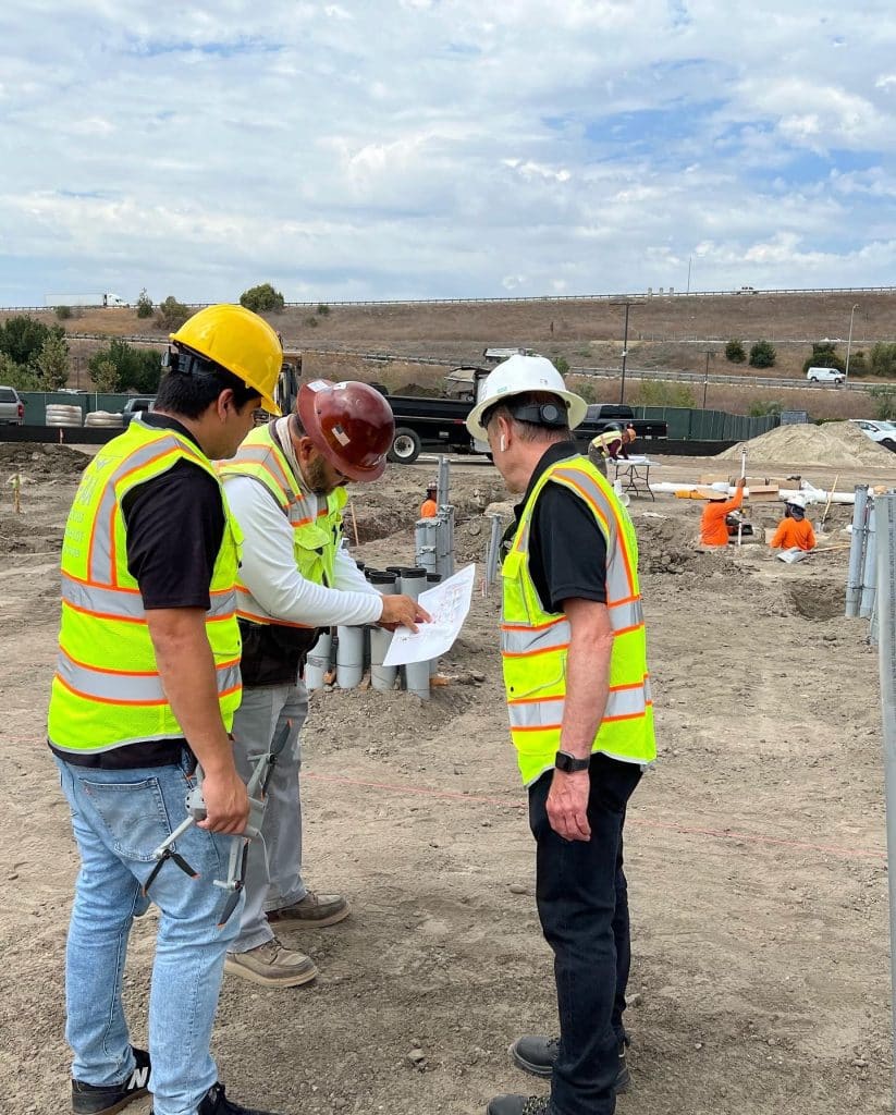
    Construction Manager Meets with Drone Service Provider in the Field
    Construction project manager meets with the Drone Service Provider (DSP) Pilot in the field

    Flight Planning

    Flight planning is a critical component of any construction monitoring mission, requiring careful consideration of site layouts, airspace restrictions, and potential hazards. As a certified and insured DSP, we invest significant time and resources into developing comprehensive flight plans that optimize coverage while minimizing risks. Project managers must recognize the complexities involved in effective flight planning and the potential consequences of overlooking key considerations. Without the necessary expertise, internal operators may struggle to develop safe and efficient flight paths, increasing the risk of accidents or disruptions to construction operations.

    Risk Assessment

    Conducting a thorough risk assessment is essential for mitigating hazards and ensuring the safety of drone operations. Professional DSPs have the experience and knowledge to identify potential risks and implement appropriate safety measures. In contrast, internal operators may lack the expertise to conduct comprehensive risk assessments, leaving them vulnerable to unforeseen dangers. Construction project managers must consider the potential consequences of inadequate risk management, including costly damages, injuries, and liability issues.

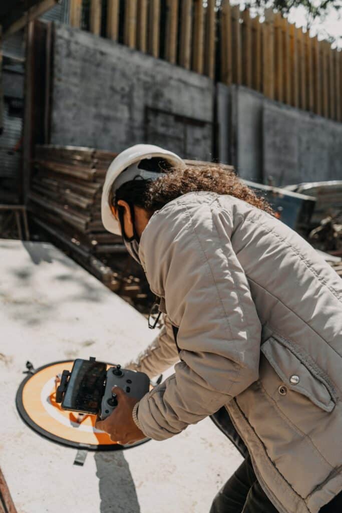
    Pilot-in-Charge (PIC) checks drone for proper operations
    Pilot-in-Charge (PIC) checks drone for proper operations

    Equipment Check

    Maintaining drone equipment in optimal condition is crucial for reliable performance and data accuracy. Professional drone service providers adhere to rigorous maintenance protocols to ensure that all equipment is in proper working order before each flight. Without the proper training and resources, internal operators may struggle to perform thorough equipment checks, increasing the risk of technical failures or malfunctions during missions. Project managers must weigh the cost savings of internal operations against the potential costs of equipment damage and downtime.

    Communications

    Effective communication is essential for coordinating drone operations with construction teams and other stakeholders. Professional drone service providers establish clear communication channels to ensure that everyone is informed and aligned throughout the project. In contrast, internal operators may face challenges in effectively communicating with external parties, leading to misunderstandings or delays. Project managers must consider the potential impact of communication breakdowns on project timelines and deliverables.

    Law Book
    At the core of every drone mission are essential FAA rules for conducting proper and safe flight operations.

    Regulatory Compliance

    Navigating regulatory requirements is a fundamental aspect of drone operations, with strict guidelines set forth by the FAA. Professional drone service providers are well-versed in regulatory compliance and ensure that all operations adhere to legal standards. Internal operators may lack the necessary knowledge and experience to navigate complex regulations, putting the project at risk of fines or penalties. Project managers must prioritize compliance and consider the potential consequences of regulatory violations on project outcomes and reputation.

    Summary

    While internalizing drone operations may offer potential cost savings, commercial construction project managers must carefully consider the challenges and risks involved. By partnering with professional drone service providers, project managers can leverage expertise, resources, and experience to ensure the success and safety of construction monitoring missions. Cutting corners on technical requirements, safety considerations, and regulatory compliance can result in costly damages, injuries, and legal liabilities, underscoring the importance of making informed decisions when integrating drones into construction projects.

    From The Editor:

    We’d love to hear your thoughts on matters pertaining to the safe, professional, and ethical operation of drones. Please check our website at www.aerialdecisions.com and watch this space as we expand on the above topics and more over the coming weeks and months.  If you like this post, feel free to click the share button at the bottom of the page.  We appreciate you helping us by spreading the content we share on our blog.
  • Why Orthomosaics are Important to the Construction Industry

    Why Orthomosaics are Important to the Construction Industry

    Drone Service Providers (DSPs) that specialize in data collection services for the commercial construction industry offer a vital tool for construction project managers: Orthomosaics. These images, sometimes called Ortho-Rectified Images, provide a bird’s-eye view of the ongoing commercial construction project, giving managers a clear and detailed overview of the site’s progress.

    What is an Orthomosaic Image?

    Let me break down what an orthomosaic is and why it’s different from a regular drone image.

    Imagine you’re putting together a big puzzle, but instead of using puzzle pieces, you’re using thousands of tiny pictures taken from above by a drone. Each picture is like a puzzle piece, capturing a small part of the area you want to map, like a construction site. 

    Orthomosaics are ortho-rectified images
    Orthomosaics are ortho-rectified images that minimize the impact of the earth’s natural curvature.

    How is an orthomosaic unique?

    Now, let’s talk about what an orthomosaic does. An orthomosaic is like creating a giant, super-detailed map of that construction site by stitching all those little pictures together. It’s not just a simple collage; it’s more like creating a seamless, bird’s-eye view image that accurately represents every detail of the site, almost like you’re looking straight down from above.

    Why an orthomosaic is different from a regular drone image:

    • Accuracy: An orthomosaic corrects any distortions or variations caused by the angle and altitude of the drone, giving you a precise and accurate representation of the site. So, it’s like having a perfectly straight-down view, even though the drone might have been flying at an angle.
    • Consistency: Every part of the orthomosaic fits together seamlessly, like pieces of a puzzle. This consistency is crucial for tasks like measuring distances, areas, and tracking changes over time on the construction site.
    • Detail: Since an orthomosaic combines numerous images, it captures a tremendous amount of detail. You can zoom in and see things with much more clarity compared to a single drone image, making it incredibly useful for analyzing the site in depth.

    So, in essence, an orthomosaic is like creating a super-accurate, detailed map of a construction site by piecing together thousands of drone photos. It helps you see the big picture while also allowing you to zoom in and examine the tiniest details, making it an invaluable tool for construction planning, progress tracking, and analysis.

    Image of Construction Planning
    Construction engineers use data collected from drones to manage complex build details

    Construction Project Managers love orthomosaics

    For project managers, having a regular supply of ortho-rectified images is like having a constantly updated blueprint of the construction site. They can track progress, identify potential issues, and make informed decisions without needing to physically visit the site each time. This saves time and ensures that the project stays on track.

    Why Construction Engineers love em’ too!

    Engineers can utilize computational tools to analyze these images and manage day-to-day operations more efficiently. For example, they can use software to measure distances, areas, and volumes accurately. They can also overlay design plans onto the images to compare progress against the original blueprint, ensuring everything is being built according to specifications.

    Benefits of orthomosaics in commercial construction

    Sharing this data with key stakeholders is crucial for highlighting regular progress on the project. By providing stakeholders with access to updated ortho-rectified images and related computational analyses, project managers can keep everyone informed and engaged. This transparency builds trust and confidence in the project’s progress and allows stakeholders to provide feedback or make adjustments as needed.

    Overall, the combination of ortho-rectified images and computational tools offers construction project managers and engineers a powerful way to manage and track the day-to-day operations of commercial construction projects. Sharing this data with key stakeholders ensures transparency and facilitates collaboration, ultimately leading to successful project completion.

    From The Editor:

    Do you need to hire a professional drone service provider for your construction project?  To speak to an aerial data specialist, fill out a form, email us or for even faster response times, give us a call at (833) FLY-4YOU or (833) 359-4968.  Check out our transparent pricing at https://www.aerialdecisions.com/drone-photography-pricing/ and watch this space as we expand on the above topics and more over the coming weeks and months.  

    If you like this post, feel free to click the share button at the bottom of the page.  We appreciate you helping us by spreading the content we share on our blog.

  • How Drones & Software Enhance Inventory Control

    How Drones & Software Enhance Inventory Control

    As a veteran Drone Service Provider (DSP) that specializes in construction progress monitoring, we’ve grown to appreciate just how much our commercial construction clients rely on us delivering the capabilities of generating regular stockpile measurements.  Stockpile measurements are critical for organizing and managing material and critical supplies ordering and replenishing, essential components for the ongoing production of any construction project.

    What are Stockpile Measurements used for?

    Inventory Management: Stockpile measurements help construction project managers and key team members keep track of the quantity of materials available on-site. This information is essential for ensuring that there is an adequate supply of materials to support ongoing construction activities without delays.

    Resource Planning: By knowing the volume of materials in stockpiles, construction project teams can plan resource allocation more effectively. This includes determining when to order more materials to replenish stockpiles and avoid shortages that could halt construction progress.

    Cost Management: Accurate stockpile measurements allow project managers to better manage costs by preventing over-ordering or under-ordering of materials. This helps to optimize budgets and avoid unnecessary expenses.

    Space Optimization: Understanding the volume of materials in stockpiles helps optimize the layout of the construction site. By strategically arranging stockpiles, managers can maximize available space and improve workflow efficiency.

    Quality Control: Regular stockpile measurements enable internal teams to monitor the quality of materials over time. This helps to identify any issues such as degradation or contamination early on, allowing for timely corrective action to maintain construction quality standards.

    Internal team members depend heavily on accurate stockpile measurements to make informed decisions about material usage and ordering. By having precise data on the quantity and status of materials on-site, construction project managers can anticipate when supplies are running low and proactively order more, thereby avoiding costly delays in construction timelines. Furthermore, these measurements aid in optimizing storage space and preventing overstocking, which can tie up capital and create unnecessary clutter on the site.

    Stockpile Measurements of a Construction Dirt Pile
    Software Can Convert Regular Drone Images to an Ortho Rectified Image thus Enabling Accurate Stock Pile Measurements

    How Drones Have Changed the Stockpile Measurement Game

    Traditionally, obtaining stockpile measurements involved manual methods that were time-consuming and prone to errors. However, the advent of drone technology has revolutionized this process, providing a faster, more accurate, and less labor-intensive solution. Tools like DroneDeploy have become invaluable in streamlining data collection by allowing us to quickly capture high-resolution aerial imagery, called Orthomosaics, of construction sites. 

    The integration of drone technology into stockpile and inventory management has brought about several significant advantages for our clients. One of the most notable benefits is the ability to collect volumetric data in near real-time. Drones equipped with advanced sensors can capture detailed information about stockpile quantities without the need for manual measurement or site visits. This enables construction project managers to monitor stockpile levels remotely and make informed decisions promptly.

    Orthomosaic of Commercial Construction Site
    Orthomosaics are Invaluable Tools for Construction Project Managers

    Drones Deliver Highly Sharable Data

    Additionally, drone technology facilitates the sharing of mission-critical data with internal stakeholders located in different offices, across the country, or even across the ocean. Through cloud-based platforms like DroneDeploy, volumetric data can be uploaded and shared seamlessly, fostering collaboration and ensuring that all team members have access to the same accurate information. This level of accessibility and transparency is essential for maintaining alignment and driving project success.

    In summary, volumetric or stockpile measurement data collection depends on drone technology to create efficiencies at scale. By leveraging drones and innovative tools like DroneDeploy, construction project managers can streamline the process of gathering and analyzing stockpile data, leading to better decision-making and more effective management of materials and critical supplies. This not only saves time and resources but also enhances overall project outcomes, ultimately contributing to the success of commercial construction endeavors.

    From The Editor

    Do you need to hire a professional drone service provider for your project?  To speak to an aerial data specialist, fill out a form, email us or for even faster response times, give us a call at (833) FLY-4YOU or (833) 359-4968.  Check out our transparent pricing at https://www.aerialdecisions.com/drone-photography-pricing/ and watch this space as we expand on the above topics and more over the coming weeks and months.  

    If you like this post, feel free to click the share button at the bottom of the page.  We appreciate you helping us by spreading the content we share on our blog.
  • The Future of Drone Surveying and Mapping for the Construction Industry

    The Future of Drone Surveying and Mapping for the Construction Industry

    Drones are becoming increasingly popular in the construction industry, and for good reason. Drones offer a number of advantages over traditional surveying and mapping methods, including:

    • Speed and efficiency: Drones can survey and map large areas quickly and easily, which can save time and money.
    • Accuracy: Drones can collect high-resolution data that is highly accurate, even in difficult-to-access areas.
    • Safety: Drones are used to survey and map dangerous or inaccessible areas without putting workers at risk.
    • Cost-effectiveness: Drones can be a cost-effective way to survey and map construction sites, especially for large or complex projects.

    What is Drone Surveying and Mapping?

    Drone surveying and mapping is the process of using drones to collect data about a physical object or area. This data is then used to create maps, models, and other visualizations.

    Drone surveying and mapping is used for a variety of purposes in the construction industry, including:

    • Site planning and design
    • Progress monitoring
    • Quantity takeoff
    • As-built documentation
    • Safety inspections
    • Damage assessment
    • Environmental monitoring
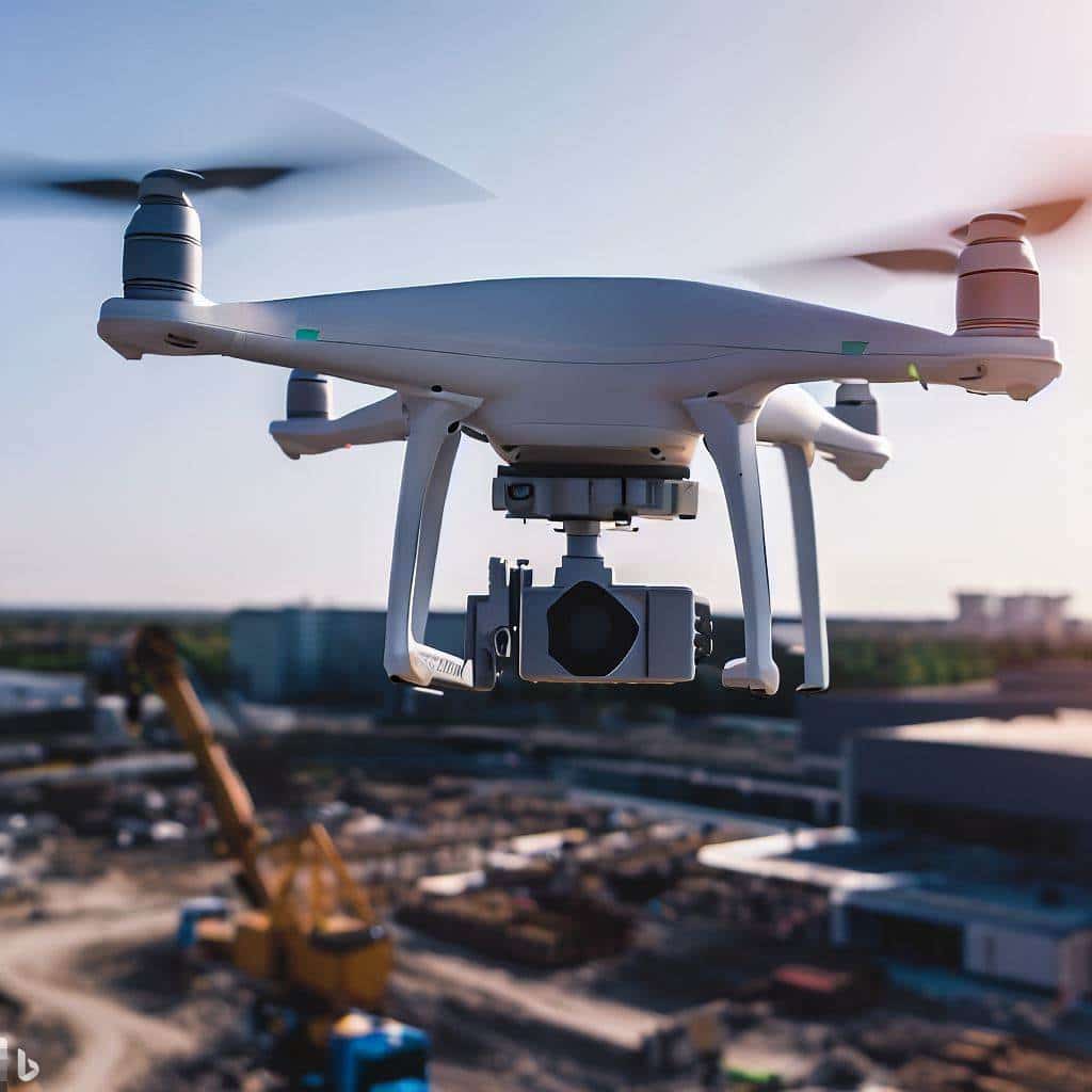
    Drone hovering over an active construction site
    Drones provide a variety of cost saving benefits to the construction industry

    How Construction Companies use Drones for Surveying and Mapping

    Here are a few examples of how today’s commercial construction companies are using drones for surveying and mapping missions:

    • Site planning and design: Drones are used to survey a construction site and create a 3D model of the area. These models used to plan the layout of the site, design the building, and estimate the cost of the project.  
    • Progress monitoring: Drones are used to track the progress of a construction project over time. This helps to ensure that the project is on schedule and within budget.  
    • Quantity takeoff: Drones are used to measure the volume of materials on a construction site. This information is used to create accurate estimates and ensure that the project is completed on time and within budget. 
    • As-built documentation: Drones are used to create a detailed record of a construction project as it is built. This documentation is used for future reference or to make changes to the project. 
    • Safety inspections: Drones are used to inspect construction sites for safety hazards. This helps to prevent accidents and injuries. 
    • Damage assessment: Drones are used to assess the damage to a construction site after an accident or natural disaster. This information is often used to make repairs and prevent further damage. 
    • Environmental monitoring: Drones are used to monitor the environmental impact of a construction project. This helps to ensure that the project is being conducted in an environmentally responsible manner. 
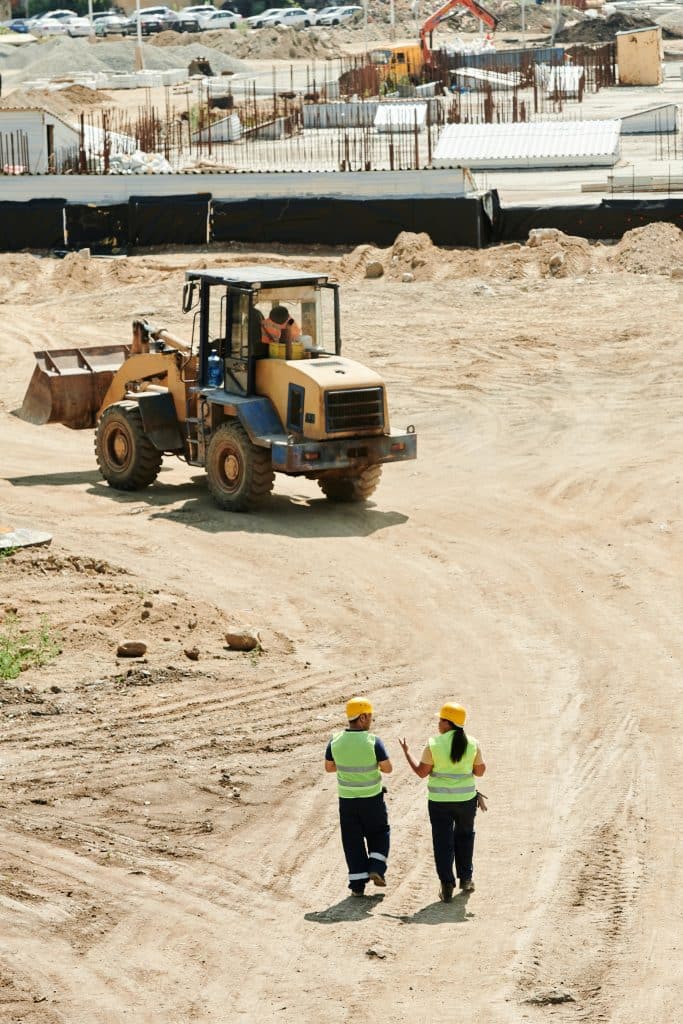
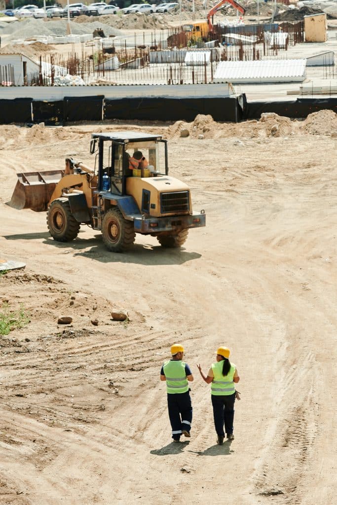
    Construction Site Walk-Through
    Construction Workers Walking a Job Site

    The Future of Drones for Surveying and Mapping for the Commercial Construction Industry

    The use of drones in surveying and mapping is rapidly expanding in the construction industry. As drone technology continues to develop, we can expect to see even more innovative and groundbreaking applications for drones in the years to come.

    Some of the potential future applications of drones in surveying and mapping for commercial construction include:

    • Real-time monitoring: Drones are used to monitor construction sites in real time, which helps to identify and address problems early on.
    • Automated data collection: Drones can be programmed to collect data automatically, which can free up workers to focus on other tasks.
    • 3D printing: Drones are often used to create 3D models of construction sites, which can then be used for 3D printing.

    In conclusion, the integration of drones into surveying and mapping processes has ushered in a new era for commercial construction. Companies like Skanska, Wingtra, and Environmental Works have demonstrated the immense potential of drones in improving efficiency, accuracy, and safety across construction projects. As a drone service provider, I am excited about the limitless possibilities and advancements that lie ahead in this rapidly evolving field. The future of drones in surveying and mapping for commercial construction is bound to be even more remarkable, and Aerial Decisions is excited to continue delivering surveying and mapping services to the industry.

    From The Editor

    Do you need to hire a professional drone service provider for your project?  To speak to an aerial data specialist, fill out a form, email us or for even faster response times, give us a call at (833) FLY-4YOU or (833) 359-4968.  Check out our transparent pricing at https://aerialdecisions.com/drone-photography-pricing/ and watch this space as we expand on the above topics and more over the coming weeks and months.  

    If you like this post, feel free to click the share button at the bottom of the page.  We appreciate you helping us by spreading the content we share on our blog.
  • The Ultimate Guide to Building Internal Construction Drone Teams

    The Ultimate Guide to Building Internal Construction Drone Teams

    As a seasoned professional in the drone services industry, I understand the critical role that enterprise drones play in revolutionizing the commercial construction sector. The ability to gather real-time data, monitor progress, and enhance safety measures has made drones an indispensable tool for construction project managers. If you’re considering building an internal construction drone crew, here are a few key considerations. I have also included a list of the top 10 drones for the construction industry. While this list is by no means comprehensive, this list of drones built for the construction industry is a great place to start.

    Enterprise Drone Payload
    Enterprise Drone Payloads Can Vary Depending on the Mission Requirements

    Factors to Consider When Building an Internal Construction Drone Crew

    1. Purpose and Goals: Define the specific tasks you intend to accomplish with your drone fleet. Whether it’s site surveys, progress tracking, safety inspections, or data collection, having a clear purpose will guide your drone selection.
    2. Flight Time and Range: Opt for drones with longer flight times and extended operational ranges. This ensures wider coverage and minimizes downtime for recharging.
    3. Payload Capacity: Consider the weight of the equipment your drones need to carry, such as high-resolution cameras, LiDAR sensors, or thermal imaging cameras.
    4. Durability: Construction sites can be challenging environments. Choose drones that are rugged and designed to withstand harsh conditions.
    5. Ease of Use: A user-friendly interface and intuitive controls are essential, especially if your team is new to drone technology.
    6. Data Management: Look for drones that offer seamless data transfer and compatibility with construction software for efficient data analysis.
    7. Regulations and Compliance: Stay updated with local aviation regulations and ensure that the drones you choose comply with the necessary requirements.
    8. Training and Support: Proper training and ongoing technical support are crucial for the successful integration of drones into your construction projects.
    9. Budget: Balance your budget with the features and capabilities you require. Investing in quality drones upfront can lead to long-term cost savings.
    10. Scalability: As your projects grow, your drone fleet should be easily expandable to meet the demands of larger construction sites.

    Key Considerations When Selecting a Drone for Construction

    When selecting the ideal enterprise drone for your internal construction team, several critical factors deserve careful consideration. First and foremost, defining the precise goals you intend to achieve with the drone is essential – whether it’s site mapping, progress monitoring, or safety inspections. Flight time and operational range are crucial, ensuring extended coverage and minimized downtime.

    The drone’s payload capacity should align with the equipment it needs to carry, such as high-resolution cameras or LiDAR sensors. Durability matters, especially for the demanding construction site environment, and user-friendliness is key to ensuring seamless integration into your team’s operations. In addition, compatibility with construction software, adherence to aviation regulations, proper training, and ongoing technical support are all pivotal elements in making a well-informed choice.

    Finally, striking the right balance between your budget and the drone’s capabilities will ultimately lead to a successful addition to your construction project toolkit.

    Top 10 Drones for the Construction Industry

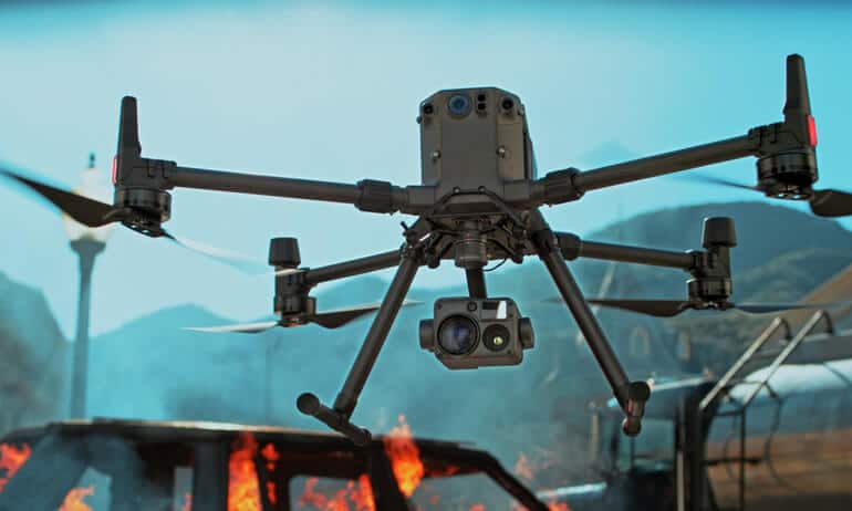
    1. DJI Matrice 300 RTK: Known for its robust design, long flight time, advanced RTK capabilities, and support for multiple payloads, this drone is a workhorse for large-scale construction projects.
    2. Skydio 2: With impressive obstacle avoidance and AI-powered navigation, the Skydio 2 excels at complex site inspections and close-quarters operations.
    3. SenseFly eBee X: This fixed-wing drone covers vast areas efficiently, making it perfect for aerial mapping and topographical surveys.
    4. Autel Robotics EVO II : Offering a variety of camera options including a high-resolution 8K variant, the EVO 2 is versatile for mapping, inspection, and monitoring tasks.
    5. Parrot Anafi USA: Built to meet the stringent needs of the U.S. military, this drone’s compact design, thermal imaging, and secure data transmission make it ideal for construction site security.
    6. Freefly Alta X: With heavy-lift capabilities, the Alta X is perfect for carrying substantial payloads like LiDAR sensors for detailed site scans.
    7. Yuneec H520: This reliable hexacopter features hot-swappable payloads, including high-resolution cameras and thermal imaging options.
    8. Autel Robotics Dragonfish VTOL: Vertical take-off and landing (VTOL) capability combined with long endurance make this drone suitable for large area mapping.
    9. Quantix Mapper: Designed for automated mapping, the Quantix Mapper provides high-resolution imagery and actionable data for construction planning.
    10. Intel Falcon 8+: Known for its stability in challenging conditions, the Falcon 8+ is suitable for precision measurements and inspections.
    DJI Matrice 300 RTK Drone
    DJI Matrice 300 RTK Drone

    My Top 5 Drones for Commercial Construction Demands

    1. DJI Matrice 300 RTK: The ultimate workhorse with advanced features and payload flexibility.
    2. Skydio 2: Perfect for navigating complex environments and conducting detailed inspections.
    3. SenseFly eBee X: Ideal for large-scale site mapping and topographical surveys.
    4. Autel Robotics EVO II: Versatile choice with high-resolution imaging for various construction tasks.
    5. Parrot Anafi USA: Offers secure data transmission and thermal imaging for enhanced security measures.

    Summary

    Building an internal construction drone crew requires careful consideration of various factors to ensure they align with your project needs and goals. The top 10 drones mentioned here provide an excellent starting point, with the top 5 drones catering specifically to the demands of commercial construction. By selecting the right drones, you can enhance efficiency, safety, and data-driven decision-making in your construction monitoring needs, ultimately leading to successful outcomes.

    From The Editor:

    Do you need to hire a professional drone service provider or 360 virtual walking tour for your project?  To speak to an aerial data specialist, fill out a form, email us or for even faster response times, give us a call at (833) FLY-4YOU or (833) 359-4968.  Check out our transparent pricing at https://aerialdecisions.com/drone-photography-pricing/ and watch this space as we expand on the above topics and more over the coming weeks and months.  If you like this post, feel free to click the share button at the bottom of the page.  We appreciate you helping us by spreading the content we share on our blog.

  • Drones’ Role in Mitigating Construction Job Site Materials Theft

    Drones’ Role in Mitigating Construction Job Site Materials Theft

    Construction site theft is a glaring problem that impacts projects in two significant ways: time and budget. The theft of vital materials, whether it’s copper wiring, heavy machinery, or tools, can significantly delay project timelines. Replacing stolen items takes time – time that could have been used to make substantial progress. Moreover, the financial blow resulting from the replacement of stolen materials can blow budgets out of proportion. Staying on schedule and within budget is crucial for the success of any construction endeavor.

    Enter drones – a high-tech tool that is transforming the way we assist general contractors tackle construction site security challenges. As a drone service provider focused on the construction industry, I’ve seen firsthand how materials theft can throw a wrench into even the most meticulously planned projects.

    Construction Site Walk-Through
    Construction Workers Walking a Job Site

    Today, I want to shed light on how this rampant issue impacts the commercial construction industry, and more importantly, how drones are emerging as a game-changing solution to mitigate materials theft.

    Real World Use Cases

    Drones have proven to be an invaluable asset in preventing construction site theft and safeguarding job sites. Let’s delve into a couple of real-world examples that showcase the power of drones in action:

    Gilbane Building Company: In a large-scale project in Rhode Island, Gilbane Building Company implemented daily drone construction monitoring to measure existing stockpiles on the job site. This proactive approach led to the swift apprehension of a thief attempting to make off with high-value materials. The timely intervention not only prevented theft but also sent a strong message to potential wrongdoers.

    Skanska USA: Skanska turned to drones to protect a high-rise project in Seattle. The drones’ aerial monitoring capabilities provided real-time visuals of the site, allowing security personnel to detect and thwart unauthorized access. This level of aerial surveillance acted as a potent deterrent against construction site theft and vandalism.

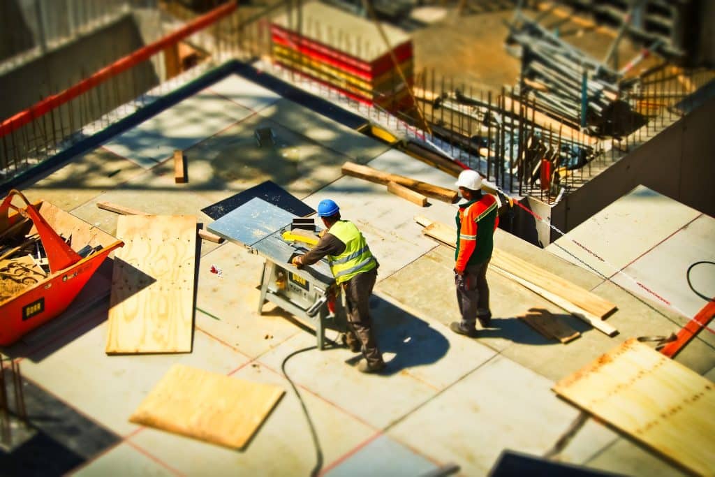
    Construction Job Site
    Craftsmen working with materials on a construction job site

    By integrating drones into an active construction project’s security measures, you as a project manager, are taking proactive steps to combat materials theft. Drones provide a bird’s-eye view of the entire site, making it easier to detect any unusual activity and respond promptly.  While not always real-time, regular drone monitoring missions, deployed at frequent intervals (I.e., weekly) enables your team to maintain a vigilant eye on construction zones, minimizing the window of opportunity for potential thieves.

    Summary

    Materials theft is an undeniable hurdle that can cripple construction projects in terms of time and budget. The solution lies in harnessing the power of drones to protect your sites, prevent theft, and ensure your projects are completed within their designated timelines and budgets. With success stories like Gilbane Building Company and Skanska USA, it’s evident that drones are emerging as a powerful tool in your battle against theft.

    By integrating drones into your construction site security strategies, you’re not only taking proactive measures to prevent theft but also sending a clear message that your construction sites are fortified, well-protected, and ready to withstand any challenges that come your way. Here’s to a more secure and successful future for the construction industry!

    From The Editor:

    Do you need to hire a professional drone service provider for your project?  To speak to an aerial data specialist, fill out a form, email us or for even faster response times, give us a call at (833) FLY-4YOU or (833) 359-4968.  Check out our transparent pricing at https://aerialdecisions.com/drone-photography-pricing/ and watch this space as we expand on the above topics and more over the coming weeks and months.  

    If you like this post, feel free to click the share button at the bottom of the page.  We appreciate you helping us by spreading the content we share on our blog.
  • Drones Impact on the Construction Industry’s Top Challenges

    Drones Impact on the Construction Industry’s Top Challenges

    We are witnessing firsthand the transformative power of drone technology in revolutionizing some of the biggest challenges in today’s construction industry.  In this blog post, I’ll delve into the five most significant challenges that construction companies face in 2023 and beyond and demonstrate how drones can be the ultimate cost effective solution to overcome these hurdles and pave the way for a more profitable future.

    Drone Flying Over Construction Site
    Drones can easily access hard to reach places helping construction managers quickly deliver critical data to key stakeholders

    Safety and Risk Management

    Ensuring safety on construction sites is a top priority, yet it remains an ongoing challenge. Drones equipped with advanced cameras and sensors can be our most valuable tool in conducting aerial inspections. By collecting real-time data, we enable construction teams to identify potential hazards and adhere to safety protocols diligently. For example, a construction company in Canada used drones to assess a high-rise building’s exterior for signs of wear and tear, facilitating timely maintenance and minimizing safety risks.

    View of Construction Site From Above
    Drones are capable of capturing data that helps project managers scale efficiencies, improve worker safety and reduce costs

    Project Monitoring and Progress Tracking

    Managing large-scale construction projects demands meticulous progress tracking. Drones excel at capturing high-resolution images and generating 3D models, allowing project managers to monitor developments and detect discrepancies promptly. A real-world instance involves a construction project in the UK, where drones were employed to track the construction of a highway expansion, streamlining communication among stakeholders and ensuring on-time completion.

    Drone Service Providers (DSP’s) like Aerial Decisions help reduce costs, boost efficiency, improve worker safety while keeping key stakeholders informed.  Drone progress monitoring adds perspective and production value to any commercial construction project.

    Environmental Sustainability

    The construction industry faces increasing pressure to embrace sustainable practices. Drones play a pivotal role in promoting environmental consciousness by conducting aerial surveys and monitoring ecological impact. With the data collected, construction companies can implement eco-friendly measures and optimize resource utilization. A construction firm in Germany utilized drones to assess the environmental impact of a wind farm project, enabling them to make informed decisions that aligned with green initiatives.

    Cost Overruns and Rising Material Costs

    Construction projects often encounter cost overruns, impacting profitability.  Drones can effectively address these challenges by providing accurate measurements and surveys. This leads to precise budget planning and minimizes unexpected expenses. A construction company in Australia harnessed drone technology to conduct volumetric surveys on a mining site, avoiding cost overruns by precisely estimating the required resources and mitigating project risks.  

    The cost of construction materials has been rising steadily in recent years, and this trend is expected to continue in 2023. This is due to a number of factors, including the increase in demand for materials, the shortage of raw materials, and the rising cost of energy.  Drones are used to collect data on the use of materials and equipment and can even deliver supplies to remote construction sites.

    Image of Construction Management Crew Scaled
    Construction Crew Walk-Through and Safety Check

    Labor Shortages and Productivity

    Labor shortages you ask?  How can drones possibly tackle the demand for human capital?  The construction industry undoubtedly faces a labor shortage, affecting productivity and project timelines.  This is due to a number of factors, including the aging workforce, the lack of interest in construction careers among young people, and the increasing complexity of construction projects. Drones can fill this gap by performing tasks that would otherwise require substantial human effort, thus boosting overall efficiency.

    Drones Even Transport Construction Materials

    An example is a construction company in Japan that utilized drones for material transportation on challenging terrains, enhancing productivity and optimizing labor resources.  Another, more common example, is the use of drones to capture images and video of hard to reach and often unsafe areas of an active construction site that would otherwise require a human to manually observe and record.  This example of drone construction progress monitoring increases both productivity and the safety of the project

    Summary

    Drones are the driving force behind tackling the most pressing challenges in the construction industry in 2023 and beyond. By harnessing drone-captured aerial data, we empower construction companies to streamline operations, enhance safety protocols, and promote environmental sustainability.  Embracing drone technology positions construction businesses for success, leading to improved profitability. From reducing costly errors and ensuring safety compliance to optimizing resource utilization and increasing overall productivity, drones unlock a world of opportunities for the commercial construction industry.

    As a professional Drone Service Provider (DSP), Aerial Decisions is committed to partnering with construction companies to leverage these transformative technologies. Together, we can soar to new heights of efficiency, sustainability, and profitability, shaping a future where innovation and construction excellence go hand in hand.

    Let’s embrace the skies and embark on this thrilling journey toward a more prosperous and sustainable construction industry, powered by the limitless potential of drone technology. The future is now, and it’s time to take flight!

    From The Editor

    Do you need to hire a professional drone service provider for your project?  To speak to an aerial data specialist, fill out a form, email us or for even faster response times, give us a call at (833) FLY-4YOU or (833) 359-4968.  Check out our transparent pricing at https://aerialdecisions.com/drone-photography-pricing/ and watch this space as we expand on the above topics and more over the coming weeks and months.  

    If you like this post, feel free to click the share button at the bottom of the page.  We appreciate you helping us by spreading the content we share on our blog.
  • A Perfect Match: Drone Technology and Construction Software

    A Perfect Match: Drone Technology and Construction Software

    As a Drone Service Provider (DSP) that specializes in data collection services for the construction industry, I am constantly intrigued by the innovative software technologies that continue to transform traditional construction processes.  I am further excited about how drone data is becoming more intertwined with each technological advancement in construction project management software. In recent years, software has become an indispensable tool for construction companies involved in commercial building projects. This blog post explores the types of software construction companies use for various phases of construction and, more importantly, how drone technology has emerged as a game-changer by providing critical data that seamlessly overlays into existing software.

    Engineer Working on Construction Plans on Computer
    Architects and Engineers Use a Variety of Software Applications to Manage Commercial Construction Projects

    Types of Software for Commercial Building Projects

    Construction companies have embraced software solutions to enhance efficiency, reduce costs, and ensure smooth project management. Here are some of the crucial software types utilized in different phases of commercial building projects:

    Building Information Modeling (BIM): BIM software facilitates the creation of detailed 3D models of the building, enabling collaboration among architects, engineers, and contractors. It streamlines design coordination, identifies clashes, and optimizes construction sequences, all while fostering better communication.

    What is BIM Software?

    BIM (Building Information Modeling) software is like a super-smart digital blueprint for commercial construction projects. It allows architects, engineers, and builders to create detailed 3D models of the building before it’s even constructed. This software helps everyone involved in the project collaborate better, identify potential problems early on, and plan everything more efficiently, resulting in smoother construction and a better end result.

    Construction Planning Software
    Today, Architects and Engineers Rely on Digital Software Tools to Manage Commercial Construction Projects

    Project Management Software: These platforms aid in planning, scheduling, and resource allocation. They offer real-time progress tracking, cost management, and document control, fostering transparency and accountability among project stakeholders.

    Virtual and Augmented Reality (VR/AR): VR/AR technologies are gaining traction in the construction industry, allowing stakeholders to experience immersive virtual walkthroughs of buildings before construction begins. These simulations aid in identifying potential design flaws and improving client engagement.

    Estimating and Takeoff Software: Accurate cost estimation is vital in construction projects. Estimating software helps construction companies determine the quantity of materials required and provides real-time pricing data to develop precise project budgets.

    Construction Drone Monitoring
    Project Managers Have Increasingly Adopted Drones for Construction Progress Monitoring

    The Role of Drones in Commercial Construction

    Drone technology has significantly impacted the construction industry, and its integration with existing software has revolutionized the way companies approach building projects. Here’s how drones contribute throughout various construction phases:

    Pre-construction Phase: Drones equipped with high-resolution cameras conduct aerial surveys and site inspections. This data is then fed into BIM software, aiding architects and engineers in creating accurate 3D models and improving initial designs.

    Active Construction Phase: Drones provide real-time monitoring of construction progress, enabling project managers to identify potential delays and streamline workflows. They also enhance job site safety by inspecting hard-to-reach areas without risking human lives.

    Post Construction Phase: Drones facilitate post-construction inspections, ensuring that the built structure aligns with the original design. Their ability to capture detailed imagery assists in creating as-built models for facility management and maintenance.

    Seamless Integration with Existing Software

    The true power of drones lies in their ability to seamlessly integrate with the software construction companies already use. Drone-captured data is effortlessly imported into BIM, project management, and estimating software, providing real-time updates and accurate information at every stage of the project. This integration ensures that construction teams work with the most current data, fostering collaboration and informed decision-making.

    In conclusion, the construction industry is embracing technology like never before. Software solutions have become a cornerstone of commercial building projects, streamlining operations, and promoting effective collaboration. However, the real game-changer has been the synergy between drones and construction software and integrating drone data with construction software is now a perfect match. The critical data captured by drones has breathed new life into pre-construction, active construction, and post-construction phases, propelling the industry into a new era of efficiency, safety, and excellence.

    From The Editor:

    Do you need to hire a professional drone service provider for your project?  To speak to an aerial data specialist, fill out a form, email us or for even faster response times, give us a call at (833) FLY-4YOU or (833) 359-4968.  Check out our transparent pricing at https://aerialdecisions.com/drone-photography-pricing/ and watch this space as we expand on the above topics and more over the coming weeks and months.  

    If you like this post, feel free to click the share button at the bottom of the page.  We appreciate you helping us by spreading the content we share on our blog.