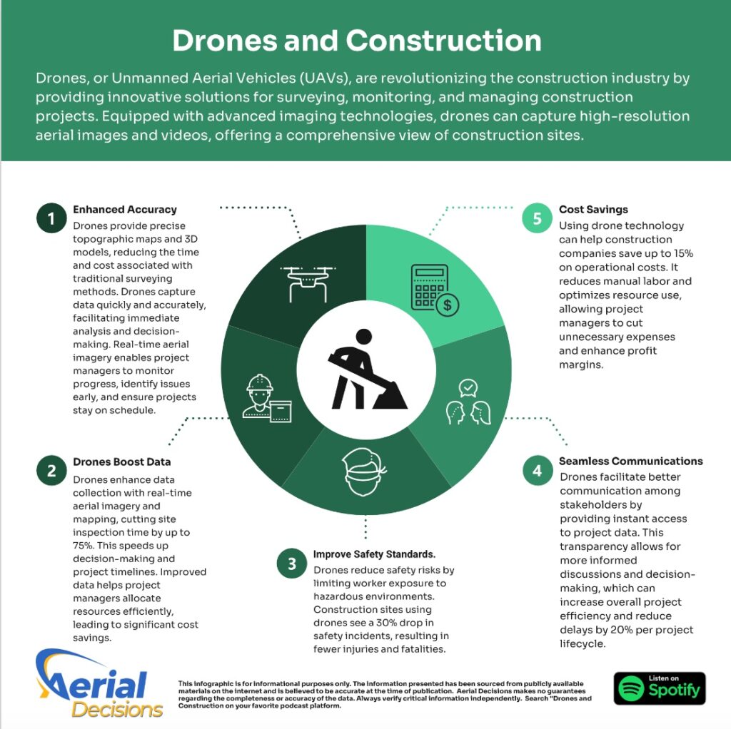
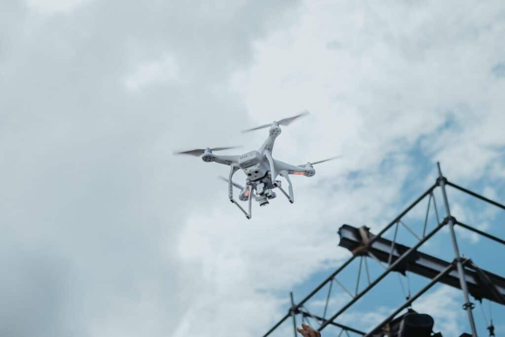
As a construction engineer or general contractor, you know one thing is certain: precision is everything. Whether you’re balancing cut-and-fill volumes, analyzing substructure conditions, or mapping utility layouts, a single mistake can snowball into delays, cost overruns, or worse—a full-on rework. That’s where drones and construction are stepping in to completely change the game.
I’ve seen firsthand how drones are transforming commercial construction projects. They’re not just high-tech gadgets; they’re tools that help us work smarter, faster, and more accurately than ever before. Let me break down how drones are reshaping key areas like earthworks, substructure analysis, and utilities reporting—and why you should consider bringing them into your next project.
Earthworks: Faster Surveys, Better Data
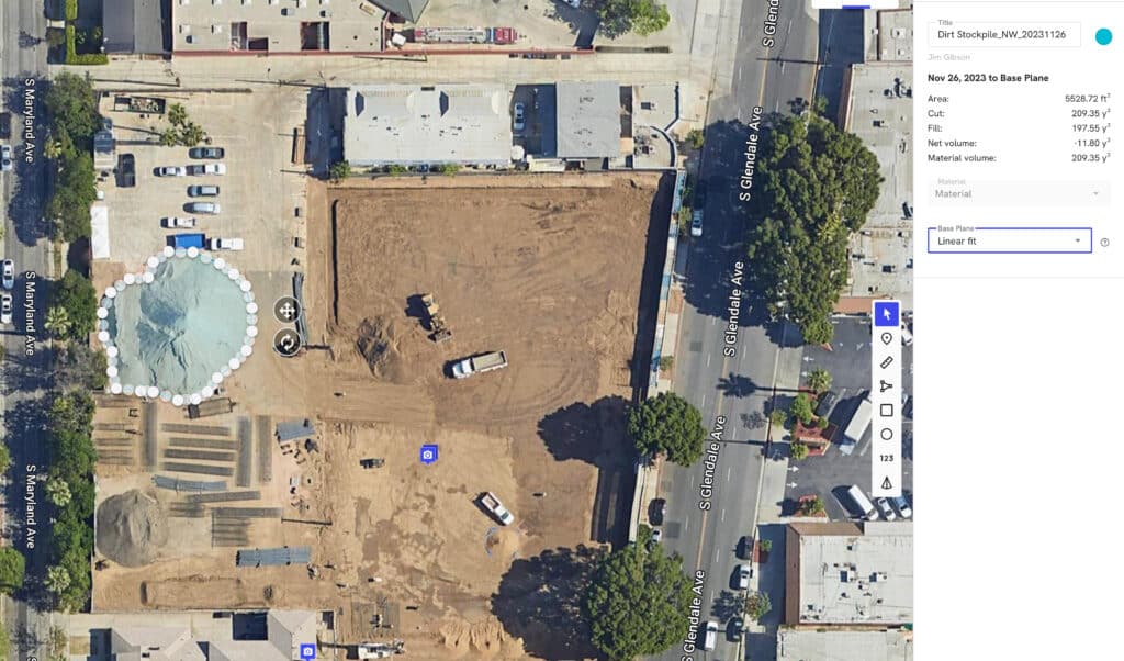
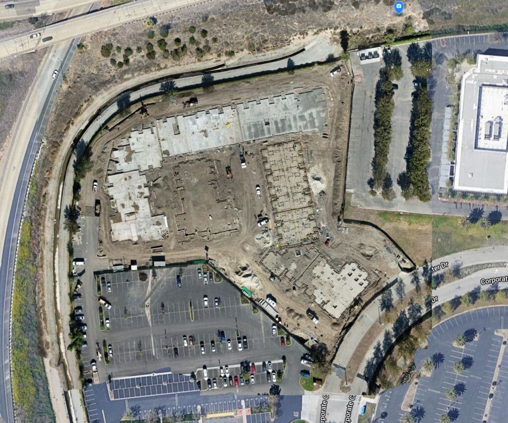
You know the headaches of manual surveying: it’s time-consuming, sometimes risky, and prone to inaccuracies. Drones take these pain points and crush them. With a drone, you can capture high-resolution aerial data in hours, not days.
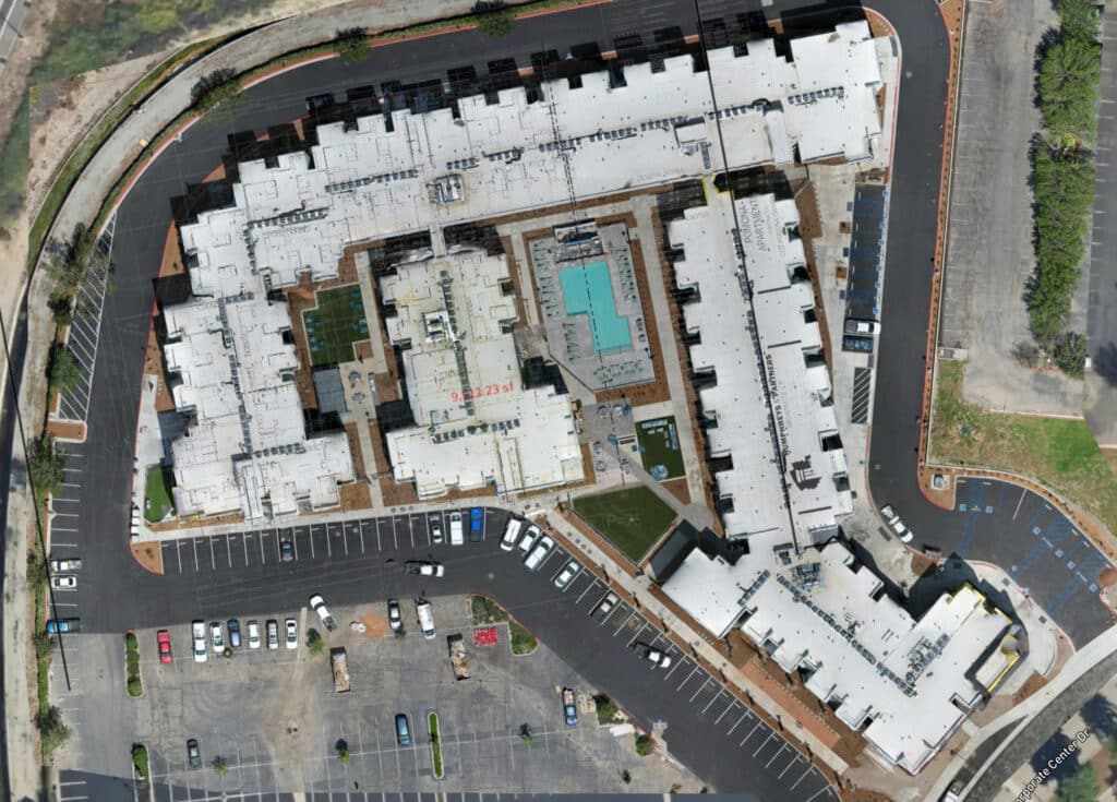
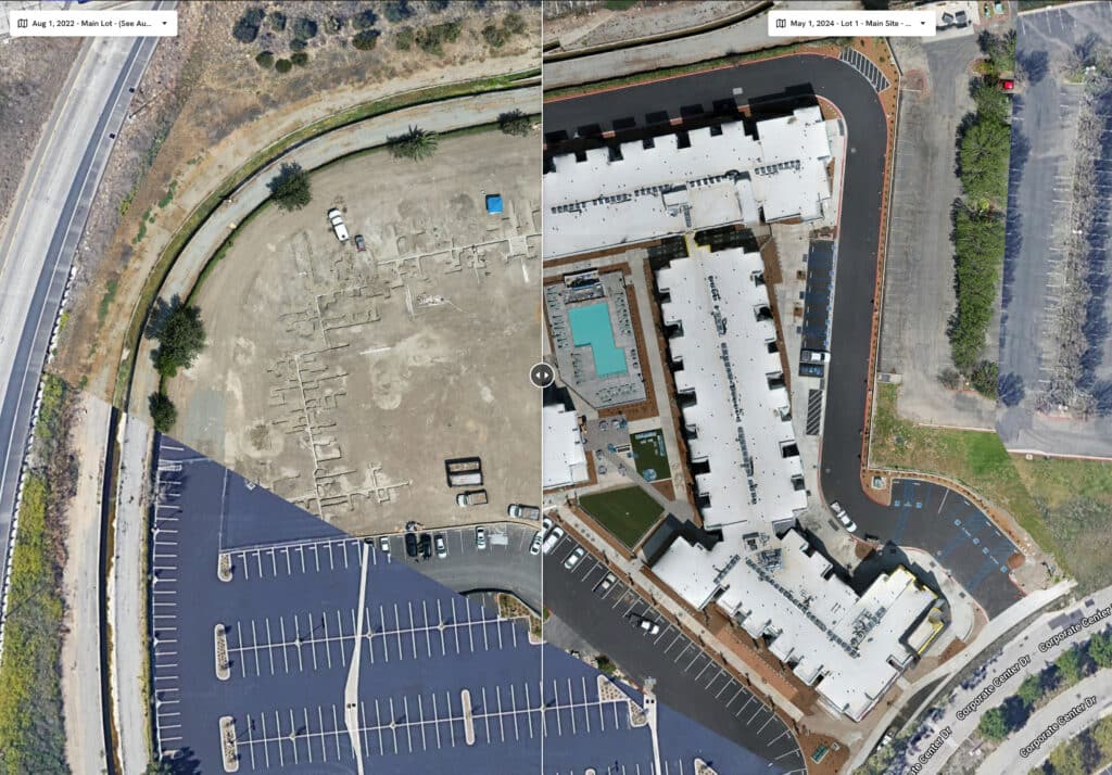
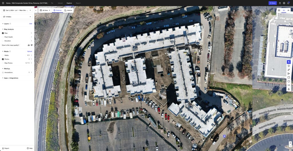
I remember reviewing a case where a construction company was building a new hospital and needed precise elevation maps to balance cut-and-fill volumes. Using drones, they created 3D models that nailed the math—reducing survey time by a third and improving accuracy by 15%. Imagine what you could do with those time savings.

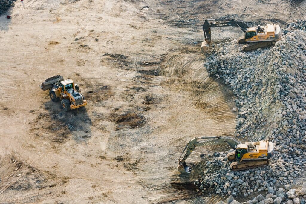
Substructure Analysis: See What’s Beneath the Surface
Foundations can be tricky, especially in urban environments or areas with complex subsurface conditions. That’s where drones equipped with LiDAR or thermal imaging shine.
Take Allianz Field in St. Paul, Minnesota. During construction, drones provided an overhead view of progress, but their real magic was in subsurface analysis. They caught early signs of soil compaction issues—issues that could’ve led to major setbacks. The result? No rework and significant savings on time and money.
By integrating drones into substructure analysis, you’re not just avoiding mistakes—you’re likely preventing them entirely.
Utilities Reporting: Mapping Without the Guesswork
If you’ve ever dealt with as-built utility layouts, you know they can be a nightmare. Buried pipelines, overlapping networks—just thinking about it gives me a headache. Drones simplify all that.
On one project, a drone with thermal imaging revealed a hidden underground water leak that would’ve caused massive delays if left undetected. It wasn’t just a win for accuracy—it saved the team tens of thousands of dollars in repairs and downtime.
By using drones for utility mapping, you can reduce guesswork and bring clarity to some of the murkiest aspects of construction.
Why It’s Time to Go Drone
Drones aren’t just a shiny new toy; they’re tools that deliver measurable ROI. Faster surveys, fewer mistakes, and better data mean projects stay on schedule and on budget. For earthworks, substructure analysis, and utilities reporting, drones are changing how we build—period.
So, here’s my advice: if you’re not using drones yet, it’s time to start. The construction industry is moving fast, and those who embrace tech like this are the ones staying ahead of the curve.
If you’re curious about how drones could make your next project more accurate, efficient, and cost-effective, let’s talk. Trust me, you won’t look back.
Drones and Construction Case Studies
Drones have become indispensable in modern construction, offering unparalleled accuracy in surveying, mapping, and analytics. Their integration into earthworks, substructure analysis, and utilities reporting has led to significant improvements in efficiency and precision. Below are real-world case studies illustrating these advancements:
Earthworks: Precision and Progress Monitoring
- Case Study: Brasfield & Gorrie’s Hospital Construction
- Project Overview: During the construction of a hospital, Brasfield & Gorrie utilized drone-generated 3D models to create elevation maps of the site.
- Results: The drone-based aerial survey reduced the time taken to survey by a third, enabling faster data collection and higher ROI.
- Source: Drone Mapping in Construction – Commercial UAV News
Substructure Analysis: Enhancing Data Integrity
- Case Study: Allianz Field Stadium Construction
- Project Overview: During the construction of Allianz Field in St. Paul, Minnesota, drones were employed to capture photos and videos, aiding in various aspects of construction management.
- Results: The integration of drone technology facilitated improved communication with subcontractors, enhanced safety monitoring, and efficient tracking of construction progress.
- Source: A Case Study on Drones in Construction: Easier than You May Think – Autodesk University
Utilities Reporting and Analytics: Improving Infrastructure Coordination
- Case Study: Road Maintenance Survey in Malaysia
- Project Overview: Drones were deployed to survey road conditions, capturing high-resolution images and data for maintenance planning.
- Results: The use of drones provided accurate assessments of road conditions, enabling efficient maintenance strategies and resource allocation.
- Source: Drone in Construction: Benefits, Applications, and Use Cases – JOUAV
These case studies demonstrate the transformative impact of drones and construction are marrying together to enhance accuracy and efficiency in construction projects. By leveraging drone technology, project engineers can achieve precise measurements, real-time monitoring, and improved decision-making across various construction phases.
Conclusion
Construction safety is evolving, and drones are leading the charge. By combining traditional measures like fall protection and PPE with cutting-edge drone technology, we’re creating safer work environments. These tools not only save lives but also improve efficiency, proving that technology and safety go hand in hand. Drones and Construction might be a small part of the bigger picture, but their impact is undeniably transformative.
From The Editor:
Do you need to hire a professional drone service provider for your project? To speak to an aerial data specialist, fill out a form, email us or for even faster response times, give us a call at (833) FLY-4YOU or (833) 359-4968. Check out our transparent pricing at https://www.aerialdecisions.com/drone-photography-pricing/ and watch this space as we expand on the above topics and more over the coming weeks and months.
If you like this post, feel free to click the share button at the bottom of the page. We appreciate you helping us by spreading the content we share on our blog.

Showcase Your Company on the Drones and Construction Podcast! If you’d like to be a featured guest on our podcast, send us an email: info@aerialdecisions.com and one of our crew will get right back to you to share the details.
About Aerial Decisions
Aerial Decisions is a Los Angeles-based Drone Services Provider (DSP). We specialize in providing cutting-edge drone data collection combined with industry leading software solutions tailored for the commercial construction industry. Our mission is to optimize the way enterprise construction projects are managed by offering precise aerial photography, detailed data analysis, and innovative software tools through a network of FAA-certified and insured drone pilots. Aerial Decisions is not just a drone service provider; we are your strategic partner in commercial construction. Our hands-on approach to understanding your unique requirements and our dedication to excellence ensures that every flight and every data point is optimized for your success. Trust us to be the eyes in the sky that elevate your construction projects to new heights.