My Perspective
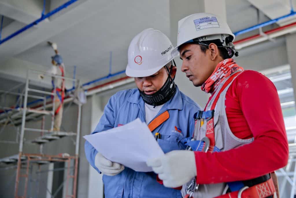
Over the past couple of years, I’ve noticed something interesting during project review meetings. When I show a client a folder full of drone photos, they’re appreciative—but the conversation usually stays focused on the images themselves.
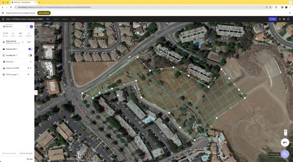
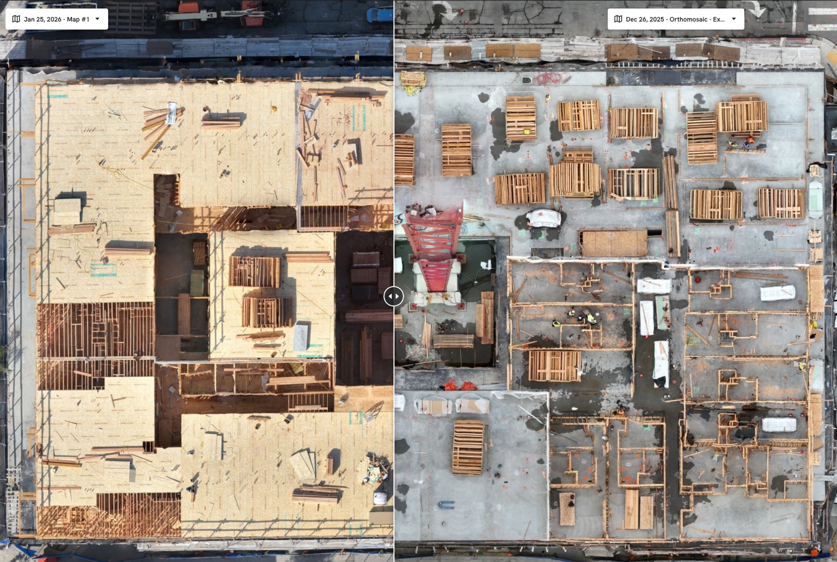
Everything changes when I pull up an orthomosaic map.
Suddenly, we’re not talking about pictures anymore. We’re talking about production, access routes, material staging, completed work, and what changed since the last flight. Owners start asking questions. Project managers begin measuring distances. Superintendents identify opportunities before they become problems.
That’s when I realized that an orthomosaic isn’t just another drone deliverable—it’s often the most valuable one we produce.
At Aerial Decisions, we’ve found that most General Contractors aren’t looking for more photos. They’re looking for a single, accurate view of the entire project that helps everyone make better decisions.
That’s exactly what an orthomosaic delivers.
Introduction: One Image. Hundreds of Decisions.
Most commercial construction projects generate thousands of photographs throughout the course of a build.
The challenge isn’t collecting images.
The challenge is turning those images into something useful.
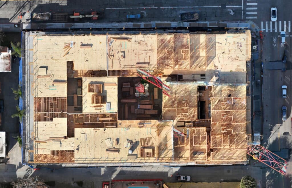
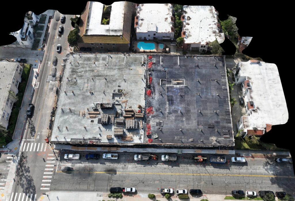
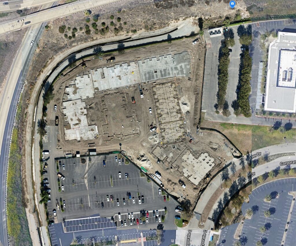
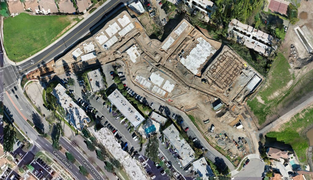
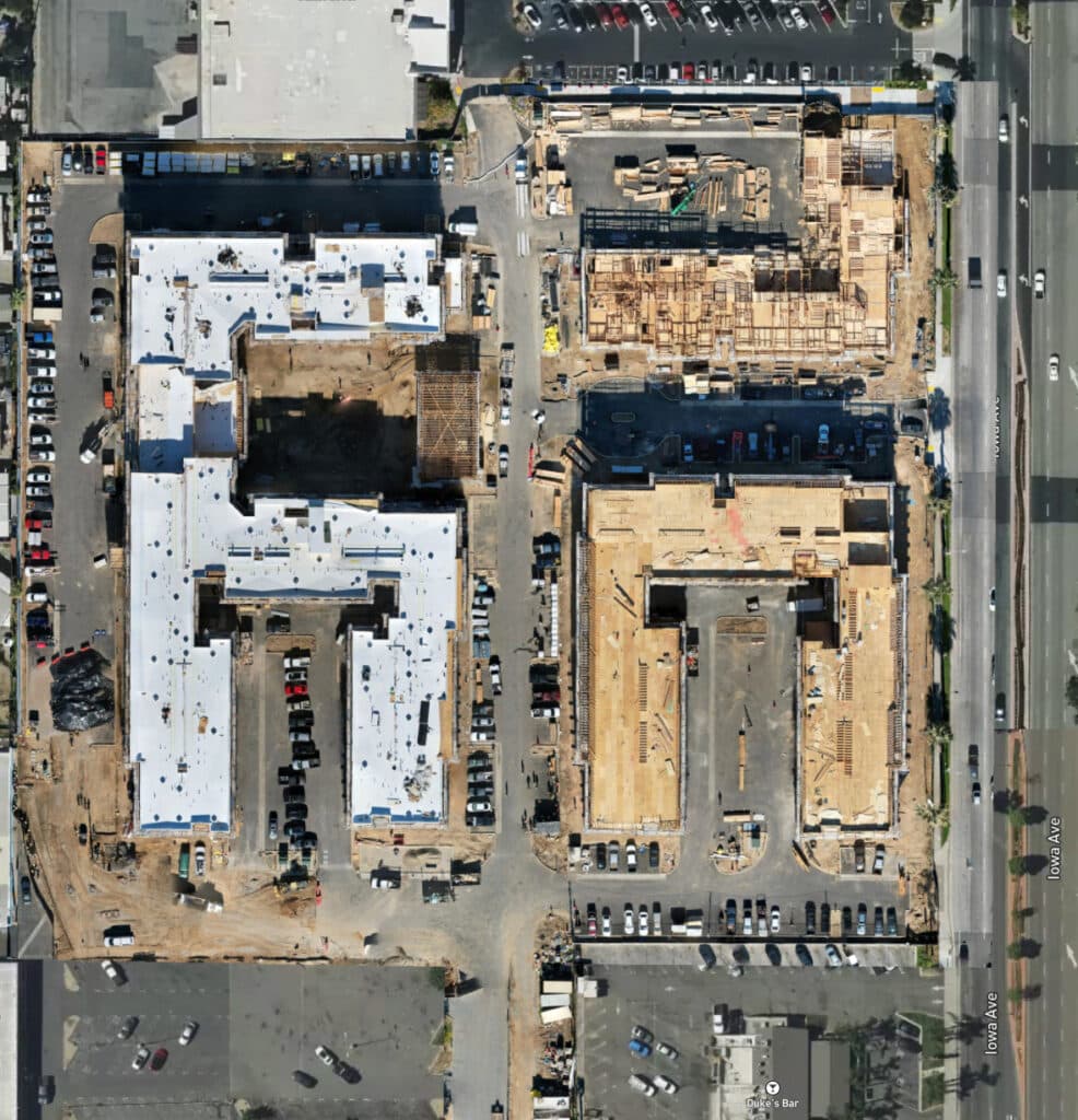
An orthomosaic map gives project teams a current, measurable, high-resolution view of the entire jobsite—all in a single image.
Instead of scrolling through hundreds of drone photos trying to understand progress, Owners and General Contractors can immediately see where work has advanced, where challenges exist, and what has changed since the previous reporting cycle.
For many of our clients, it’s one of the most valuable deliverables we provide.
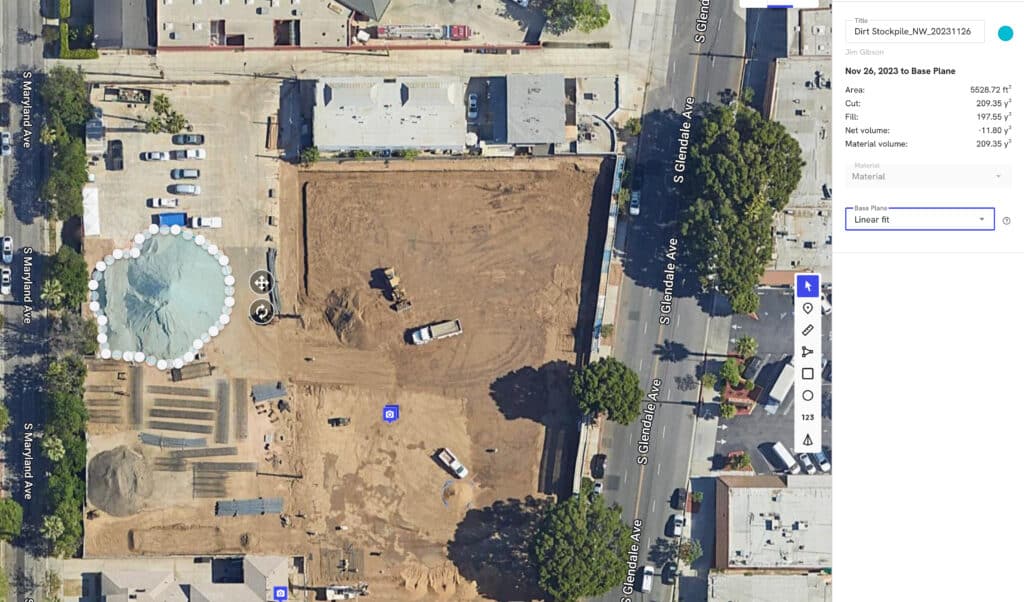
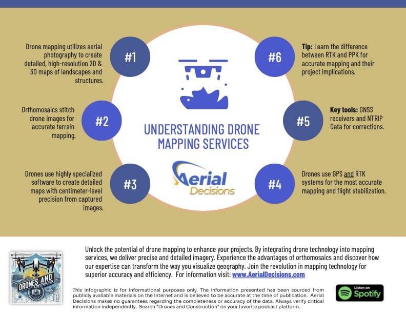
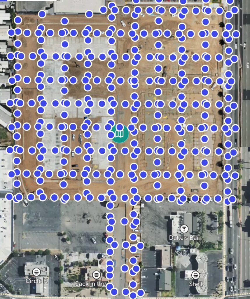
What Is an Orthomosaic Map?
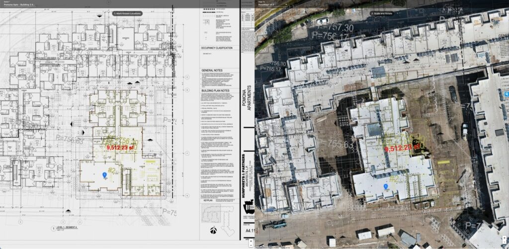
An orthomosaic map is a high-resolution aerial image created by stitching together hundreds of overlapping drone photographs and correcting them for perspective and distortion.
Unlike a standard aerial photograph, an orthomosaic is geographically accurate.
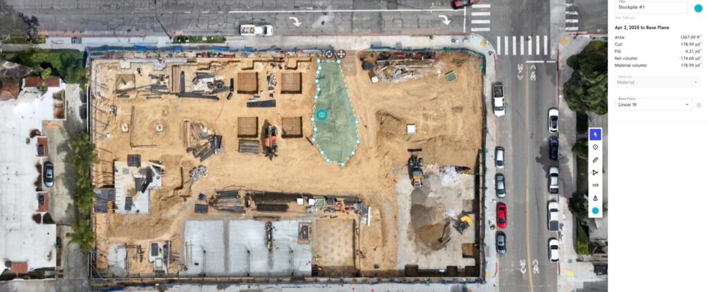
That means it can be used to:
- Measure distances
- Calculate areas
- Track progress
- Compare site conditions over time
- Support executive reporting
Think of it as a living blueprint of your project—updated as often as your reporting schedule requires.
How Is an Orthomosaic Created?
Although the final product looks like one photograph, it’s actually built from hundreds—or even thousands—of overlapping drone images.
A professional workflow typically includes:
- Mission planning
- RTK positioning when appropriate
- Ground Control Points (when required)
- High-overlap image capture
- Photogrammetry processing
- Quality control review
The result is a seamless map that provides consistent visibility across the entire project.
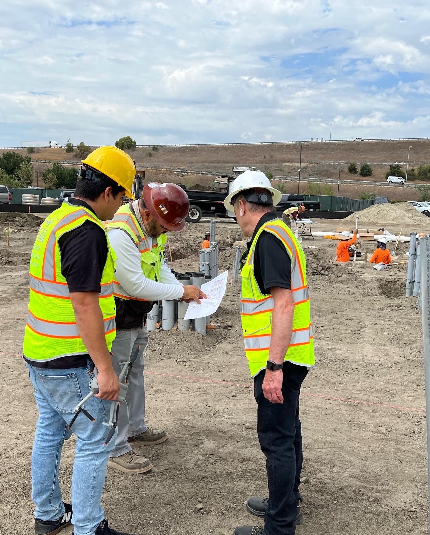
Why General Contractors Value Orthomosaic Mapping
From our experience, orthomosaics create value because they simplify communication.
Instead of relying on written descriptions of site conditions, teams can see the entire project in one image.
Most clients use orthomosaics for:
Progress Tracking
Compare this month to last month.
Site Logistics
Monitor laydown yards, access roads, and staging areas.
Earthwork Documentation
Measure excavation and grading progress.
Executive Reporting
Provide Owners with a current visual overview of the project.
Historical Documentation
Maintain a complete timeline of site development.
Orthomosaic Map vs. Standard Drone Photography
| Standard Drone Photos | Orthomosaic Maps |
|---|---|
| Individual images | Complete site map |
| Perspective distortion | Corrected and measurable |
| Difficult to compare | Easy month-over-month comparison |
| Limited measurements | Accurate distance and area measurements |
| Good for marketing | Excellent for project management |
Both have value.
But they solve different problems.
Mini Case Snapshot
Project Type: Commercial roadway improvement project
Challenge: Project stakeholders needed a clearer way to communicate monthly progress across multiple work zones.
Drone Solution: Monthly orthomosaic mapping combined with standardized aerial photography.
Outcome: Improved stakeholder communication, faster progress reviews, and a consistent historical record throughout construction.
Data Accuracy and Professional Use
From our experience working alongside construction teams and engineers, orthomosaic mapping provides highly accurate, repeatable documentation for progress tracking, reporting, and general measurement.
However, it’s important to understand where orthomosaics fit within the construction workflow.
Orthomosaic maps are not intended to replace licensed land surveying, legal boundary determination, or engineering-grade survey deliverables.
Licensed surveyors remain responsible for:
- Boundary verification
- Control networks
- Engineering and design accuracy
- Legal documentation
Most successful projects combine traditional surveying with recurring orthomosaic mapping to improve visibility between survey milestones.
Why Orthomosaics Improve Project Communication
One of the biggest benefits we see isn’t technical—it’s communication.
Everyone—from the superintendent to the Owner—can look at the same map.

That shared perspective reduces misunderstandings, improves reporting, and creates more productive conversations.
Instead of asking,
“Where exactly is that?”
people begin asking,
“What’s our plan for fixing it?”
That’s a much better conversation.
Frequently Asked Questions
What makes an orthomosaic different from an aerial photo?
An orthomosaic is corrected for distortion and can be measured accurately, while a standard aerial photo cannot.
Can you measure distances on an orthomosaic?
Yes. Orthomosaics allow project teams to measure distances, areas, and other site dimensions for construction planning and progress tracking.
How often should an orthomosaic be created?
Most commercial projects benefit from monthly orthomosaic updates, with more frequent mapping during critical phases.
Are orthomosaics accurate?
Yes. When captured and processed correctly, orthomosaics provide reliable project-level measurements suitable for progress monitoring and documentation.
Who benefits most from orthomosaic mapping?
General Contractors, Owners, Developers, Project Managers, and Municipal Agencies all benefit from having a consistent visual record of project progress.
Executive Takeaway
One of the best compliments we receive from clients is hearing that an orthomosaic became the first thing they opened before every project meeting.
That’s because a single, accurate map often replaces hundreds of individual photographs and gives everyone a common understanding of the jobsite.
At Aerial Decisions, we’ve found that better visibility almost always leads to better conversations—and better conversations lead to better project decisions.
Disclaimer
Drone mapping and data services provided by Aerial Decisions are intended for visual documentation, progress tracking, and general measurement purposes only. These services do not replace licensed land surveying, boundary determination, or engineering-grade deliverables.
From The Editor:
Do you need to hire a professional drone service provider for your project? To speak to an aerial data specialist, fill out a form, email us or for even faster response times, give us a call at (833) FLY-4YOU or (833) 359-4968. Check out our transparent pricing and watch this space as we expand on the above topics and more over the coming weeks and months.
If you like this post, feel free to click the share button at the bottom of the page. We appreciate you helping us by spreading the content we share on our blog.

Showcase Your Company on the Drones and Construction Podcast! If you’d like to be a featured guest on our podcast, send us an email: info@aerialdecisions.com and one of our crew will get right back to you to share the details.
About Aerial Decisions
Aerial Decisions is a Los Angeles-based Drone Services Provider (DSP). We specialize in providing cutting-edge drone data collection combined with industry leading software solutions tailored for the commercial construction industry. Our mission is to optimize the way enterprise construction projects are managed by offering precise aerial photography, detailed data analysis, and innovative software tools through a network of FAA-certified and insured drone pilots. Aerial Decisions is not just a drone service provider; we are your strategic partner in commercial construction. Our hands-on approach to understanding your unique requirements and our dedication to excellence ensures that every flight and every data point is optimized for your success. Trust us to be the eyes in the sky that elevate your construction projects to new heights.